
Ahramat al-Giza, stone pyramids on the desert edge of Gizeh
Published on 09/09/2026 at 16:24 | Editorial responsibility: Rafael Müller, Editor-in-Chief AD HOC NEWS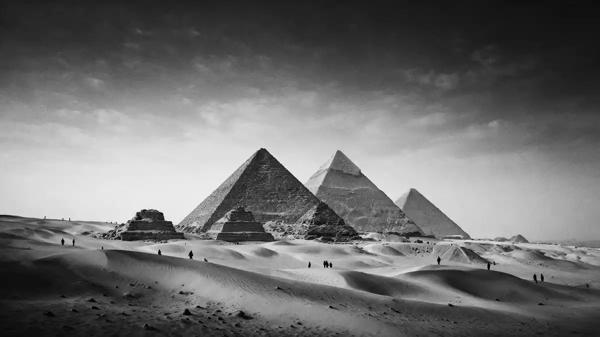
Ahramat al-Giza, known in English as the Pyramids of Giza, rise from the desert plateau west of the Nile near Gizeh as a concentration of ancient stone pyramids and tombs. On this plateau three royal pyramids of Egypt’s Fourth Dynasty dominate the skyline, forming a funerary landscape that has shaped ideas of pharaonic Egypt for millennia.
Fourth Dynasty stone geometry on the Giza Plateau
The core of Ahramat al-Giza is a group of three major pyramids attributed to the Fourth Dynasty pharaohs Khufu, Khafre and Menkaure, set on a limestone plateau beside the Nile valley in northern Egypt. These pyramids were erected in the Old Kingdom during the twenty-sixth century BC, over several generations, as monumental tombs for rulers whose names still define the site.Fourth Dynasty pyramids Each pyramid is part of a wider complex that includes temples, causeways and subsidiary structures, arranged to form a carefully organised necropolis west of the river.Giza pyramid complex
The Great Pyramid of Khufu stands as the largest of the three, built from enormous limestone blocks with a square base and sloping sides meeting at a high point above the plateau. It is accompanied by smaller pyramids for royal family members and a system of internal passages and chambers cut into the structure.Great Pyramid of Khufu Nearby, the pyramid of Khafre retains sections of casing stone on its upper levels, while the pyramid of Menkaure completes the trio with more modest proportions and traces of granite in its lower courses.Khafre and Menkaure pyramids
A necropolis of pyramids, temples and the Great Sphinx
Ahramat al-Giza is more than a group of isolated pyramids; it is an extensive necropolis where stone structures of different scales form a layered funerary landscape. Around the three main pyramids lie mortuary temples at the pyramid bases and valley temples closer to the former river edge, linked by long stone causeways that once carried processions between them.temples and causeways Beyond these major elements, the plateau holds rows of mastaba tombs, shafts and smaller pyramids that together form a city of the dead from the Old Kingdom.
On the eastern side of the plateau sits the Great Sphinx of Giza, carved directly from the bedrock and aligned with the pyramid of Khafre, combining a lion’s body with a human head wearing a royal headdress.Great Sphinx near Khafre The presence of the Sphinx beside the temples and causeways gives Ahramat al-Giza an additional monumental focus, extending the view beyond the pure geometry of the pyramids to include sculpted rock forms and architectural framing along the plateau’s edge.Sphinx and surrounding necropolis
World Heritage desert edge above Greater Cairo
The Giza Plateau occupies the western side of the Nile valley, south-west of central Cairo and close to the modern city of Gizeh, marking the point where urban districts give way to open desert. From the plateau the three pyramids stand above the surrounding terrain, forming a stone horizon that separates the cultivated lands along the river from the sands stretching further west.plateau west of the Nile The site has been inscribed as a UNESCO World Heritage property since 1979, recognised as the only surviving monument among the traditional Seven Wonders of the Ancient World.UNESCO World Heritage since 1979
The stone architecture of Ahramat al-Giza shows the scale and refinement reached by Old Kingdom builders, from the precisely laid courses of the Great Pyramid to the alignment of temples and sphinx with the plateau and river. Visitors encounter not only isolated monuments but an entire planned funerary zone, where the arrangement of pyramids, tombs and processional routes reflects the central role of royal burials in Fourth Dynasty Egypt.Old Kingdom funerary landscape
Visiting Ahramat al-Giza: what travellers from Western Europe should know
- Ahramat al-Giza stands on the Giza Plateau on the west bank of the Nile near the city of Gizeh, forming part of the Greater Cairo region in Egypt. It is reached by road from central Cairo, with routes crossing the river towards the desert edge.
- The terrain of the site is a desert plateau with sandy and rocky ground, including inclines and stone steps around the pyramids, tombs and viewing areas. Movement across the area involves walking on uneven surfaces and climbing constructed stairways within certain monuments.
- Ahramat al-Giza lies close to the Nile valley and the built-up districts of Gizeh, so wide views from the plateau take in both the pyramids and parts of the surrounding urban landscape along the river.
- The official language is Arabic and the currency is the Egyptian pound.
- Entry requirements depend on your nationality; UK travellers can check the FCDO travel advice at gov.uk/foreign-travel-advice, Irish travellers the Department of Foreign Affairs at ireland.ie.
Searching for Ahramat al-Giza on social platforms
These links open searches for Ahramat al-Giza on each platform.
Frequently asked questions about Ahramat al-Giza
Where is Ahramat al-Giza located?
Ahramat al-Giza stands on the Giza Plateau west of the Nile near Gizeh, on the south-western edge of the Greater Cairo urban area in Egypt.
What can visitors expect to see at Ahramat al-Giza?
Visitors encounter three major Fourth Dynasty pyramids with their temples and tombs, as well as the Great Sphinx and extensive burial structures spread across the desert plateau.
What makes Ahramat al-Giza distinctive among ancient sites?
Ahramat al-Giza combines the scale of the Great Pyramid of Khufu with a complete royal necropolis and the Great Sphinx, forming the only surviving monument among the classical Seven Wonders of the Ancient World.


