
Aillte an Mhothair: Ireland’s sheer Atlantic edge at Liscannor
Published on 08/22/2026 at 06:51 | Editorial responsibility: Rafael Müller, Editor-in-Chief AD HOC NEWS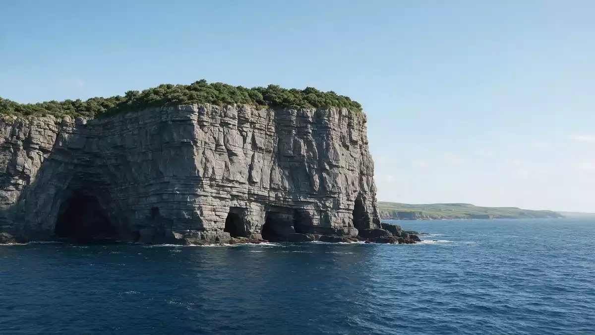
Aillte an Mhothair, on the Atlantic coast near Liscannor in County Clare, is a long line of sea cliffs where layered rock faces drop steeply to the waves below. The cliffs combine dramatic height with exposed geology, making the vertical edge itself the defining experience of the place.
Atlantic cliffs shaped in the Carboniferous seas
Aillte an Mhothair occupies the south-western edge of the Burren region of County Clare, facing the open Atlantic along a stretch of coastline several kilometres long.south-western edge of the Burren The cliffs rise from near sea level at their southern end at Hag’s Head to a high point where the rock stands well over 200 m (656 ft) above the water.
The rock faces expose thick beds of dark siltstone, shale and sandstone laid down during the Carboniferous period, when the area formed part of a shallow marine basin.Carboniferous period These rocks date from hundreds of millions of years ago, with the sandstones and shales representing sediments deposited by ancient rivers and seas in the Namurian stage of that period.Namurian sandstone and shale The layering of these sediments is clearly visible on the cliff faces, forming horizontal bands that extend along the coast.
Aillte an Mhothair, Hag’s Head and O’Brien’s Tower
The Irish name Aillte an Mhothair is associated with an earlier fort near Hag’s Head, at the southern end of the cliffs, whose remains gave rise to the “cliffs of the ruin” meaning attached to the name.Aillte an Mhothair name Hag’s Head marks the start of the main cliff line, where the rock begins to rise sharply from the shoreline and the sea meets the base of the formation.
Near one of the highest points of Aillte an Mhothair stands O’Brien’s Tower, a round stone tower constructed in 1835 by Sir Cornelius O’Brien as a viewing structure on the cliff top.O’Brien’s Tower constructed in 1835 The tower sits close to the section of the cliffs that reaches around 214 m (702 ft) above the Atlantic, giving it a prominent position in views along the cliff line.maximum cliff height near the tower From the area around the tower, paths follow the cliff edge, with the sea far below and the strata of sandstone and shale visible in the faces.
Burren and Cliffs of Moher UNESCO Global Geopark
Aillte an Mhothair forms part of the Burren and Cliffs of Moher UNESCO Global Geopark, a designation that recognises the geological significance of the region and its exposed Carboniferous rocks.UNESCO Global Geopark designation The Geopark links the cliffs with the limestone plateau of the Burren to the north and east, together forming an area where the underlying geology is visible on a large scale.
Within this Geopark, Aillte an Mhothair presents a coastline of cliffs extending for roughly 14 km (8.7 miles), where repeating cycles of sandstone, siltstone and mudstone can be seen in the exposed faces.14 km of cliffs The height of the cliffs above the Atlantic, combined with their length and the clear stratification of the rock, makes this section of coast a striking example of ancient marine sedimentary geology.formed over 320 million years ago
Visiting Aillte an Mhothair: what travellers from Western Europe should know
- Aillte an Mhothair lies on the Atlantic coast of County Clare near Liscannor, reached by road routes from Ennis and Galway, with signposted access to the cliff area.
- The terrain at the cliffs involves exposed cliff edges, uneven ground and sections of path with gradients and steps, so walking in the main viewing areas requires steady footing.
- In coastal weather, mist, rain and strong winds can reduce visibility along the cliffs, and conditions at the cliff edge differ markedly from inland areas.
- The cliffs stand opposite the Aran Islands at the mouth of Galway Bay, with views across the water towards the islands from parts of the cliff-top paths.
- The official language is English and the currency is the euro.
Searching for Aillte an Mhothair on social platforms
These links open searches for Aillte an Mhothair on each platform.
Frequently asked questions about Aillte an Mhothair
Where is Aillte an Mhothair located?
Aillte an Mhothair is on Ireland’s Atlantic coast in County Clare, near the village of Liscannor and at the south-western edge of the Burren region.
What should visitors expect on a visit to Aillte an Mhothair?
Visitors encounter high sea cliffs with exposed rock strata, cliff-top paths above the Atlantic and views along a long section of coastline, with O’Brien’s Tower on the higher ground.
What makes Aillte an Mhothair distinctive compared with other coastal landscapes?
Aillte an Mhothair combines significant cliff height, a long continuous line of cliffs, clearly visible Carboniferous rock layers and inclusion in a UNESCO Global Geopark centred on the Burren and the cliffs.


