
Ayutthaya Historical Park and the island city of ruins
Published on 08/25/2026 at 08:23 | Editorial responsibility: Rafael Müller, Editor-in-Chief AD HOC NEWS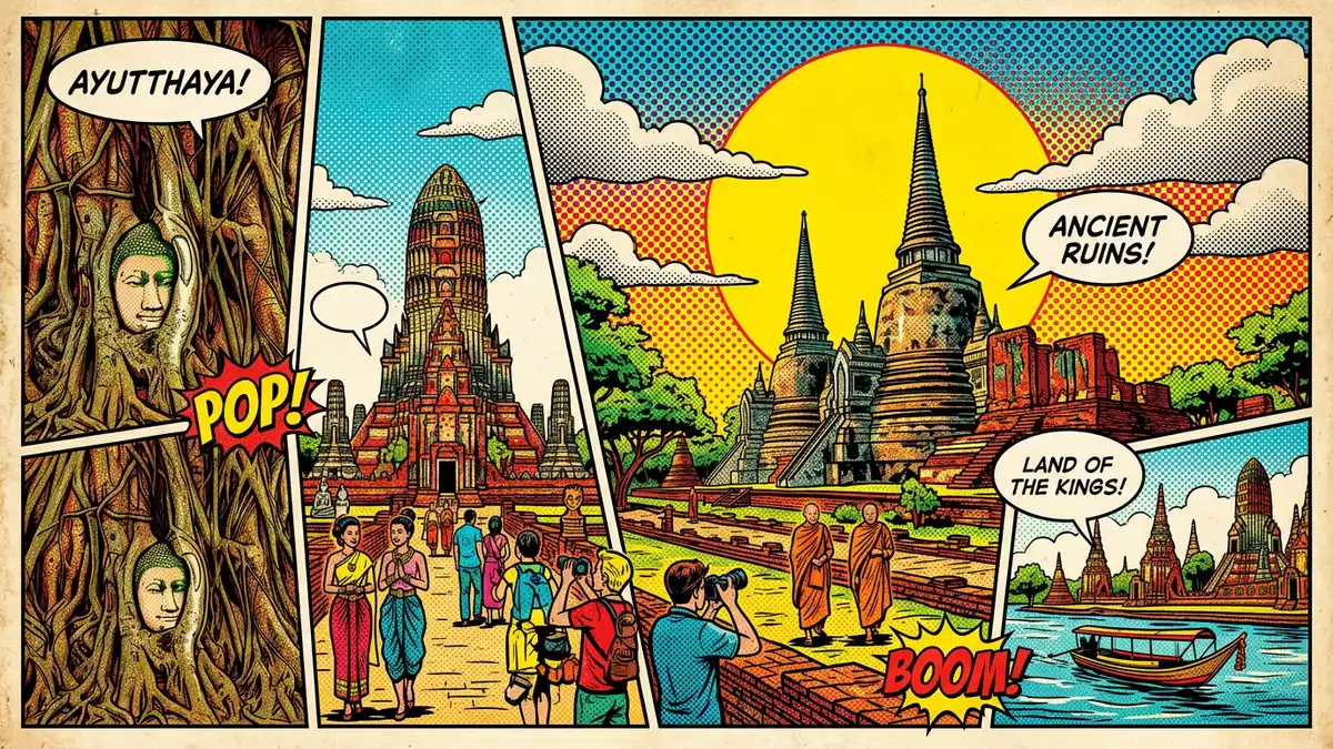
Ayutthaya Historical Park in Ayutthaya is an archaeological landscape of brick and stucco ruins on an island encircled by rivers, preserving the former capital of the Ayutthaya Kingdom. The site forms the core of the “Historic City of Ayutthaya”, which was inscribed as a UNESCO World Heritage Site in 1991 under cultural criterion (iii), recognising the remains of a once-powerful Siamese city.Historic City of Ayutthaya inscription
An island city shaped by rivers and red brick
The historic core of Ayutthaya sits on a low island formed where the Chao Phraya, Pa Sak and Lopburi rivers meet, and Ayutthaya Historical Park spans much of this terrain.island city encircled by rivers Within this island, the park covers around 289 ha (about 710 acres), holding the principal temple and palace ruins of the former capital.289 ha World Heritage core
The setting is largely level ground broken by raised temple platforms, brick terraces and prang towers. Many structures rise from broad bases of reddish laterite and brick, faced with stucco that now flakes and reveals the construction underneath. In places, collapsed walls and scattered bricks mark the outlines of vanished halls, while ponds, moats and water channels recall the hydraulic layout of the old city. Between the ruins stand trees and patches of grass, so walking the park means moving constantly between masonry and open ground.
Capital of the Ayutthaya Kingdom and its destruction
Ayutthaya became the capital of a powerful Siamese kingdom in the fourteenth century, after the city was founded by King Ramathibodi I in 1350 and made his seat of power shortly afterwards.foundation by Ramathibodi I in 1350 From 1351 until the late eighteenth century the Ayutthaya Kingdom governed large parts of mainland Southeast Asia, and the island city grew into a major hub of trade and diplomacy for European, Persian, Chinese and Japanese merchants.capital of the Ayutthaya Kingdom
This long period of rule ended violently in 1767, when invading Burmese forces sacked the city and left many monasteries, palaces and statues damaged or headless.destruction in 1767 The modern park preserves that aftermath as much as the earlier grandeur: pedestal bases without their Buddha images, burnt brickwork and leaning chedis stand beside restored prangs and reconstructed platforms. Walking through the park gives a sense of a city that ended abruptly yet retained enough material to trace its grid of monasteries and royal compounds.
Temple forms, prang towers and the famous Buddha head
Ayutthaya Historical Park is best understood through its characteristic temple forms, especially the Khmer-style prang towers and the broad bases of Siamese chedis. One of the most recognisable ensembles is Wat Mahathat, where the remains of a central prang and surrounding cloister mark an important royal monastery within the city. Nearby, the stone and brick likeness of a Buddha head nestled within the roots of a tree has become a widely recognised symbol of Ayutthaya’s ruined state.Wat Mahathat and Buddha head in tree
Further west, the long brick platform of Wat Phra Si Sanphet indicates the former royal temple associated with the palace compound, lined by three prominent chedis that recall the ritual core of the kingdom.Wat Phra Si Sanphet royal temple Other sites such as Wat Ratchaburana and Wat Chaiwatthanaram display variations on the prang-and-gallery plan, with central towers rising above lower halls and terraces. Across the park, visitors encounter both brick foundations where only the plan survives and taller structures where stairways still climb to upper platforms, offering elevated views over the island’s patchwork of ruins, trees and water.
Visiting Ayutthaya Historical Park: what travellers from Western Europe should know
- Ayutthaya Historical Park lies within the island city of Ayutthaya in Phra Nakhon Si Ayutthaya Province, central Thailand, reached by rail and road services from Bangkok and other regional centres.
The main approaches cross bridges over the Chao Phraya and Pa Sak rivers onto the historic island. - The terrain inside the park alternates between level paths, grassy areas and temple platforms reached by stairways, so moving between major sites involves walking on uneven brick surfaces and climbing steps without handrails.
- Ayutthaya’s climate is tropical, and the open character of the ruins means many walkways and terraces are exposed to sun, with shade mainly under trees or within surviving halls.
- The park sits amid the wider urban area of Ayutthaya, and several distinct temple clusters are separated by modern streets, canals and small neighbourhoods, so visiting more than one cluster involves crossing ordinary city traffic.
- The official language is Thai and the currency is the Thai baht. Entry requirements depend on your nationality; UK travellers can check the FCDO travel advice at gov.uk/foreign-travel-advice, Irish travellers the Department of Foreign Affairs at ireland.ie.
Searching for Ayutthaya Historical Park on social platforms
These links open searches for Ayutthaya Historical Park on each platform.
Frequently asked questions about Ayutthaya Historical Park
Where is Ayutthaya Historical Park?
Ayutthaya Historical Park is on the island city of Ayutthaya in Phra Nakhon Si Ayutthaya Province, central Thailand, about 80 km north of Bangkok.location north of Bangkok
What should visitors expect on a visit?
Visitors encounter extensive brick and stucco ruins of temples and palaces, linked by open paths and city streets, with prang towers, chedis, foundations and occasional intact halls forming a continuous archaeological landscape.ruins of capital and temple forms
What makes Ayutthaya Historical Park distinctive?
The park combines the layout of a former royal capital, its riverside island setting and emblematic features such as prang towers, three large chedis at Wat Phra Si Sanphet and the Buddha head in a tree at Wat Mahathat, all within a single walkable area.distinctive ensemble of ruins


