
Bay of Fundy and the coastline shaped by the tides
Published on 09/23/2026 at 16:38 | Editorial responsibility: Rafael Müller, Editor-in-Chief AD HOC NEWS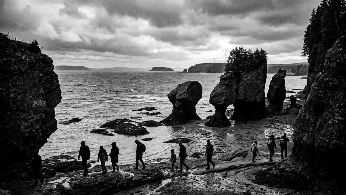
Bay of Fundy reaches Saint John as a moving landscape rather than a fixed waterfront. Twice each day, Atlantic water rises and falls through the bay, meeting the Saint John River at the Reversing Rapids. Cliffs, tidal flats, sea caves and harbour channels reveal the change in different forms.
Bay of Fundy: a coastline measured by water
The bay lies between New Brunswick and Nova Scotia, opening towards the Gulf of Maine. Its long, narrowing basin carries some of the largest tidal movements on Earth, with the greatest ranges reaching about 16 m (52 ft) in parts of the bay. Fundy’s tidal range changes from place to place along the coast.
Two high tides and two low tides occur during each tidal day. The interval between high and low water averages about six hours and 13 minutes. At low tide, sections of shoreline become exposed mudflat, beach or rock platform; at high tide, the same places lie beneath moving seawater.
Saint John and the Reversing Rapids
Saint John sits where the Saint John River enters the bay through a rocky gorge. The meeting of river water and Fundy tides produces whirlpools, standing waves and rapids known as the Reversing Rapids. The Reversing Rapids can be viewed from lookout points near the gorge and from the Harbour Passage.
The water does not present the same scene throughout the tidal cycle. River flow dominates at low tide, while the rising bay changes the balance inside the gorge. Between the opposing water levels comes slack tide, when the surface becomes comparatively calm before the next phase begins.
Stone, forests and a geological record
The shore around Saint John belongs to the Stonehammer UNESCO Global Geopark. Its rocks preserve almost one billion years of geological history, from the Late Precambrian to the last ice age. Stonehammer’s geological record includes ancient marble, volcanic rocks, sedimentary layers and glacially shaped landscapes.
Fundy National Park extends the coastal story through cliffs, coves, estuaries, salt marshes and Acadian forest. Its shoreline exposes bedrock as the tides move across the coast. Intertidal habitats alternate between salt water, freshwater runoff, sun, silt and ice, supporting plants and animals adapted to repeated change.
At St Martins, red sandstone cliffs contain sea caves that can be reached from the beach when the tide has receded. The caves belong to a coastal landscape of rock, harbour, beach and tidal water, while the Fundy Trail connects the village with further shoreline scenery.
Visiting Bay of Fundy: what travellers from Western Europe should know
- Saint John is on New Brunswick’s Bay of Fundy coast. The Reversing Rapids are reached from viewpoints near Bridge Road, Fallsview Avenue and the Harbour Passage.
- The shoreline changes substantially between high and low tide. Sea caves at St Martins are accessible from the beach only when the tide has receded.
- Fundy National Park lies along the bay east of Saint John. Its coastal landscape includes cliffs, salt marshes, estuaries and forest.
- The official language is English and French, and the currency is the Canadian dollar.
- Entry requirements depend on your nationality; UK travellers can check the FCDO travel advice at gov.uk/foreign-travel-advice, Irish travellers the Department of Foreign Affairs at ireland.ie.
Searching for Bay of Fundy on social platforms
These links open searches for Bay of Fundy on each platform.Frequently asked questions about Bay of Fundy
Where is Bay of Fundy?
Bay of Fundy lies between New Brunswick and Nova Scotia on Canada’s Atlantic coast. Saint John occupies its western side in New Brunswick.
What can visitors expect to see?
Visitors encounter changing water levels, rocky gorges, tidal flats, cliffs, sea caves, salt marshes and forested coastal landscapes.
What makes the bay distinctive?
Its powerful tides alter the appearance of the shoreline during each tidal cycle. At Saint John, the changing water meets the Saint John River at the Reversing Rapids.


