
Bay of Islands from Paihia’s shoreline and stories
Published on 08/17/2026 at 13:23 | Editorial responsibility: Rafael Müller, Editor-in-Chief AD HOC NEWS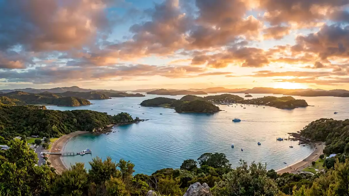
On the east coast of New Zealand’s North Island, the Bay of Islands spreads out in front of Paihia as a sheltered harbour scattered with islands and historic shorelines. It is both a subtropical maritime landscape and a place where M?ori voyaging traditions and nineteenth-century European missions left enduring landmarks.
A drowned valley of islands and peninsulas
The Bay of Islands is a broad drowned valley system on the Pacific coast of the Far North District, carved by ancient rivers and later flooded by the sea to form a natural harbour.drowned valley system Its waters open towards the ocean between the long Cape Brett Peninsula to the east and peninsulas and headlands that shelter the bay from swells further north.passage to the Pacific Within this harbour, islands and inlets break the surface in every direction, turning even short boat journeys into constantly shifting views across water and low hills.
Geographers describe the bay as extending across tens of kilometres and containing well over one hundred named islands, with Urupukapuka Island the largest of them.Urupukapuka Island From Paihia’s foreshore, the water is framed by nearby headlands and the outlines of islands further out, while, behind the town, the land rises in low ridges clothed in coastal vegetation. The result is a harbour that feels enclosed yet expansive, offering sheltered anchorages, open channels and views towards the outer ocean.
M?ori arrival, voyaging and settlement
Long before European ships crossed the horizon, M?ori navigators brought waka from central Polynesia to this coast and settled around the bay and on its islands. One tradition links the arrival of the M?taatua canoe to the Bay of Islands, sailed here by Puhi, whose descendants formed the Ng?puhi iwi that is today one of the country’s largest tribal groups.M?taatua canoe and Ng?puhi Communities established p? and k?inga on sheltered headlands and fertile river mouths, taking advantage of the harbour’s mix of fishing grounds, cultivable land and safe landing places.
These settlements gave rise to recognised hap? in different parts of the bay, such as Ng?ti Miru around Kerikeri, each with its own history of alliances, conflict and trade.tribal communities around the bay Marae and other M?ori sites in the wider region continue to embody these histories, and travellers basing themselves in Paihia encounter them most directly at the Waitangi Treaty Grounds, where carved meeting houses and flagstaffs stand close to the shore. The M?ori names for the bay, including Te P?whairangi, underline that this harbour is a cultural landscape as much as a scenic one.M?ori names for the bay
From Cook’s charts to missions and a treaty
In 1769 the British navigator Captain James Cook sailed into these waters and applied the English name “Bay of Islands” to the harbour, noting the abundance of islands as he charted the coastline.Captain James Cook named the bay Other European visitors followed, including the French explorer Marion du Fresne, whose short-lived settlement on Moturoa Island in the eighteenth century showed how attractive the bay’s sheltered anchorages and timbered shores were to overseas crews.early European settlements
In the nineteenth century, British missionaries of the Church Missionary Society established stations around the bay, and Paihia became one of their key bases. Henry Williams and his wife Marianne settled there in 1823 and built a church, part of a mission landscape that also included Kerikeri and other nearby sites.Henry Williams mission at Paihia A printing press set up in Paihia in the 1830s by William Colenso later produced printed copies of the Treaty of Waitangi in 1840, linking the town to the document that underpins the relationship between the British Crown and M?ori rangatira.printing press at Paihia Across the water at Waitangi, that treaty was first signed in the same year, in a setting of lawns, native trees and views across the bay.
Paihia as gateway town on the waterfront
Today Paihia is a coastal town on the Bay of Islands shoreline in New Zealand’s Northland Region, acting as a gateway to the harbour and its islands.town on the Bay of Islands shoreline Low-rise buildings cluster around the curve of the main beach, where a wharf extends into the water and vessels depart towards Urupukapuka Island, Russell and the outer harbour. Behind the waterfront, streets rise gently inland, and bush-covered ridges frame the town, giving it a setting where sea and land meet at close range.
From Paihia’s foreshore it is a short journey by road to the Waitangi Treaty Grounds, which occupy the next headland along and combine historic buildings with open green spaces and carved M?ori structures.Waitangi Treaty House nearby Across the bay, the older settlement of Russell sits on its own waterfront, and further inland Kerikeri lies at the head of an inlet where mission buildings and stone storehouses survive beside the river. This cluster of towns and historic sites around the bay makes Paihia an effective base for exploring both the maritime landscape and the layered history of Northland.
Visiting Bay of Islands: what travellers from Western Europe should know
- The Bay of Islands lies in the Far North of New Zealand’s North Island, with Paihia on its southern shore, reached by road connections from Auckland and Whang?rei.
- Paihia’s waterfront and wharf sit at sea level, with short approaches on foot and gently rising streets behind the beach rather than steep climbs.
- Harbour cruises and ferries depart from Paihia’s wharf towards Russell, Urupukapuka Island and the outer bay, linking coastal settlements and islands across sheltered water.
- Waitangi Treaty Grounds are located on the next headland along from Paihia, reached by a short road journey and offering walking routes across lawns and low slopes.
- The official language of New Zealand is English and the currency is the New Zealand dollar.
Searching for Bay of Islands on social platforms
These links open searches for Bay of Islands on each platform.Frequently asked questions about Bay of Islands
Where is the Bay of Islands in New Zealand?
The Bay of Islands is on the east coast of the Far North District of New Zealand’s North Island, with towns such as Paihia, Russell and Kerikeri around its shores.
What can visitors expect when basing themselves in Paihia?
Visitors staying in Paihia find a coastal town with a beach, wharf and low hills, regular boat connections across the harbour and road access to nearby historic sites such as Waitangi.
What makes the Bay of Islands distinctive compared with other harbours?
The Bay of Islands combines a drowned valley harbour with numerous islands, peninsulas and historic M?ori and mission sites, giving it both a varied maritime geography and concentrated cultural landmarks.


