
Bijagos Archipelago, a tidal world of islands off Bissau
Published on 08/22/2026 at 09:07 | Editorial responsibility: Rafael Müller, Editor-in-Chief AD HOC NEWS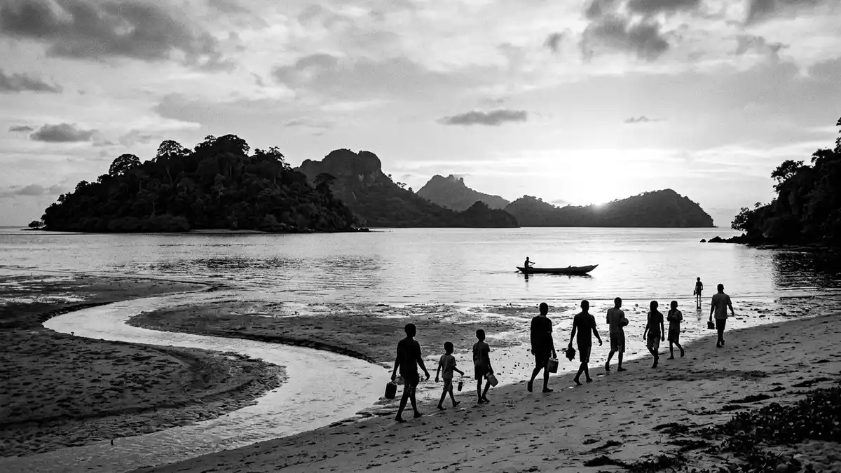
The Bijagos Archipelago off the coast of Guinea-Bissau is a broad scatter of low islands, sandbanks and tidal channels where land and sea continually trade places. Recognised as a biosphere reserve in the late twentieth century, it forms an insular counterweight to the mainland around Bissau, with shallow Atlantic waters, mangrove forests and remote villages spread across dozens of islands.
A tidal archipelago shaped by land and sea
The Bijagos Archipelago lies in the shallow coastal waters of Guinea-Bissau in West Africa, formed from the ancient delta of the Rio Geba and Rio Grande rivers as they reach the Atlantic. The island group consists of around 88 islands and islets, only a fraction of which are permanently inhabited, extending across more than 10,000 km2 (3,861 sq mi) of marine and intertidal landscapes.Bolama-Bijagós Biosphere Reserve Wide expanses of mudflats and sandbanks emerge at low tide, creating tidal patterns that are visible even in satellite imagery of the archipelago.tidal landscapes of the Bijagós Archipelago
The islands sit some distance offshore from Bissau, forming an insular zone sometimes referred to as Bolama-Bijagos because of the regional capital Bolama and the wider archipelago. Mangroves line the creeks and estuaries, while coastal savannah, palm groves and pockets of tropical forest occupy higher ground.exceptional biodiversity with mangroves and savannahs Between them lie lagoons, salt pans and shallow channels which give the archipelago its characteristic mixture of water and land.
UNESCO recognition and protected marine landscapes
In 1996 UNESCO recognised the Bijagos Archipelago as a biosphere reserve, acknowledging the coexistence of conservation and traditional island life across the Bolama-Bijagós region.archipelago recognised as a Biosphere Reserve on 16 April 1996 The biosphere reserve extends over more than 1,046,950 ha, including extensive intertidal flats, mangroves and surrounding waters.surface and location of the Bolama-Bijagós Biosphere Reserve Within this wider protected area sits a more focused World Heritage Site known as the Coastal and Marine Ecosystems of the Bijagós Archipelago, inscribed in 2025 as a natural site.
The World Heritage listing covers about half of the archipelago’s intertidal and marine habitats, including three named marine protected areas: João Vieira and Poilão Marine National Park, Orango Islands National Park and the community marine protected area of the Urok Islands (Formosa, Nago and Chediã).Coastal and Marine Ecosystems of the Bijagós Archipelago These protected zones safeguard turtle nesting beaches, coastal lagoons and mangrove-lined channels, while the islands beyond them act as a buffer against external pressures.
Islands, communities and wildlife
Among the archipelago’s islands, Bubaque serves as the administrative centre and is described as the most populous island, acting as a hub for transport between the mainland and other parts of the Bijagos.Bubaque as administrative capital of the archipelago Other islands stand out for particular landscapes or protected status: Orango is the largest in terms of surface area, João Vieira and Poilão form a marine national park, and Rubane and Canhabaque are known for beaches and traditional settlements.major islands such as Bubaque, Orango Grande and João Vieira
The archipelago’s mixture of habitats supports a wide range of wildlife. Mangroves and surrounding waters provide feeding grounds for fish, reptiles and marine mammals, while intertidal flats host migratory shorebirds and wetlands typical of West Africa’s Atlantic coast.mangroves and surrounding waters support rich birdlife and other fauna Green sea turtles use some of the outer islands, particularly Poilão, as important nesting sites, adding a further layer of ecological significance.intertidal zones and turtle nesting areas across the archipelago
Visiting Bijagos Archipelago: what travellers from Western Europe should know
- The Bijagos Archipelago lies off the coast of Guinea-Bissau to the west of Bissau, reached by boats that cross the coastal waters between the mainland and islands such as Bubaque.
- Travel within the archipelago involves moving between islands by boat and walking along beaches, sandy tracks and paths that pass through mangroves or low forest, with some stretches exposed at low tide.
- The terrain is low-lying and close to sea level, with extensive mudflats and sandbanks; footwear suited to wet ground and soft sand is important on tidal approaches.
- The official language of Guinea-Bissau is Portuguese and the currency is the West African CFA franc.
- Entry requirements depend on your nationality; UK travellers can check the FCDO travel advice at gov.uk/foreign-travel-advice, Irish travellers the Department of Foreign Affairs at ireland.ie.
Searching for Bijagos Archipelago on social platforms
These links open searches for Bijagos Archipelago on each platform.
Frequently asked questions about Bijagos Archipelago
Where is the Bijagos Archipelago located?
The Bijagos Archipelago is off the Atlantic coast of Guinea-Bissau in West Africa, lying offshore from Bissau in the shallow coastal waters of the Rio Geba delta.
What can travellers expect on a visit to the Bijagos Archipelago?
A visit centres on low islands, mangroves, beaches and tidal flats, with boat journeys between islands, walking on sand and mud, and glimpses of wildlife in protected marine areas.
What makes the Bijagos Archipelago distinctive among Atlantic island groups?
The archipelago combines an extensive tidal landscape of 88 islands and intertidal zones with UNESCO recognition as both a biosphere reserve and a marine World Heritage Site.


