
Bora Bora’s volcanic peaks and luminous lagoon
Published on 09/24/2026 at 09:16 | Editorial responsibility: Rafael Müller, Editor-in-Chief AD HOC NEWS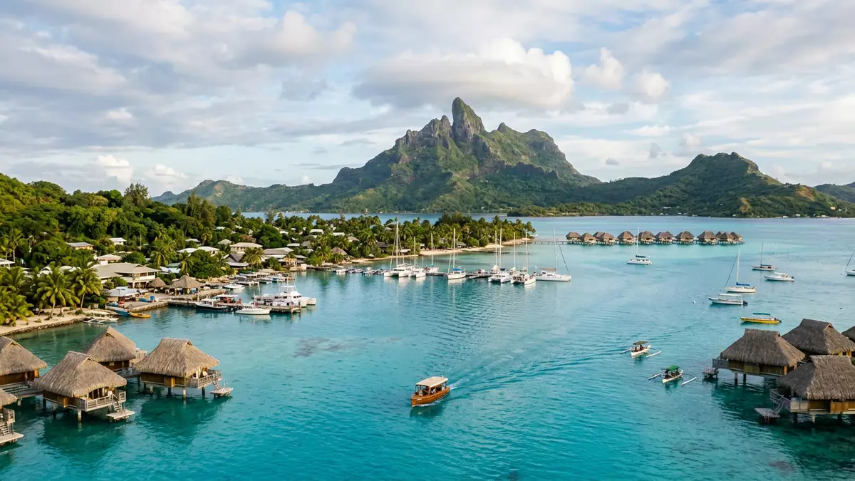
Bora Bora is a volcanic island whose central peaks rise from a lagoon enclosed by coral reef. Vaitape, the principal village, faces the western waters, while Mount Otemanu forms the island’s highest point at 727 m (2,385 ft).
Bora Bora’s volcanic heart above the lagoon
The island belongs to the Leeward Islands of the Society Islands in French Polynesia. Its main landform is the remnant of an extinct volcano, with steep ridges rising from a compact island surrounded by reef and lagoon.
Mount Otemanu reaches 727 m (2,385 ft), and Mount Pahia rises to 658 m (2,159 ft). Their dark volcanic slopes create the central skyline, while the surrounding lagoon extends towards coral reef and offshore motu. The highest peaks of Bora Bora are part of a landscape shaped by volcanic rock, erosion and coral growth.
From Polynesian settlement to French territory
Polynesian settlers reached Bora Bora during the first centuries of the current era, joining the wider network of ocean navigation across the Society Islands. The Tahitian form Pora Pora is traditionally associated with the meaning “First Born”.
European records place the first sighting by Dutch admiral Jacob Roggeveen in 1722. Captain James Cook visited Bora Bora in 1769 and 1777, and France annexed the island in 1888. The political history of Bora Bora includes a nineteenth-century kingdom before the island became part of French Polynesia.
Vaitape on the western shore
Vaitape lies on the western side of the main island and serves as Bora Bora’s principal village and administrative centre. Its position faces the main lagoon, with the volcanic peaks rising inland behind the settlement.
The western coast connects the inhabited island with the lagoon’s maritime landscape. Reef passages, sheltered waters and offshore motu form the setting around Vaitape, while Mount Otemanu and Mount Pahia remain visible reference points across the island. Bora Bora’s volcanic island and lagoon are inseparable parts of its geography.
Visiting Bora Bora: what travellers from Western Europe should know
- Bora Bora lies in the South Pacific, in the Leeward Islands of French Polynesia. Vaitape is on the western coast, and flights arrive at Faa’a International Airport before the onward connection to Bora Bora.
- The island combines steep volcanic terrain with lagoon and reef environments. Mount Otemanu rises to 727 m (2,385 ft), while Vaitape sits close to sea level.
- The official languages are French and Tahitian, and the currency is the CFP franc.
- Entry requirements depend on your nationality; UK travellers can check the FCDO travel advice at gov.uk/foreign-travel-advice, Irish travellers the Department of Foreign Affairs at ireland.ie.
Searching for Bora Bora on social platforms
These links open searches for Bora Bora on each platform.
Frequently asked questions about Bora Bora
Where is Bora Bora?
Bora Bora is in the Leeward Islands of the Society Islands, within French Polynesia in the South Pacific. Vaitape is its principal village on the western coast.
What can travellers expect from the landscape?
The island has steep volcanic peaks, a surrounding lagoon, coral reef and offshore motu. Mount Otemanu is the highest point at 727 m (2,385 ft).
What makes Bora Bora distinctive?
Its volcanic central ridge rises inside a reef-enclosed lagoon. The combination places dark mountain slopes, shallow waters and coral formations within one compact island setting.


