
Cape of Good Hope, where the Atlantic cliffs frame Kapstadt’s horizon
Published on 08/23/2026 at 14:17 | Editorial responsibility: Rafael Müller, Editor-in-Chief AD HOC NEWS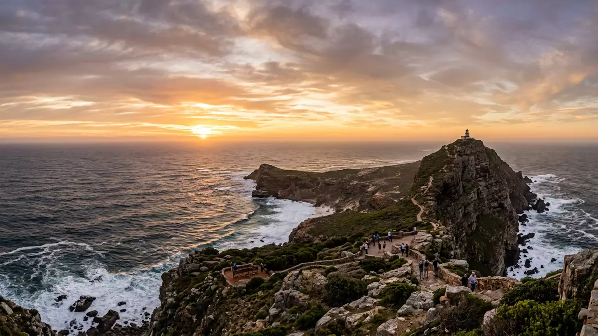
Cape of Good Hope is a rocky headland on the Atlantic edge of the Cape Peninsula, south of Kapstadt in South Africa. It forms part of Table Mountain National Park and has been a landmark for sailors and travellers since the fifteenth century, when European navigators began rounding the southern tip of Africa.
A rocky Atlantic promontory at Africa’s south-western edge
Geographically, Cape of Good Hope lies towards the southern end of the Cape Peninsula, a mountainous spur that projects into the Atlantic Ocean from South Africa’s south-western coast. The headland is one of three prominent points at the tip of the peninsula, alongside Cape Point and Cape Maclear, and it presents steep cliffs dropping towards the surf below.One of three points The wider Cape of Good Hope section forms part of a protected area that was organised as a nature reserve in 1939, later incorporated into the Cape Peninsula National Park and renamed under the Table Mountain National Park banner in 2004.Creation of the nature reserve
The promontory stands close to the meeting zone between major ocean systems. Along the Atlantic margin, the cool Benguela Current flows northwards from Antarctic latitudes, while warmer water linked to the Agulhas system moves down the Indian Ocean side of southern Africa.Convergence of cool and warm currents As a result, seas around Cape of Good Hope can be energetic, with breakers striking the cliffs and rocky inlets. Inland from the surf, the terrain rises into low mountains and slopes covered in fynbos, the characteristic shrubland of the Western Cape.
From Bartolomeu Dias to Table Mountain National Park
The name Cape of Good Hope entered European charts in the late fifteenth century, when Portuguese navigator Bartolomeu Dias sailed south along Africa’s Atlantic coast. In 1488, on a voyage seeking a sea route towards India, Dias rounded the cape and became the first recorded European to sight the headland from the deck of a ship.Dias rounding the cape in 1488 Accounts from the era describe him using the term “Cape of Storms”, while King John II of Portugal is associated with the more optimistic “Cape of Good Hope”, a name that reflected expectations of an ocean route linking Europe and Asia.Naming from Cape of Storms to Cape of Good Hope
In the centuries after Dias’s voyage, the cape’s profile became a waypoint for sailing ships trading between European ports and destinations in India, East Africa and the East Indies. It gave its name to a Cape Colony founded by the Dutch East India Company in the seventeenth century and later to the Cape Province, a large administrative region within South Africa.Cape Colony named after the cape On land, archaeological work across the peninsula has revealed traces of human presence dating back to the Early Stone Age, highlighting that this stretch of coastline has long been part of wider patterns of movement and settlement.Early Stone Age occupation
Landscape, wildlife and viewpoints along the Cape Peninsula
Within Table Mountain National Park, the Cape of Good Hope section offers a mixture of coastal scenery, inland slopes and viewpoints over both ocean basins. The headland itself stands above beaches and rocky bays, with surf rolling in from the Atlantic and seabirds using the cliffs as nesting ground. Inland, the vegetation is dominated by fynbos, a diverse plant community adapted to the region’s climate and soils.Promontory near the meeting of oceans The protected land area of Table Mountain National Park covers hundreds of square kilometres, with an additional marine reserve extending protection into the surrounding waters.Extent of the park and marine reserve
Routes across the peninsula connect the Atlantic and False Bay coasts. Roads approach the Cape of Good Hope from Kommetjie along the Atlantic seaboard and from Simon’s Town on the False Bay side, giving access to viewpoints where the outline of the Cape Peninsula can be seen running back towards Kapstadt and Table Mountain.Approach roads from Kommetjie and Simon’s Town From elevated points near the headland, it is possible to look along the coast in both directions, taking in the relationship between cliffs, open sea and the broader mountain chain of the peninsula.
Visiting Cape of Good Hope: what travellers from Western Europe should know
- Cape of Good Hope lies south of Kapstadt on the Cape Peninsula, within South Africa’s Table Mountain National Park. It is reached by road from Kapstadt via coastal routes on the Atlantic or False Bay sides.
- The terrain around the headland includes steep slopes, coastal cliffs and uneven rocky paths, with sections that involve walking on gradients rather than flat ground.
- Nearby, the small town of Simon’s Town on the False Bay coast and the settlement of Kommetjie on the Atlantic side provide reference points along the approaches to the cape.
- The official language is Afrikaans and the currency is the South African rand.
- Entry requirements depend on your nationality; UK travellers can check the FCDO travel advice at gov.uk/foreign-travel-advice, Irish travellers the Department of Foreign Affairs at ireland.ie.
Searching for Cape of Good Hope on social platforms
These links open searches for Cape of Good Hope on each platform.
Frequently asked questions about Cape of Good Hope
Where is Cape of Good Hope in relation to Kapstadt?
Cape of Good Hope is on the Atlantic coast of the Cape Peninsula, south of Kapstadt in South Africa, within Table Mountain National Park.
What can visitors expect when they reach the cape?
Visitors encounter steep coastal cliffs, Atlantic surf, fynbos-covered slopes and viewpoints looking along the Cape Peninsula and out towards open ocean.
What makes Cape of Good Hope distinctive among African capes?
The cape combines a rugged Atlantic headland with a long role in navigation since Bartolomeu Dias rounded it in 1488, giving it a prominent place in maritime history.


