
Chott el Djerid, the vast salt lake of southern Tunisia
Published on 08/14/2026 at 14:28 | Editorial responsibility: Rafael Müller, Editor-in-Chief AD HOC NEWS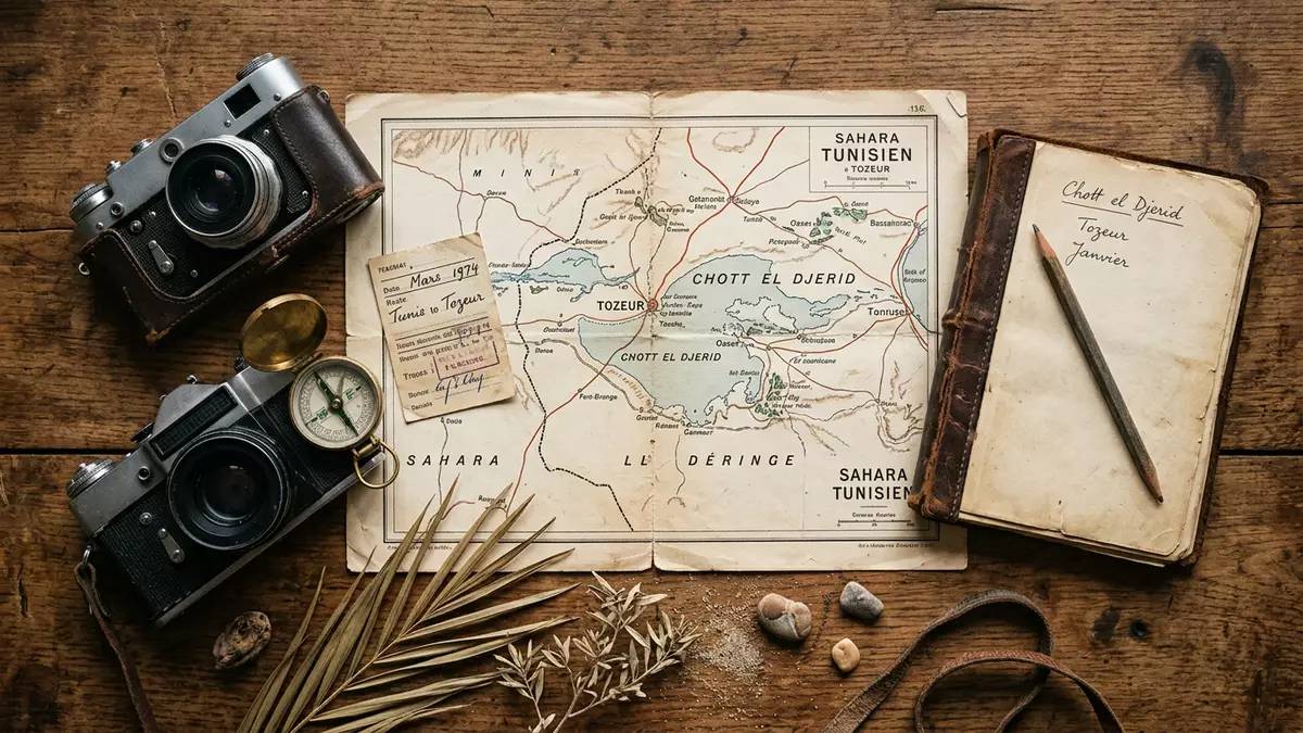
South of the oasis town of Tozeur in Tunisia, Chott el Djerid stretches across the desert as a vast salt lake whose flat, pale surface and mirages form one of North Africa’s most distinctive landscapes. Set within the wider Jerid region, the basin’s saline crust, shallow depressions and distant palm fringes make it a striking contrast to the dunes and rocky uplands of the surrounding Sahara.
A Saharan salt basin between oases and desert
Chott el Djerid is a large endorheic salt lake, meaning a closed drainage basin with no outlet to the sea, occupying a broad depression in southern Tunisia between the oases around Tozeur and the desert towards Kebili.large saline lake The lake lies in a synclinal hollow at the transition between Tunisia’s mountain chains to the north and the Saharan platform to the south, placing it in a geological setting where groundwater and surface inflows collect and evaporate rather than draining to the coast.creux synclinal The Jerid region, whose name is associated with palm groves, encompasses the surroundings of Tozeur and Nefta and forms the cultural backdrop to the lake’s edge settlements.region of Jerid
The saline depression covers several thousand square kilometres, making it the largest sebkha, or salt plain, in Tunisia and a dominant feature of the country’s southern map.plus vaste plaine saline Elevations on the salt flats lie modestly below sea level in places, accentuating the basin-like character of the terrain where mineral-rich waters can accumulate.elevation below sea level The lake is divided administratively between the governorates of Tozeur to the west and Kebili to the east, and is framed by desert landscapes that extend towards the Algerian border and the Gulf of Gabès beyond the wider chain of chotts.
Salt crusts, shallow water and optical effects
For much of the year, the surface of Chott el Djerid is a broad, hard crust of salt and mineral deposits, ranging in colour from bright white to pale ochre depending on moisture and sediment.salt pans of the chott Shallow basins and channels punctuate this crust, forming patches of standing water when rainfall or inflow from wadis and aquifers reaches the depression. During wetter periods, the chott takes on more of the character of a low lake, with sheets of water reflecting the sky above the salt flats.salt lake, almost always dry
The area’s arid climate, with limited annual rainfall and high evaporation, emphasises the contrast between the desiccated crust and the occasional shallow pools.mean annual rainfall and evaporation These conditions contribute to optical phenomena familiar to travellers on the causeway across the lake: heat shimmering above the flats and distant reflections that give rise to mirage-like impressions of water and objects on the horizon.optical phenomena Along parts of the shore, shallow water and salt-encrusted mud form irregular patterns, with small islands of higher ground and occasional vegetation marking the gradual transition from basin floor to the outskirts of the surrounding oases.
From palm oases to causeways and viewpoints
On the northern side of Chott el Djerid lie the oases of Tozeur and Nefta, whose date palm plantations and irrigated plots form a band of green against the pale expanse of the basin.oases towns on the periphery The Jerid’s palm groves are an established feature of this region, and their presence close to the lake underlines the contrast between cultivated fertility and the mineral-rich, sparsely vegetated basin floor.region of palm groves To the east, settlements such as Kebili and Douz connect the chott to further Saharan routes, with the salt flats forming a natural foreground to the dune fields and desert tracks beyond.between oases and desert towns
A paved road crosses Chott el Djerid on an embankment, giving passing travellers long views over the salt flats and shallow depressions.paved causeway across the chott Roadside stopping places and informal viewpoints along this crossing offer access to the crust at the lake’s edge, where the texture of the salt and the shallow relief of the basin can be seen at close range. Beyond the road, the wider chott extends as a largely undeveloped natural landscape, with the salt plains and occasional water surfaces forming an open, horizontal scene broken only by distant palm belts, low rises and infrastructure lines at the margins.vast saline depression
Visiting Chott el Djerid: what travellers from Western Europe should know
- Chott el Djerid lies in southern Tunisia between Tozeur and Kebili, and is crossed by a paved road embankment that links the oasis region with the desert further east.
- The salt flats form an open, largely level basin, where approaches from the road may involve walking on uneven, encrusted surfaces that can be soft or waterlogged in places.
- The surrounding Jerid region includes palm oases such as Tozeur and Nefta, with the nearest larger settlements providing services and acting as bases for excursions onto the chott and nearby desert landscapes.
- The official language is Arabic and the currency is the Tunisian dinar.
- Entry requirements depend on your nationality; UK travellers can check the FCDO travel advice at gov.uk/foreign-travel-advice, Irish travellers the Department of Foreign Affairs at ireland.ie.
Searching for Chott el Djerid on social platforms
These links open searches for Chott el Djerid on each platform.
Frequently asked questions about Chott el Djerid
Where is Chott el Djerid located?
Chott el Djerid lies in southern Tunisia between the oases around Tozeur and the desertward settlements towards Kebili, within a saline depression framed by mountains and desert.
What should visitors expect on a visit?
Visitors encounter a broad salt basin with crusted surfaces, shallow depressions that can hold water, distant palm belts and wide, open views from roadside stopping places on the crossing.
What makes Chott el Djerid distinctive?
The combination of its size, position between palm oases and desert, saline crusts and the flat horizon that contributes to mirage-like optical effects gives Chott el Djerid a character specific to this Saharan region.


