
Dujiangyan and the Minjiang river reshaped for the Chengdu plain
Published on 09/08/2026 at 06:08 | Editorial responsibility: Rafael Müller, Editor-in-Chief AD HOC NEWS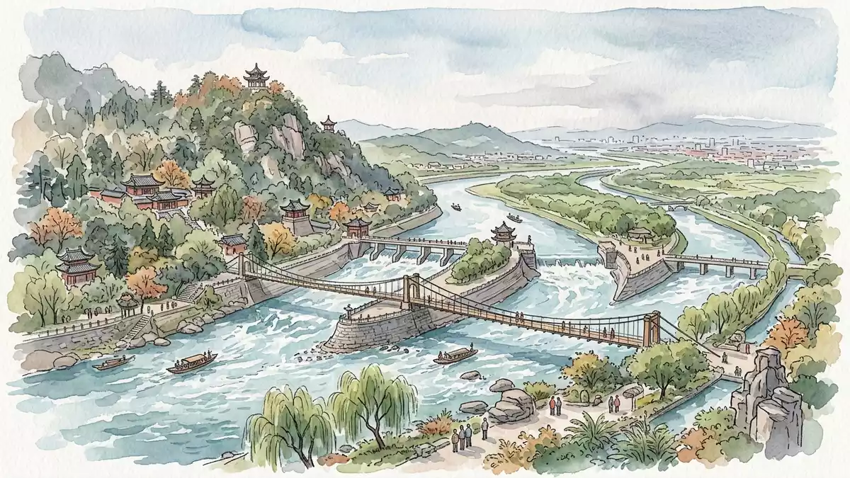
On the western edge of the Chengdu plain in Sichuan, Dujiangyan turns the flow of the Minjiang River into an organised web of channels that still irrigates farmland more than two millennia after it was first built. Constructed under Li Bing in the Warring States period, this ancient hydraulic work redirects mountain water across the flatlands without relying on a single dam, a layout that has earned its place alongside Mount Qingcheng on the UNESCO World Heritage List.
An ancient river project that still works
Dujiangyan is an irrigation and flood-control system on the Minjiang River in Sichuan Province, west of the Chengdu plain and close to Dujiangyan City. The project was begun in the third century BC under Li Bing, governor of Shu in the state of Qin, using the river’s existing gradient to send water into channels across the plain.The Dujiangyan irrigation system Construction is traditionally dated to around 256 BC, in the late Warring States period before the Qin unification of China.the project was first built around 256 BC
The system divides the flow of the Minjiang into channels that run through the Chengdu flatlands, bringing water to an extensive agricultural region that became known as a “Land of Heaven” for its productivity.The Dujiangyan Irrigation System Over the centuries it was enlarged and adjusted under successive dynasties, yet its basic principle – diverting and sharing the river’s water without a blocking dam – has remained. The work is set where the Sichuan basin meets the higher ground that rises towards the Qinghai–Tibet plateau, a junction that gives the channels a steady fall from river to fields.uses natural topographic and hydrological features
Weirs, dikes and an inlet cut from the Minjiang
The visible core of Dujiangyan is a sequence of earth and stone works in the river itself, paired with embankments and channels on the banks. At the upstream end a diversion structure known as the Yuzui – literally “fish mouth” – splits the river’s current, bending part of the flow towards the irrigation side while leaving the remainder to continue down the main course.Fish Mouth and Diamond Dike Nearby a low overflow weir called Feishayan provides an outlet where excess water and sediment can pass back to the river, relieving pressure on the channels.
Further along, the Baopingkou inlet cuts through the river bank, forming a controlled opening where water enters the main irrigation channel system feeding the Chengdu plain.Baopingkou inlet Additional embankments and dikes such as Baizhang Dike and the Miter Dike refine the division between flood discharge and irrigation flow, shaping the way water fans out across the network.diversion and drainage, control and diversion functions The system’s structures sit within a broader scenic area that includes riverbanks, bridges and temple sites such as Erwang Temple, which adds architectural and cultural layers around the engineering works.Dujiangyan Scenic Area
World Heritage landscape on the Chengdu plain
The importance of Dujiangyan lies not only in its age but also in its continuing role in shaping the landscape west of Chengdu. The irrigation network still distributes river water to farmland on the Chengdu plain, controlling floods and supporting agriculture over a wide area.still controls the waters of the Minjiang River In recognition of this long-lived function and its engineering methods, Mount Qingcheng and the Dujiangyan Irrigation System were inscribed together on the UNESCO World Heritage List in 2000 as a cultural site.inscribed on the World Heritage List in 2000
The site forms part of a wider mountain-and-river landscape west of Chengdu, with forested slopes rising above the river and cultivated land stretching across the plains downstream. Within the scenic area, paths and bridges connect viewpoints over the river works with temple courtyards and parkland, giving visitors close views of the diversion structures and the channels that feed the fields.the scenic area blends ancient engineering, natural beauty and traditional architecture Dujiangyan’s recognition has expanded beyond UNESCO to include listings as a heritage irrigation structure by international commissions, reflecting its status as a long-running example of river management and water sharing.a Heritage Irrigation Structure
Visiting Dujiangyan: what travellers from Western Europe should know
- Dujiangyan lies in Sichuan Province near Dujiangyan City, north-west of Chengdu, on the Minjiang River at the western edge of the Chengdu plain. It is reached by rail and road links from Chengdu, with onward local transport bringing travellers into the scenic area.
- The core waterworks are set in and beside the river, with paths, bridges and steps connecting different viewpoints; visiting the site involves walking over uneven ground and ascending and descending stairways.
- Mount Qingcheng rises nearby above the river valley, and the wider Dujiangyan Scenic Area includes temple complexes such as Erwang Temple and parkland that frame views of the irrigation structures.
- The official language is Chinese and the currency is the renminbi (yuan).
- Entry requirements depend on your nationality; UK travellers can check the FCDO travel advice at gov.uk/foreign-travel-advice, Irish travellers the Department of Foreign Affairs at ireland.ie.
Searching for Dujiangyan on social platforms
These links open searches for Dujiangyan on each platform.Frequently asked questions about Dujiangyan
Where is Dujiangyan?
Dujiangyan is on the Minjiang River near Dujiangyan City in Sichuan Province, north-west of Chengdu on the western fringe of the Chengdu plain.
What should visitors expect at Dujiangyan?
Visitors encounter river works, dikes, weirs, channels, bridges, paths and nearby temples within a scenic area that combines hydraulic engineering with mountain and river views.
What makes Dujiangyan distinctive?
Dujiangyan is distinctive as an ancient irrigation and flood-control system, begun in the third century BC, that still diverts river water without using a blocking dam and forms part of a World Heritage site.


