
Farangi Samarias: walking Kreta’s limestone gorge to the Libyan Sea
Published on 08/20/2026 at 07:16 | Editorial responsibility: Rafael Müller, Editor-in-Chief AD HOC NEWS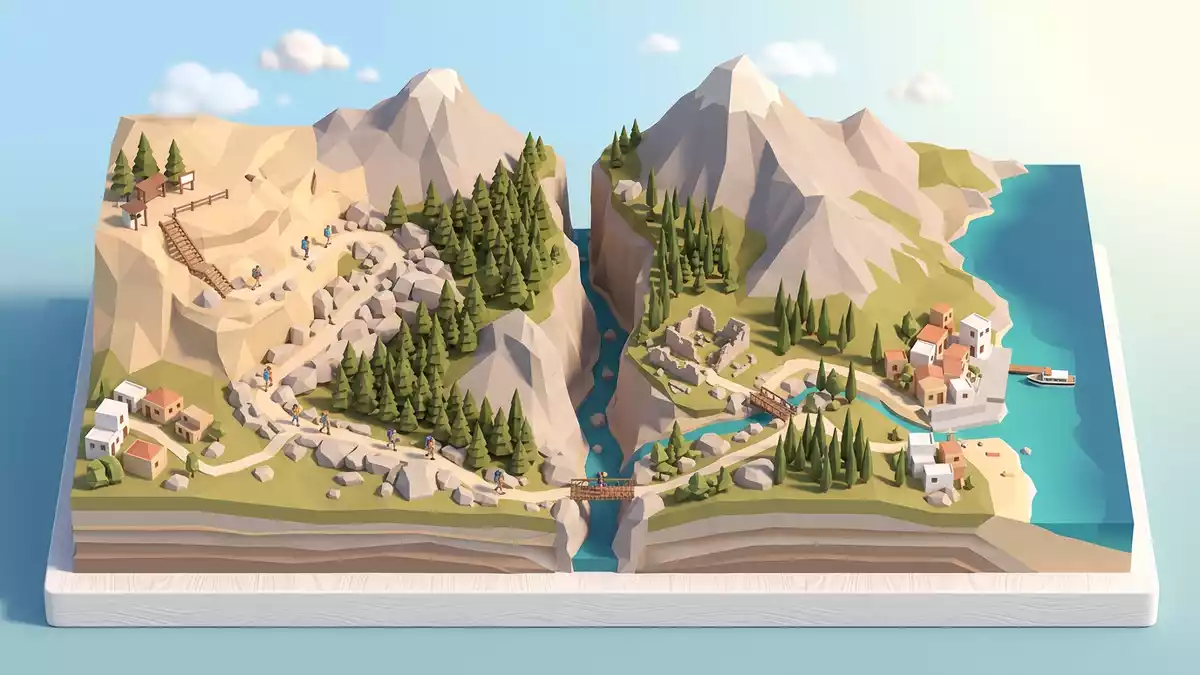
Farangi Samarias, known in English as the Samaria Gorge, is a long limestone ravine carved into the south-west of Kreta in Greece. Stretching from the upland basin of Omalos down to the Libyan Sea, it forms the core of the Gorge of Samaria National Park, created in 1962 as one of Greece’s first protected mountain landscapesNationalpark Samaria. The protected area has since been recognised by UNESCO as a biosphere reserve, placing this Cretan gorge within the international Man and the Biosphere networkbiosphere reserve status.
Limestone, depth and the line from plateau to sea
Farangi Samarias cuts through a mountainous limestone block in the regional unit of Chania, following a roughly north–south line from the Omalos plateau to the coast at Agia Roumelimountainous limestone area. The gorge itself is commonly described as about 13 to 16 km long, with additional kilometres on foot between the lower exit and the small harbour village on the Libyan Seahike from Xyloskalo to Agia Roumeli. The highest entrance at Xyloskalo on the Omalos plateau lies at over 1,200 m (around 3,900 ft) above sea level, and the path gradually descends through the gorge towards the coasthighest point about 1,200 m.
The landscape along Farangi Samarias shifts from upland pine and cypress woods to narrower sections where high limestone walls rise above the path. In the upper part, the route follows the line of the riverbed as it drops away from Omalos, with occasional wooden bridges spanning the stream. Further down, the gorge narrows between cliffs, including the famous “Iron Gates” section where the rock faces stand close together and tower over the stony channelSamaria-Schlucht description. Close to the sea, the cliffs open out and the path leads towards the small settlement of Agia Roumeli on the shore.
National park, biosphere reserve and Cretan wildlife
Farangi Samarias lies at the heart of the Samaria National Park, designated in 1962 to protect the gorge and its surrounding mountain slopesnational park in Chania. In 1981 the area joined the UNESCO Man and the Biosphere Programme, reflecting the ecological importance of this limestone ravine and its Mediterranean forestsUNESCO Man and the Biosphere listing. The national park covers parts of the Lefka Ori, the “White Mountains” of western Kreta, and includes steep cliffs, high peaks and the river corridor that runs along the gorge.
The vegetation inside Farangi Samarias mixes coniferous woodland with hardy shrubs that cling to ledges and scree. Hikers pass through stands of pine and cypress, with scattered plane trees near the riverbed where water is presentpine and cypress woods. The gorge is also known for its role as habitat of the Cretan wild goat, the kri-kri, which uses the cliffs and ledges of the White Mountains. A wider variety of birds and smaller mammals live in the park’s mosaic of forest, rock and riverbed, forming one of Kreta’s key mountain ecosystems.
Walking the long descent through Farangi Samarias
The classic traverse of Farangi Samarias follows a marked path from Xyloskalo on the Omalos plateau down to Agia Roumeli on the Libyan Sea, a journey that is commonly described as around 16 km for the gorge section and several kilometres more to the harbourXyloskalo to Agia Roumeli route. The descent at the upper end involves a long series of bends on a stony track. Lower down, the route alternates between level stretches and sections that pick their way through boulders in the riverbed. Wooden bridges and short constructed stairways appear where the river and rock demand them, but much of the way remains a simple mountain path.
Farangi Samarias includes several points with simple resting places, water taps and remnants of older settlement. About halfway down, the abandoned village of Samaria lies close to the path, with former stone houses and a small church under the surrounding slopesabandoned village Samaria. The lower sections bring walkers into the narrowest part of the gorge before emerging into a wider valley and eventually reaching the pebbled beach and harbour buildings of Agia Roumeli.
Visiting Farangi Samarias: what travellers from Western Europe should know
- Farangi Samarias lies in south-western Kreta, in the regional unit of Chania, between the Omalos plateau in the north and the coastal village of Agia Roumeli on the Libyan Sea. Access to the northern entrance at Xyloskalo is by road from Chania, while the southern exit at Agia Roumeli is reached by boat services along the coast.
- The terrain inside Farangi Samarias is demanding, with a long descent from over 1,200 m (around 3,900 ft) and many kilometres on stony paths, uneven riverbed sections and constructed steps. Walkers should be prepared for sustained walking on rock and gravel and for narrow passages between high limestone walls.
- The gorge lies within the Lefka Ori, and temperatures and river conditions vary with the season at this altitude and in the river channel.
- The official language is Greek and the currency is the euro.
Searching for Farangi Samarias on social platforms
These links open searches for Farangi Samarias on each platform.
Frequently asked questions about Farangi Samarias
Where is Farangi Samarias located on Kreta?
Farangi Samarias lies in south-western Kreta in the regional unit of Chania, running from the Omalos plateau through the White Mountains to the Libyan Sea near Agia Roumeli.
What should visitors expect when walking through the gorge?
Visitors encounter a long mountain walk on stony paths and riverbed sections, with steep limestone walls, forested slopes, an abandoned village and a final approach to the sea at Agia Roumeli.
What makes Farangi Samarias distinctive among Cretan landscapes?
The gorge combines a deep limestone ravine, a lengthy descent from over 1,200 m (around 3,900 ft), its status as a national park and UNESCO biosphere reserve, and its route from mountain plateau to Libyan Sea.


