
Fernando de Noronha rises from a submerged volcanic mountain
Published on 09/24/2026 at 01:50 | Editorial responsibility: Rafael Müller, Editor-in-Chief AD HOC NEWS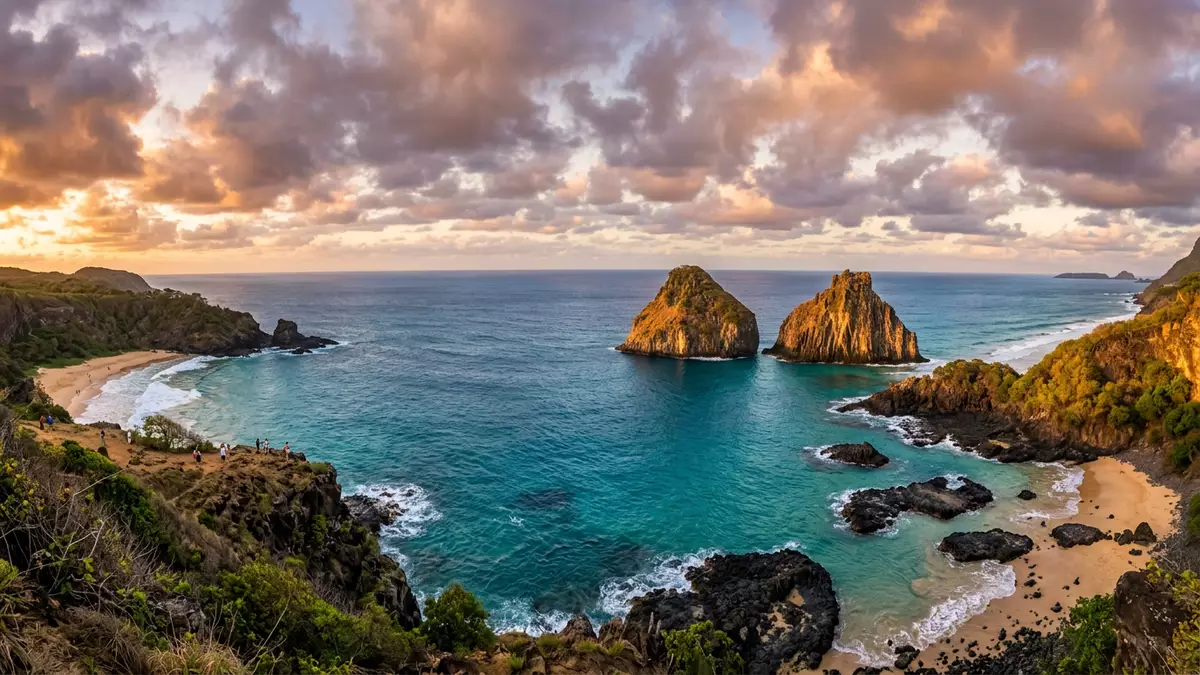
Fernando de Noronha is an Atlantic archipelago whose visible islands form the peaks of a submerged volcanic mountain chain. Volcanic cliffs, forested slopes and protected marine waters define the landscape, while the island’s human history reaches back to the sixteenth century.
Fernando de Noronha and the shape of a submarine volcano
The archipelago lies in the equatorial South Atlantic, off Brazil’s north-eastern coast. Its 21 islands, islets and rocks represent exposed parts of a volcanic mountain system extending far below the sea.
The main island rises to Morro do Pico, a prominent volcanic peak reaching 323 m (1,060 ft) above sea level. The exposed rocks include basalt, phonolite and other alkaline volcanic materials, formed during separate volcanic episodes in the Miocene and Pliocene.
The geological record gives Fernando de Noronha a character distinct from a continental beach destination. Dark rock formations, narrow headlands and steep coastal faces meet clear water around the island. the submerged mountain chain is central to the site’s physical identity.
From Portuguese discovery to a protected island district
Portuguese navigators recorded the archipelago in 1503, during an expedition associated with Gonçalo Coelho and Américo Vespucci. Its position in the Atlantic gave it a place in maritime history, while its isolated setting shaped later military and administrative uses.
Fortifications and churches remain among the visible traces of the island’s colonial period. Vila dos Remédios contains historic buildings connected with Portuguese occupation, including the Church of Nossa Senhora dos Remédios and the ruins of Fort Nossa Senhora dos Remédios.
Fernando de Noronha became part of Pernambuco after Brazil’s 1988 constitutional changes. The archipelago is administered as a state district rather than as a municipality, giving the inhabited island a distinctive political status within Brazil.
Protection of the surrounding waters developed during the twentieth century. The Fernando de Noronha Marine National Park was created in 1988, covering marine areas and much of the archipelago’s protected landscape. the 1988 marine park forms part of the island’s modern identity.
Sea turtles, dolphins and the Atlantic forest
Fernando de Noronha is recognised for marine habitats supporting tuna, sharks, sea turtles, cetaceans and other ocean species. Spinner dolphins gather in the surrounding waters, while seabirds use the islands and offshore rocks.
The islands contain remnants of insular Atlantic forest and include an oceanic mangrove in the South Atlantic. Their isolation has also produced endemic plants and animals, adding a biological dimension to the volcanic landscape.
In 2001, UNESCO inscribed Fernando de Noronha and Atol das Rocas Reserves as a World Heritage property. The designation covers natural values connected with marine feeding grounds, resident spinner dolphins and endangered species such as hawksbill turtles. the protected marine area includes terrestrial and ocean spaces around the main island.
The protected setting is visible in the relationship between land and sea. Beaches sit beneath volcanic slopes, offshore rocks break the horizon, and forested areas meet paths, forts and small settlements. Fernando de Noronha is therefore both a geological formation and a living Atlantic habitat.
Visiting Fernando de Noronha: what travellers from Western Europe should know
- Fernando de Noronha lies in the Atlantic Ocean off north-eastern Brazil and belongs to the state of Pernambuco. Flights connect the island with mainland Brazilian airports.
- The landscape includes volcanic slopes, rough coastal rock, beaches and uneven paths. Access to viewpoints and shorelines can involve steps or walking over irregular ground.
- The official language is Portuguese and the currency is the Brazilian real.
- Entry requirements depend on your nationality; UK travellers can check the FCDO travel advice at gov.uk/foreign-travel-advice, Irish travellers the Department of Foreign Affairs at ireland.ie.
Searching for Fernando de Noronha on social platforms
These links open searches for Fernando de Noronha on each platform.
Frequently asked questions about Fernando de Noronha
Where is Fernando de Noronha?
Fernando de Noronha is an archipelago in the equatorial South Atlantic, off Brazil’s north-eastern coast. It forms part of the state of Pernambuco.
What can visitors expect on the island?
Visitors encounter volcanic scenery, beaches, forested areas, historic forts and marine habitats. Walking routes can include uneven ground, slopes and steps.
What makes Fernando de Noronha distinctive?
The archipelago combines exposed peaks of a submerged volcano with protected waters supporting dolphins, sea turtles, sharks and seabirds. UNESCO inscribed it with Atol das Rocas Reserves as a World Heritage property in 2001.


