
Glacier National Park and its glacially carved landscape
Published on 09/23/2026 at 05:41 | Editorial responsibility: Rafael Müller, Editor-in-Chief AD HOC NEWS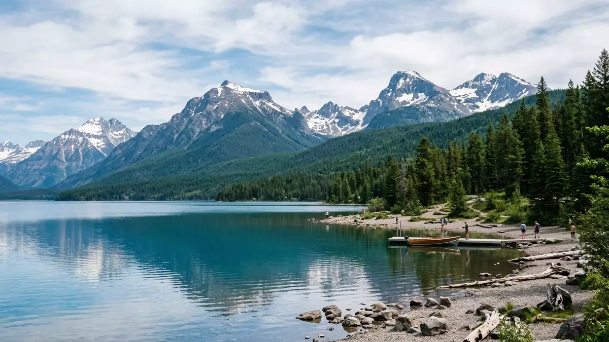
Glacier National Park is a landscape of broad lakes, sharp mountain ridges and valleys carved by ice. In northern Montana, the park stretches from West Glacier towards the Canadian border, with the Continental Divide crossing its high country.
Established on 11 May 1910, Glacier National Park combines ancient rock formations, alpine terrain and historic roads. Its visible character lies in the meeting of water, forest, exposed stone and surviving glaciers.
Glacier National Park: valleys shaped by ice
The park covers about 1,583 square miles (4,101 square kilometres) in the northern Rocky Mountains. Lake McDonald occupies a long valley on the western side, while mountain passes, hanging valleys and high ridges rise towards the Continental Divide.
Lake McDonald is the largest lake in the park. It extends for about 9.4 miles (15.1 kilometres), reaches more than 1 mile (1.6 kilometres) in width and has a recorded depth of 464 feet (141 metres). Its shoreline leads towards forested slopes and the western entrance area near Apgar.
Glacial landforms appear throughout Glacier National Park. Valleys have broad floors, steep walls and rock benches, while higher routes cross exposed slopes and alpine meadows. The landscape records sedimentation, mountain uplift and repeated glaciation across immense spans of geological time.
From Precambrian rock to a national park
Many rocks in Glacier National Park formed between about 800 million and 1.2 billion years ago. Mud and sand accumulated in ancient seas, hardened into sedimentary rock, and became part of the mountain landscape.
About 70 million years ago, large geological movements lifted these rock layers. Ice later cut valleys and cirques into the uplifted terrain. Coloured mudstone, quartzite and limestone appear among the exposed formations.
Human history reaches back more than 10,000 years. Blackfeet, Salish, Kootenai and Pend d’Oreille peoples have longstanding cultural connections with the region, whose eastern and western landscapes differ in vegetation, elevation and landform.
George Bird Grinnell campaigned for national-park protection, and President William Howard Taft signed the establishing legislation in 1910. The park became part of Glacier National Park’s history.
Going-to-the-Sun Road and the Continental Divide
Going-to-the-Sun Road crosses Glacier National Park between the western and eastern sides. Completed in 1932, it reaches Logan Pass at 2,025 metres (6,646 feet) above sea level.
The road is a National Historic Landmark and follows a route through forest, cliffs, open slopes and high mountain terrain. Its central crossing lies near the Continental Divide, where waters drain towards different parts of North America.
Glacier National Park contains a triple divide. Water from the surrounding high country can reach the Pacific Ocean, Hudson Bay or the Gulf of America through separate drainage systems.
The road forms one part of a larger network of trails, historic chalets and mountain facilities. Historic buildings include Lake McDonald Lodge, Granite Park Chalet, Many Glacier Hotel and Sperry Chalet.
In 1932, Glacier National Park and Waterton Lakes National Park in Alberta became Waterton-Glacier International Peace Park. The connected landscape received World Heritage status in 1995, as recorded in the World Heritage description.
Visiting Glacier National Park: what travellers from Western Europe should know
- Glacier National Park lies in north-western Montana, with West Glacier at the western entrance. Amtrak serves the nearby station at West Glacier, and roads connect the area with Kalispell and the wider Flathead Valley.
- The terrain ranges from valley floors near Lake McDonald to Logan Pass at 2,025 metres (6,646 feet). Mountain trails include steep gradients, exposed rock, forested sections and alpine ground.
- Going-to-the-Sun Road crosses the park through high mountain terrain. Its route includes narrow valleys, cliff sections, forest and the Continental Divide.
- The official language is English and the currency is the US dollar.
- Entry requirements depend on your nationality; UK travellers can check the FCDO travel advice at gov.uk/foreign-travel-advice, Irish travellers the Department of Foreign Affairs at ireland.ie.
Searching for Glacier National Park on social platforms
These links open searches for Glacier National Park on each platform.
Frequently asked questions about Glacier National Park
Where is Glacier National Park?
Glacier National Park is in northern Montana, United States, beside the Canadian border. West Glacier marks the western entrance area, near the Flathead Valley.
What can visitors expect to see?
The park contains forested valleys, mountain lakes, glacial landforms, high passes, historic buildings and alpine terrain. Going-to-the-Sun Road crosses the mountains to Logan Pass.
What makes Glacier National Park distinctive?
Its landscape combines Precambrian sedimentary rock, glacial valleys and the Continental Divide. Together with Waterton Lakes National Park, it forms Waterton-Glacier International Peace Park.


