
Glacier National Park and the Crown of the Continent
Published on 09/10/2026 at 11:13 | Editorial responsibility: Rafael Müller, Editor-in-Chief AD HOC NEWS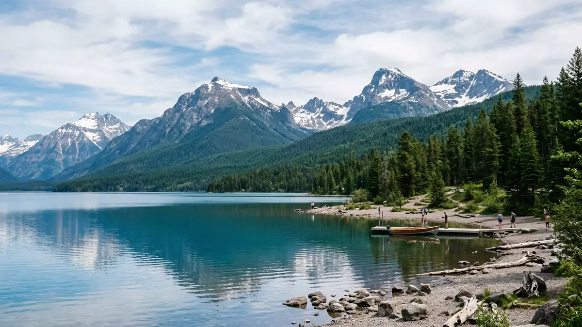
Glacier National Park in north-western Montana stretches east from West Glacier into the high ranges that form the so?called Crown of the Continent, where rivers begin journeys towards three different oceans. Established as a United States national park in 1910, it preserves a sweep of alpine valleys, clear lakes and sharply carved peaks that show what the northern Rocky Mountains looked like before large settlements and highways arrived.
Mountains on an ancient foundation
The setting of Glacier National Park is defined by two major mountain ranges, the Lewis Range and the Livingston Range, which trend from north-west to south-east and carry the Continental Divide through the park towards the Canadian border.two mountain ranges The park’s highest summit, Mount Cleveland, rises to 3,192 m (10,466 ft), while a number of other peaks exceed 3,000 m (10,000 ft), giving the skyline above West Glacier a strongly serrated profile.Mount Cleveland
These mountains stand on rocks of the Belt Supergroup, a thick sequence of Precambrian sedimentary formations laid down between about 1.6 billion and 800 million years ago in an ancient inland sea that covered parts of present?day western Montana, northern Idaho and eastern Washington.Belt Supergroup Later, during the formation of the Rocky Mountains, a huge slab of this older rock was pushed eastwards over much younger strata along the Lewis Overthrust Fault, displacing material that is over a billion years older than the rock beneath it.Lewis Overthrust The result is an unusual geological arrangement, in which ancient sedimentary layers form prominent cliffs and ridges above forested valleys carved by ice.
Glacial valleys, lakes and the Continental Divide
The park’s present landforms were shaped by repeated advances of alpine glaciers over the last two million years, particularly during the Pleistocene Ice Age, when ice filled the valleys and left only the highest summits protruding above the snowfields.Pleistocene Ice Age As the ice moved, it carved broad U?shaped valleys and cirques, scoured rock faces and left chains of lake?filled basins that now hold clear mountain water. In the western part of the park, near West Glacier, Lake McDonald stretches for about 16 km (10 miles) and reaches a depth of around 141 m (464 ft), a long corridor of water flanked by steep forested slopes.Lake McDonald
Further east, peaks such as Triple Divide Peak mark points where meltwater and rainfall can flow towards different ocean basins, underscoring the park’s position at a continental hinge.Triple Divide Peak The Continental Divide itself follows the crest of the Lewis Range through Glacier National Park, separating Pacific?bound waters from those flowing towards Hudson Bay and the Gulf of Mexico.Continental Divide In cirque basins such as Avalanche Lake and Cracker Lake, suspended glacial silt gives the water an opaque turquoise colour, while streams draining these basins often run milky white.
From native homelands to an international peace park
The region that became Glacier National Park was long inhabited by Indigenous peoples, including the Blackfeet on the eastern slopes and the Flathead and Kootenai communities towards the western valleys.Blackfeet and Flathead In 1895, Chief White Calf of the Blackfeet agreed to sell a mountain strip of around 800,000 acres (3,200 km²) to the United States government, with hunting rights retained while the land remained public; this strip later formed part of the national park boundary.Chief White Calf
Glacier National Park itself was created on 11 May 1910, after campaigns by conservation figures such as George Bird Grinnell and support from the Great Northern Railway, which promoted the area’s scenery to travellers from the eastern United States.established in 1910 In 1932, the park was joined with Waterton Lakes National Park in Alberta to form the Waterton?Glacier International Peace Park, later recognised as a UNESCO World Heritage Site and a Biosphere Reserve for its combination of mountain ecosystems and relatively intact wildlife communities.Waterton-Glacier International Peace Park
Going-to-the-Sun Road and the view from West Glacier
One of Glacier National Park’s most distinctive human features is the Going?to?the?Sun Road, a transmountain route that runs from West Glacier on the western side to the community of St. Mary in the east, crossing the Continental Divide at Logan Pass.transmountain road Planned in the early twentieth century as an automobile route into the heart of the park, it was surveyed in the 1920s and substantially completed by 1932, with a formal dedication on 15 July 1933.completion in 1933
From West Glacier, the road follows the shore of Lake McDonald, then climbs towards Logan Pass, where fields of snow can linger beside meadows and rock outcrops. Along its length, the alignment passes beneath cliffs, across high slopes and over stone bridges, and has been recognised on the National Register of Historic Places as an outstanding engineering achievement in a mountain setting.National Register listing For travellers based in Western Europe, this combination of a historic mountain road, roadside trailheads and long perspectives down glacial valleys makes West Glacier a natural starting point for exploring the park’s interior.
Visiting Glacier National Park: what travellers from Western Europe should know
- Glacier National Park lies in Flathead and Glacier counties in Montana, with West Glacier forming a main western gateway near the Flathead River and the southern end of Lake McDonald.
- The terrain within the park ranges from forested valley floors to high passes above 2,000 m (6,500 ft), with many maintained trails climbing steep slopes and crossing areas where snow can remain late into the year.
- Amtrak’s Empire Builder route serves West Glacier and East Glacier, and the Great Northern Railway corridor along Marias Pass continues to provide a key rail approach along the park’s southern boundary.
- The official language is English and the currency is the United States dollar.
- Entry requirements depend on your nationality; UK travellers can check the FCDO travel advice at gov.uk/foreign-travel-advice, Irish travellers the Department of Foreign Affairs at ireland.ie.
Searching for Glacier National Park on social platforms
These links open searches for Glacier National Park on each platform.Frequently asked questions about Glacier National Park
Where is Glacier National Park and how is it related to West Glacier?
Glacier National Park is in north-western Montana on the United States border with Canada, with West Glacier forming a key western entrance near Lake McDonald and the Flathead River.
What kind of landscapes can visitors expect inside the park?
Visitors encounter steep Rocky Mountain peaks, broad glacial valleys, clear lakes and dense coniferous forests, together with alpine meadows and passes along the Continental Divide.
What makes Glacier National Park distinctive among mountain parks?
The combination of ancient Belt Supergroup rocks, active glacial landforms, continental watershed divides and its joint designation with Waterton Lakes as an International Peace Park gives the area a distinctive character among high mountain regions.


