
Glacier National Park and the High Road over the Divide
Published on 08/16/2026 at 14:56 | Editorial responsibility: Rafael Müller, Editor-in-Chief AD HOC NEWS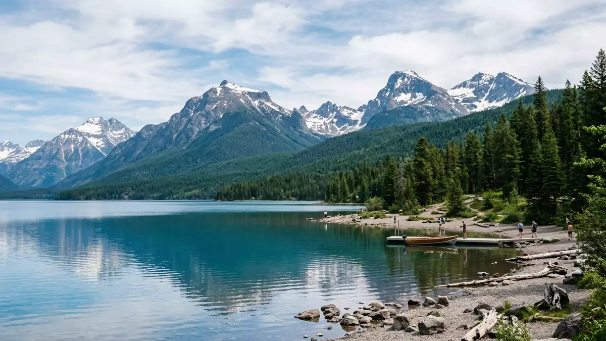
Glacier National Park in northwest Montana centres on a steep rise of the Rocky Mountains, where a single high road climbs from West Glacier over the Continental Divide. Created as a national park in 1910, it later became part of Waterton?Glacier International Peace Park with neighbouring Waterton Lakes National Park in Alberta, giving this stretch of mountains a shared protected status across the United States–Canada border.Glacier National Park was established on 11 May 1910
An alpine park on the Continental Divide
Glacier National Park lies in the northern Rocky Mountains of Montana, pressed against the border with Canada and adjoining Waterton Lakes National Park across that line.The park sits in northwestern Montana along the Canadian border The mountains here form part of the Lewis and Livingston ranges, and their ridgelines mark the course of the Continental Divide across the park.In Glacier, the divide follows the crests of the Lewis and Livingston ranges
Water draining from these slopes runs towards three great basins of the continent, a configuration described as a “Triple Divide” where flows ultimately reach the Pacific, Atlantic and Arctic oceans.The park stands astride a continental “Triple Divide” Within this setting, long glacial valleys and chains of lakes cut into the rock, including broad Lake McDonald on the west side and high basins that still hold remnant glaciers such as Grinnell Glacier.Lake McDonald lies at the low western side beneath higher peaks
Waterton?Glacier: an international peace park
From the Canadian border southwards, Glacier National Park shares its crestline and valleys with Waterton Lakes National Park, and together they form Waterton?Glacier International Peace Park. The two parks were formally combined under that designation in 1932, symbolically linking protected land on both sides of the border.The two national parks were combined as an International Peace Park in 1932
In 1995 this binational area was inscribed on the UNESCO World Heritage List for its mountain scenery, intact ecosystems and the meeting of prairie and peaks along the front ranges.Waterton?Glacier International Peace Park was added to the World Heritage List in 1995 Glacier National Park is also recognised as a Biosphere Reserve, reinforcing its role as a protected landscape where grizzly bears, mountain goats and other wildlife move across passes and forested slopes relatively uninterrupted.
Going?to?the?Sun Road: from West Glacier to Logan Pass
For many visitors from West Glacier, the park first reveals itself along Going?to?the?Sun Road, a mountain highway that cuts eastwards through the interior. This route runs for around 50 miles between the western entrance near West Glacier and the eastern entrance near St. Mary, crossing big elevation differences as it climbs towards the centre of the range.The Going?to?the?Sun Road spans about 50 miles across the parkThe road runs between the west and east entrances and crosses the Continental Divide
Construction of Going?to?the?Sun Road took place between 1921 and 1932, and it later gained National Historic Landmark status for its early twentieth?century engineering.
The highway was built in the 1920s and early 1930s At Logan Pass, roughly midway along the route, the tarmac reaches about 2,026 m (6,646 ft) and crosses the Continental Divide at the highest point accessible by standard vehicles in the park.The road crosses the Continental Divide at Logan Pass, 6,646 ft above sea levelLogan Pass marks the highest point on the road and the divide
Visiting Glacier National Park: what travellers from Western Europe should know
- Glacier National Park lies in northwest Montana on the border with Canada, with West Glacier serving as a gateway settlement close to the western entrance.
- Going?to?the?Sun Road begins near West Glacier, and driving or joining transport on this road is a straightforward way to see the park’s central valleys and high passes.
- Terrain ranges from valley floors near Lake McDonald to higher viewpoints such as Logan Pass, where short walks lead away from the road onto alpine slopes.
- The landscape includes steep mountain sides and roadside pullouts above substantial drops, and some paths on the higher ground involve uneven surfaces and moderate gradients.
- The official language is English and the currency is the US dollar. Entry requirements depend on your nationality; UK travellers can check the FCDO travel advice at gov.uk/foreign-travel-advice, Irish travellers the Department of Foreign Affairs at ireland.ie.
Searching for Glacier National Park on social platforms
These links open searches for Glacier National Park on each platform.
Frequently asked questions about Glacier National Park
Where is Glacier National Park?
Glacier National Park is in northwest Montana in the United States, bordering Canada and adjoining Waterton Lakes National Park across the international boundary.
What can visitors expect on a first visit from West Glacier?
Visitors entering from West Glacier encounter Lake McDonald, forested valleys and the climb of Going?to?the?Sun Road towards Logan Pass on the Continental Divide.
What makes Glacier National Park distinctive?
The park’s position on the Continental Divide, its role in Waterton?Glacier International Peace Park and the engineering of Going?to?the?Sun Road together give it a distinctive character.


