
Glacier National Park and the mountain road that threads its heart
Published on 08/22/2026 at 16:12 | Editorial responsibility: Rafael Müller, Editor-in-Chief AD HOC NEWS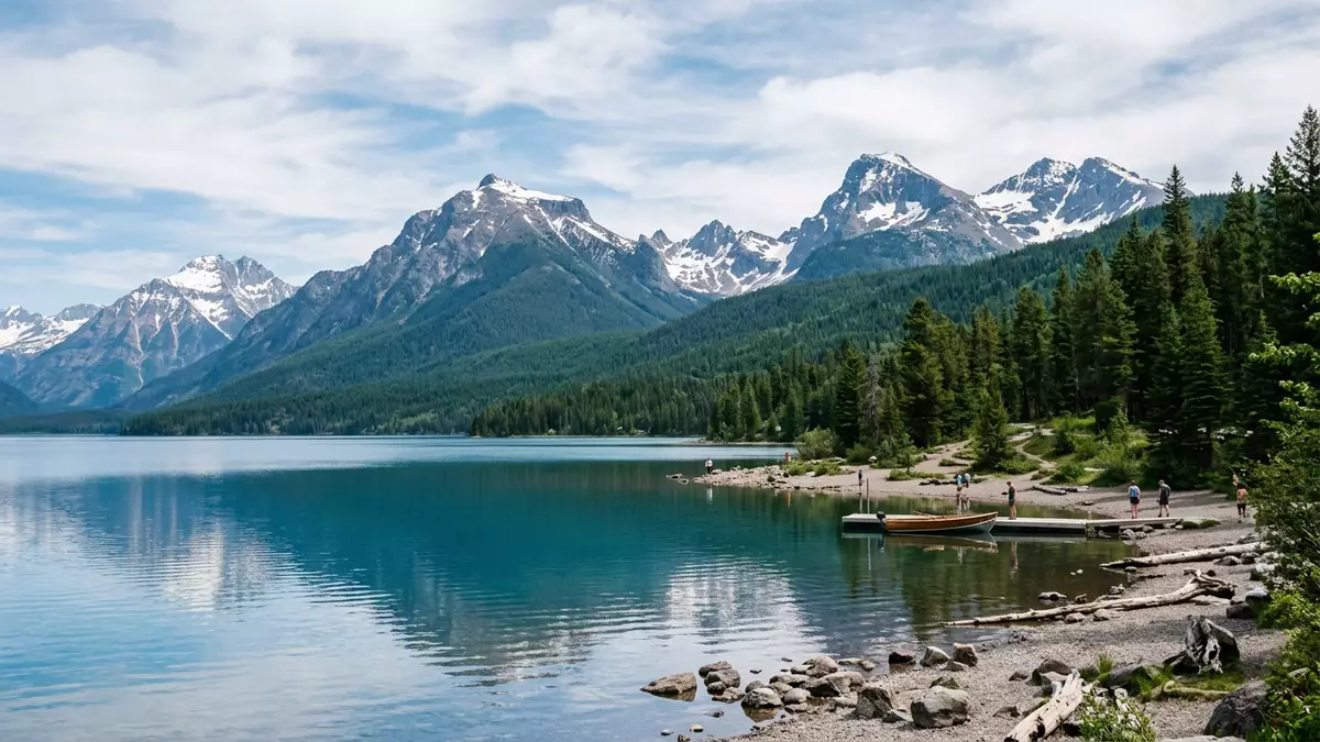
Glacier National Park in Montana stretches north from West Glacier to the Canadian border, where it adjoins Waterton Lakes National Park and forms an international protected landscape in the northern Rocky Mountains.Glacier National Park, established in 1910, straddles the Continental Divide and carries the waters of North America towards three different oceans.
The Crown of the Continent in stone, ice and water
Glacier National Park occupies more than 1,500 square miles of rugged terrain in north-western Montana, a portion of which lies above the timberline where steep peaks rise over glacial valleys.The park’s 1,583 square miles encompass sections of the Lewis and Livingston Ranges, sub-ranges of the Rocky Mountains that run north-west to south-east through the park.These mountain ranges dominate the park’s skyline, framing deep U-shaped valleys carved by Ice Age glaciers.
The park’s nickname, “The Crown of the Continent”, reflects a geographical fact: high ridges form a triple divide where meltwater feeds river systems flowing to the Pacific, the Gulf of Mexico and Hudson Bay.USGS descriptions of the park emphasise this position at the headwaters of three major drainage basins, as well as the presence of numerous lakes, hanging valleys and horn-shaped peaks.
An engineered thread: Going-to-the-Sun Road
Across this mountainous landscape runs Going-to-the-Sun Road, a scenic highway that links the western entrance near West Glacier with the eastern side at St Mary and crosses the Continental Divide at Logan Pass.The road, completed in 1932 and formally dedicated in 1933, was one of the first major National Park Service projects built specifically for travellers arriving by automobile.Civil engineering accounts describe it as the first major trans-mountain scenic highway in the United States, threading its way over high terrain rather than confining traffic to low passes.
Going-to-the-Sun Road extends for nearly 50 miles between valley forests and alpine meadows, passing above Lake McDonald, climbing towards Logan Pass and descending to the eastern boundary.Landscape histories record a length of 48.7 miles between West Glacier and St Mary, with stone guardwalls, culverts and retaining structures built in the National Park Service Rustic style using native limestone and argillite.The historic district along the road includes bridges, tunnels, arches and tens of thousands of feet of guardwalls, all constructed between the early 1920s and the late 1930s.
Logan Pass and the high alpine environment
At Logan Pass the road crosses the Continental Divide, bringing visitors to a high saddle surrounded by peaks, snowfields and alpine vegetation.National Park Service descriptions of the Going-to-the-Sun Road Historic District note that the route passes through lake-filled valleys and an alpine pass, with distinct zones of vegetation layered along its length.Fact sheets for Glacier National Park record an elevation of 2,025 m (6,646 ft) at Logan Pass, underlining the high-altitude environment encountered at the crossing.
From this height the surrounding ridges form part of the triple divide, where precipitation can join the Columbia River system towards the Pacific, the Missouri–Mississippi system towards the Gulf of Mexico, or the Saskatchewan system towards Hudson Bay.Educational material produced for the park describes horn-shaped peaks, sharp ridges and glacially carved valleys radiating from this core, with rivers flowing in three directions from what is often termed the Crown of the Continent.
Visiting Glacier National Park: what travellers from Western Europe should know
- Glacier National Park lies in north-western Montana in the United States, with West Glacier marking the western entrance where the trans-mountain road begins.
- The park’s terrain includes steep mountain slopes, high passes such as Logan Pass at 2,025 m (6,646 ft) and valleys lined with lakes, so approaches on foot can involve sustained gradients.
- The western approach follows the valleys of the Flathead River and the shores of Lake McDonald, while the eastern side lies near St Mary, with the road forming the main motor route between them.
- The official language is English and the currency is the United States dollar.
- Entry requirements depend on your nationality; UK travellers can check the FCDO travel advice at gov.uk/foreign-travel-advice, Irish travellers the Department of Foreign Affairs at ireland.ie.
Searching for Glacier National Park on social platforms
These links open searches for Glacier National Park on each platform.
Frequently asked questions about Glacier National Park
Where is Glacier National Park located?
Glacier National Park is in north-western Montana in the United States, along the border with Canada, with West Glacier marking its western entrance.
What can visitors expect on a visit to Glacier National Park?
Visitors encounter steep mountain ranges, glacial valleys, numerous lakes and a high crossing of the Continental Divide along Going-to-the-Sun Road, with marked contrasts between forested lowlands and alpine terrain.
What makes Glacier National Park distinctive compared with other mountain parks?
The combination of its triple divide headwaters, its position within the Rocky Mountains and the historic trans-mountain Going-to-the-Sun Road gives Glacier National Park a rare blend of rugged landscape and engineered access.


