
Gros Morne National Park and the rocks beneath the landscape
Published on 09/24/2026 at 07:39 | Editorial responsibility: Rafael Müller, Editor-in-Chief AD HOC NEWS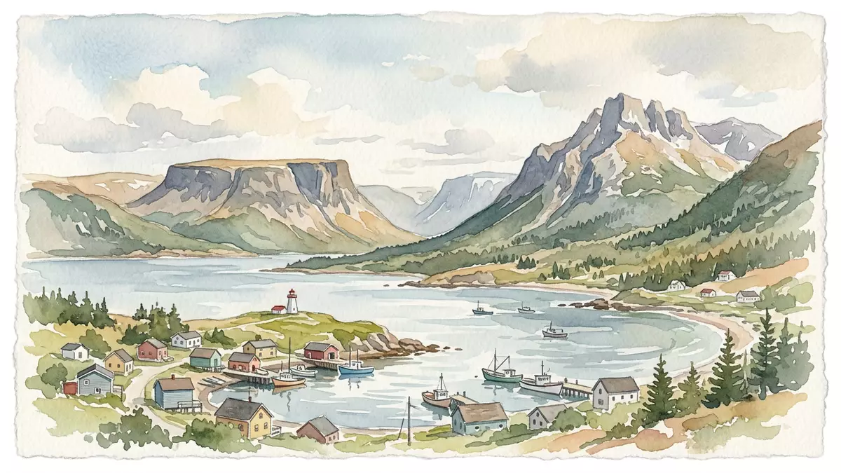
Gros Morne National Park is a landscape where the Earth’s deep structure appears at the surface. On Newfoundland’s western coast, mountains, fjords, coastal lowlands and rust-coloured mantle rock form a single protected park linked by roads, trails and water.
The park’s visible geology is its defining feature. Continental movement, ancient ocean floor, uplift and glacial erosion are recorded in its rocks, while communities such as Rocky Harbour provide a base beside the coast.
The Tablelands place Earth’s mantle in the landscape
The Tablelands are a broad, flat-topped area of brown and red peridotite. This rock formed in the upper mantle and reached the surface through plate movements hundreds of millions of years ago. Its colour and sparse vegetation distinguish it from the surrounding green hills.
Peridotite is rich in minerals that occur deep inside the planet. At Gros Morne, the material is exposed across an accessible landscape rather than hidden beneath layers of younger rock. The Tablelands geological landscape belongs to a wider sequence of rocks connected with the ancient Iapetus Ocean.
The park does not present geology as an isolated museum display. Rock formations form the ground beneath valleys, slopes and shorelines. Walking routes cross open terrain, forest and upland areas, with the Tablelands providing the clearest visual contrast between mantle rock and the vegetation-covered landscape around it.
Fjords, mountains and the work of ice
Gros Morne National Park includes part of the Long Range Mountains, a range associated with the Canadian Appalachians. Glaciers carved valleys into the highlands and left steep-sided waterways, including Western Brook Pond, a freshwater fjord extending through the interior.
Western Brook Pond is enclosed by rock walls rising to about 600 m (2,000 ft). The waterway is not connected to the sea, although its shape records a coastal glacial origin. Ice excavated the valley, while changes in land level and drainage left a freshwater basin behind.
Repeated glaciation also shaped raised beaches, moraines, troughs and other landforms across the park. The scenery therefore combines several scales of time: ancient rocks formed during continental events, mountain relief altered by erosion, and glacial features created during the last two million years.
The coast adds another layer to the landscape. Headlands, coves and lowland habitats meet the mountain interior, while ponds and wetlands occupy hollows between ridges. The park protects the Western Newfoundland Highlands and the St Lawrence Lowlands, two ecological regions with different terrain and plant communities.
A national park written in continental history
Gros Morne National Park was designated a UNESCO World Heritage Site in 1987. Its inscription recognises both exceptional natural scenery and geological formations that represent major stages in the Earth’s evolution. The World Heritage designation is closely connected with the park’s record of plate tectonics.
Before the Atlantic Ocean took its present form, North America and Europe were connected through older continental arrangements. The Iapetus Ocean opened between landmasses and was later closed as plates moved together. Rocks from oceanic crust and the mantle were transported and raised into the region that includes western Newfoundland.
Some of the park’s rocks date from the Precambrian era, while other formations belong to the period when the Iapetus Ocean opened and closed. Fossils in sedimentary layers record marine life from the Cambrian and Ordovician periods. Green Point contains a geological boundary that marks the transition between the Cambrian and Ordovician systems.
The result is a landscape that can be read through its materials. Granite and gneiss appear in ancient mountain rocks, sedimentary layers preserve former seabeds, and peridotite exposes material from the upper mantle. The geological history of Gros Morne connects these elements across the park.
Visiting Gros Morne National Park: what travellers from Western Europe should know
- Gros Morne National Park lies on Newfoundland’s west coast, with Rocky Harbour serving as a principal community and park-service location. Roads connect the coastal settlements with the park’s inland landscapes.
- Western Brook Pond lies beyond the road network and is reached by a walking route before boat access across the fjord. The approach crosses forest and open ground.
- The Tablelands consist of exposed peridotite and uneven upland terrain. Routes there cross a landscape with sparse vegetation and visible rock surfaces.
- The park spans coastal lowlands, mountain terrain, ponds and fjords. Conditions on the mountain change with the seasons; the local cable-car operators and alpine clubs provide information.
Searching for Gros Morne National Park on social platforms
These links open searches for Gros Morne National Park on each platform.Frequently asked questions about Gros Morne National Park
Where is Gros Morne National Park?
Gros Morne National Park is on the west coast of Newfoundland, in the Canadian province of Newfoundland and Labrador. Rocky Harbour lies within the park region and provides a recognised local reference point.
What can visitors expect to see?
The park contains fjords, mountain valleys, coastal habitats, glacial landforms and the exposed peridotite of the Tablelands. Walking routes connect forest, shore and upland terrain.
What makes the park distinctive?
Its rocks preserve evidence of continental movement, an ancient ocean and exposed mantle material. The combination of geological history and glacial scenery underpins its 1987 UNESCO World Heritage status.


