
Gunung Bromo and the volcanic sea of sand
Published on 09/24/2026 at 09:15 | Editorial responsibility: Rafael Müller, Editor-in-Chief AD HOC NEWS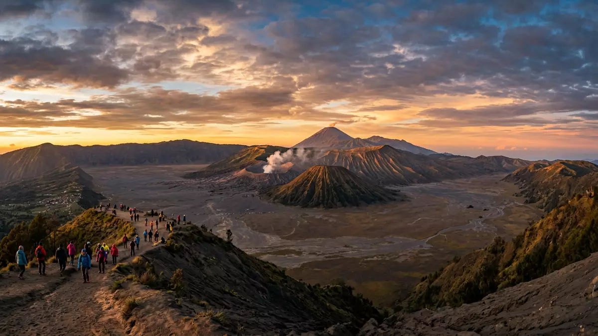
Gunung Bromo rises from a broad volcanic basin near Probolinggo, surrounded by black sand, steep caldera walls and neighbouring cones. At 2,329 m (7,641 ft), the active summit is not the highest peak in the region, but its crater sits within a landscape shaped by several generations of volcanic activity.
Gunung Bromo above the Tengger caldera
Gunung Bromo belongs to the Bromo Tengger Semeru National Park in East Java, Indonesia. Its summit stands within the larger Tengger caldera, a volcanic depression about 16 km wide that forms the main geographical setting for the mountain. Tengger caldera details
The inner basin contains the Tengger Sand Sea, a wide expanse of volcanic debris stretching around a cluster of cones. Gunung Bromo shares this floor with Mount Batok, whose sharply ridged sides provide a contrasting profile. Semeru, Java’s highest mountain, rises farther south at 3,676 m (12,060 ft), linking the Bromo landscape to a much larger volcanic massif.
A young cone in an ancient volcanic landscape
The Tengger volcanic complex began developing about 820,000 years ago. Successive eruptions formed overlapping volcanic structures and calderas, while the Sand Sea caldera formed during the late Pleistocene and early Holocene.
Gunung Bromo is the youngest cone within the Tengger caldera complex. Its activity is recorded from 1804, and the crater continues to define the mountain’s appearance. The Tengger volcanic basin
The Tengger people and Mount Brahma
Gunung Bromo also belongs to the cultural landscape of the Tengger people, a Hindu community living around the highlands of East Java. The name Bromo derives from Brahma, one of the principal deities in Hindu tradition.
At the foot of the cone stands the Pura Luhur Poten temple, a Hindu place of worship surrounded by the Sand Sea. The temple’s dark stone forms sit against volcanic gravel and the open caldera floor. The annual Yadnya Kasada ceremony connects the mountain with offerings, prayer and Tengger religious life.
The cultural setting is inseparable from the physical landscape. A volcanic cone, a Hindu temple and a sea of ash occupy the same basin, while the surrounding ridges preserve the outlines of older eruptions.
Visiting Gunung Bromo: what travellers from Western Europe should know
- Gunung Bromo lies in East Java, near Probolinggo, within Bromo Tengger Semeru National Park. Road approaches lead through the highland settlements of Ngadisari and Cemoro Lawang.
- The approach crosses the Tengger Sand Sea, a broad surface of loose volcanic material. The final ascent to the crater includes a stairway above the basin.
- The summit area lies at high elevation, and the surrounding caldera includes exposed volcanic slopes, ash and uneven ground.
- The official language is Indonesian and the currency is the Indonesian rupiah.
- Entry requirements depend on your nationality; UK travellers can check the FCDO travel advice at gov.uk/foreign-travel-advice, Irish travellers the Department of Foreign Affairs at ireland.ie.
- Conditions on the mountain change with the seasons; the local cable-car operators and alpine clubs provide information.
Searching for Gunung Bromo on social platforms
These links open searches for Gunung Bromo on each platform.Frequently asked questions about Gunung Bromo
Where is Gunung Bromo?
Gunung Bromo is in East Java, Indonesia, near Probolinggo. It lies within Bromo Tengger Semeru National Park and the Tengger caldera.
What can visitors expect at Gunung Bromo?
The landscape includes a volcanic sand basin, steep caldera walls, neighbouring cones and a stairway leading towards the crater. The terrain combines loose ash, exposed slopes and high-altitude conditions.
What makes Gunung Bromo distinctive?
Its 2,329 m cone rises from the Tengger Sand Sea beside Mount Batok and the Pura Luhur Poten temple. Geological history and Tengger Hindu culture share the same volcanic setting.


