
Honghe Hani Titian and the living terraces of Yuanyang
Published on 09/23/2026 at 20:04 | Editorial responsibility: Rafael Müller, Editor-in-Chief AD HOC NEWS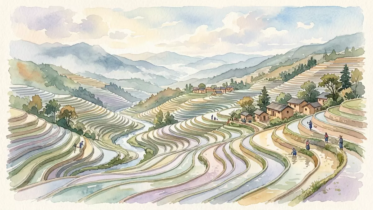
Honghe Hani Titian is a vast agricultural landscape in southern Yunnan, where rice fields descend across the Ailao Mountains near Yuanyang. Forests, villages, channels and paddies form visible layers on the mountain slopes, while the Hani people’s farming tradition reaches back more than 1,300 years.
Honghe Hani Titian: rice fields across the Ailao Mountains
The terraces occupy the south banks of the Hong River in mountainous terrain. Their fields follow narrow valleys and steep slopes, creating repeated bands of water and earth between forested ridges and river country. The UNESCO-listed cultural landscape covers 16,603 hectares in southern Yunnan, a figure that defines its regional scale rather than a single viewpoint.
Three named terrace areas are Bada, Duoyishu and Laohuzui. Their slopes differ, with Bada more gently graded, Duoyishu steeper and Laohuzui markedly steep. The changing gradients give the landscape a varied profile across the valleys, while the paddies remain connected by the wider irrigation system.
Forests, channels and villages above the paddies
Water begins in the forested mountaintops and moves through channels towards the fields. The documented system includes four main canals and 392 branch ditches, together extending for 445.83 km. the irrigation network remains part of the landscape’s visible cultural identity.
Villages sit between the upper forests and the terraces. Traditional houses use rammed earth, adobe brick, earth and stone, with tall thatched roofs forming the mushroom-house profile associated with Hani settlements. The arrangement is a vertical sequence of forest, village, field and river, repeated across the mountain basins.
The farming system joins rice cultivation with animals living in or around the paddies. Red rice is the principal crop, while buffalo, cattle, ducks, fish and eels are part of the agricultural cycle. The fields therefore appear not as isolated plots, but as working spaces connected to household life, livestock and water management.
A Hani agricultural tradition recorded in 2013
The Hani developed the terrace system across more than a millennium. Their knowledge includes water allocation, field cultivation, forest stewardship and communal maintenance. The landscape also carries religious traditions connected with the sun, moon, mountains, rivers, forests and fire.
The Hani Rice Terraces became a UNESCO World Heritage cultural landscape in 2013. The designation covers the relationship between physical features and living practices, including forests, water supply, villages, terraces and the social structures that connect them. the 2013 inscription places Honghe Hani Titian within the international heritage framework.
The landscape also belongs to the Globally Important Agricultural Heritage Systems programme, with recognition dating from 2010. the Hani agricultural system is recorded as a living combination of farming knowledge, biodiversity and natural-resource management.
Its character lies in the meeting of engineered slopes and living traditions. The terraces are built surfaces, yet their appearance depends on forests, rainfall, waterways, crops, animals and settlements. From Yuanyang, the landscape can be read as a chain of connected elements rather than as a single monument.
Visiting Honghe Hani Titian: what travellers from Western Europe should know
- Honghe Hani Titian lies in Yuanyang County, in Honghe Hani and Yi Autonomous Prefecture, Yunnan, China. The landscape extends across the Ailao Mountains and the southern bank of the Hong River.
- The terrain consists of steep mountain slopes, narrow valleys and stepped paddies. Viewpoints and villages are linked by roads and paths that cross uneven hillside ground.
- The main landscape elements appear in vertical order: forested mountaintops, Hani villages, irrigated terraces and river valleys.
- The official language is Mandarin Chinese and the currency is the Chinese yuan.
- Entry requirements depend on your nationality; UK travellers can check the FCDO travel advice at gov.uk/foreign-travel-advice, Irish travellers the Department of Foreign Affairs at ireland.ie.
Searching for Honghe Hani Titian on social platforms
These links open searches for Honghe Hani Titian on each platform.Frequently asked questions about Honghe Hani Titian
Where is Honghe Hani Titian?
It is in Yuanyang County, Honghe Hani and Yi Autonomous Prefecture, in southern Yunnan, China. The terraces lie across the Ailao Mountains above the Hong River.
What can visitors expect to see?
The landscape combines stepped rice fields, forested ridges, Hani villages, irrigation channels and narrow mountain valleys. Red rice cultivation and mixed farming remain central features.
What makes the terraces distinctive?
The distinctive feature is the connected system of forests, water channels, villages and paddies. Hani communities have maintained this agricultural landscape for more than 1,300 years.


