
Honghe Hani Titian and the terraced mountains of Yuanyang
Published on 08/24/2026 at 12:42 | Editorial responsibility: Rafael Müller, Editor-in-Chief AD HOC NEWS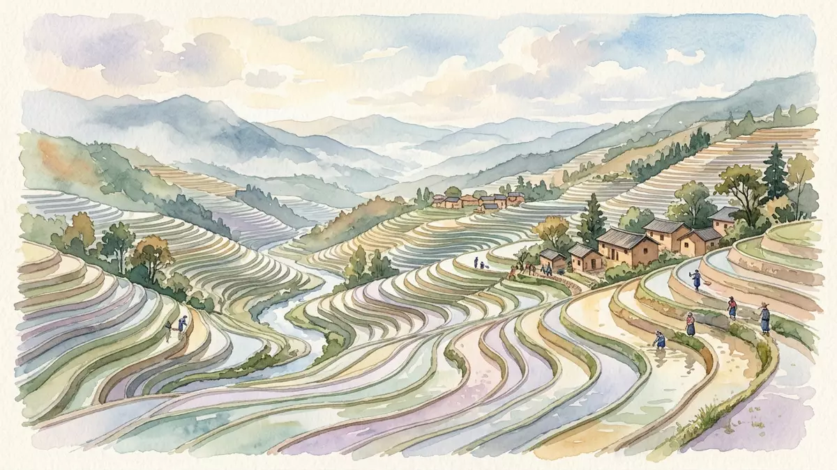
Honghe Hani Titian in Yuanyang refers to the band of rice terraces carved into the southern slopes of the Ailao Mountains, a stepped farming landscape shaped over generations by Hani communities in south-west China. It forms part of the Cultural Landscape of Honghe Hani Rice Terraces, a recognised agricultural and settlement system inscribed as a UNESCO World Heritage cultural landscape in 2013.
Terraced hills between Ailao Mountains and Hong River
The core of Honghe Hani Titian lies on south-facing slopes of the Ailao Mountains above the Hong River in Yuanyang County, within the Honghe Hani and Yi Autonomous Prefecture of Yunnan Province. Across these slopes, hillside fields descend in successive levels, creating an extensive pattern of terraces where earth embankments hold shallow basins of water and rice. The UNESCO listing defines a property of 16,603 ha in southern Yunnan, where terraces cascade from mountain ridges down towards the river, forming long sweeps of cultivated ground interspersed with forest and settlement.Cultural Landscape of Honghe Hani Rice Terraces
Within this wider landscape, Yuanyang County contains some of the most concentrated terrace systems, arranged along three main valleys and their side slopes.Yuanyang terrace valleys The terraces sit between forested upper slopes and the river corridor below, with water channels guiding mountain runoff into the fields. Villages stand on slightly higher ground above the terraces or on ridges between them, forming clusters of houses and paths that overlook the stepped fields.
A 1,300-year Hani agricultural system
Honghe Hani Titian belongs to a long-developed agricultural system attributed to the Hani people, one of China’s recognised ethnic minority groups. Over more than 1,300 years, communities have shaped mountain slopes into irrigated rice terraces and organised water, forest and settlement into a single working landscape.Hani terrace history The terraces are fed by an intricate network of channels that transport water from forested mountain tops and streams to the fields, maintaining soil moisture suitable for rice growing.
The Honghe Hani Rice Terraces extend across several counties, including Yuanyang, Honghe, Lüchun and Jinping, covering an area of tens of thousands of hectares, with Yuanyang providing one of the densest terrace bands.Hani terraces in four counties In this setting, Honghe Hani Titian can be understood as a named portion of the wider terrace system, where rice cultivation sits alongside fish farming and the keeping of ducks in flooded fields, forming a multi-layered agricultural practice across the slopes.integrated rice terraces
A recognised cultural landscape in Yunnan
The Cultural Landscape of Honghe Hani Rice Terraces, including Honghe Hani Titian in Yuanyang, appears on the UNESCO World Heritage List as a cultural landscape, emphasising the interaction between human communities and their environment over a long period.UNESCO inscription in 2013 The property is also classified in China as a State Priority Protected Site and has further recognition at county level in Yuanyang, reflecting its importance as both a working farming region and a historical landscape.
Across the terraced slopes, fields, villages, forests and watercourses form a connected pattern that is visible from many vantage points on the hills. The terraces follow the natural shape of the mountains, creating curved lines that wrap around contours and frame small basins of water and rice seedlings. As light changes over the day and seasons, the fields can appear as bands of bright water, green rice or harvested earth, but the underlying structure of embankments and basins remains constant as a defining feature of Honghe Hani Titian.
Visiting Honghe Hani Titian: what travellers from Western Europe should know
- Honghe Hani Titian lies in Yuanyang County in the Honghe Hani and Yi Autonomous Prefecture of Yunnan, China, and is reached primarily by road from other towns and cities in the province, with many journeys starting from Kunming towards the hillside town of Xinjie.road approach via Kunming
- The terraced landscape occupies steep mountain slopes above the Hong River, so many paths and tracks between viewpoints, villages and fields involve gradients and uneven ground across earthen embankments and stone steps.
- The surrounding area includes forested upper slopes of the Ailao Mountains and river valleys below, with villages positioned on ridges overlooking the terraces, meaning that movement on foot often alternates between narrow paths, stairways and short stretches of road through settled areas.terrace setting near Yuanyang
- The official language is Chinese and the currency is the yuan (renminbi), used in Yuanyang and across Yunnan.
- Entry requirements depend on your nationality; UK travellers can check the FCDO travel advice at gov.uk/foreign-travel-advice, Irish travellers the Department of Foreign Affairs at ireland.ie.
Searching for Honghe Hani Titian on social platforms
These links open searches for Honghe Hani Titian on each platform.
Frequently asked questions about Honghe Hani Titian
Where is Honghe Hani Titian located?
Honghe Hani Titian is in Yuanyang County in the Honghe Hani and Yi Autonomous Prefecture of Yunnan Province in south-west China, on the southern slopes of the Ailao Mountains above the Hong River.
What can visitors expect to see at Honghe Hani Titian?
Visitors encounter a broad expanse of rice terraces stepping down steep hillsides, with earthen embankments holding shallow fields, villages on ridges and forested upper slopes forming a continuous mountain landscape.
What makes Honghe Hani Titian distinctive among rice-terrace landscapes?
Honghe Hani Titian stands within a recognised UNESCO cultural landscape shaped by Hani communities over more than 1,300 years, where terraces, water channels, forests and villages operate together as a single long-established agricultural system.


