
Jokulsarlon, the iceberg-filled lagoon of southeast Iceland
Published on 08/18/2026 at 14:44 | Editorial responsibility: Rafael Müller, Editor-in-Chief AD HOC NEWS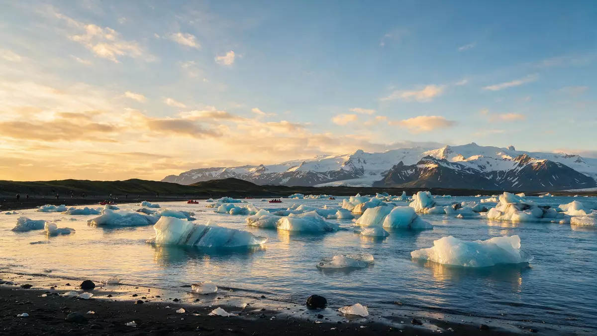
Jokulsarlon is a glacial lagoon in southeast Iceland where icebergs broken from Breidamerkurjokull drift through still, milky water towards the Atlantic Ocean, with the ice of Vatnajokull rising behind them.The lagoon lies within Vatnajokull National Park and forms one of the most recognisable landscapes on Iceland’s southern coast.
A lagoon carved from glacier and sea
Jokulsarlon is a glacial lake that formed where the outlet glacier Breidamerkurjokull has retreated from the North Atlantic coast, leaving a basin that filled with meltwater and ice.The lagoon developed during the twentieth century as the glacier pulled back from the shoreline, and it continues to expand as the ice front moves inland.Satellite observations describe Jokulsarlon as one of Iceland’s deepest lakes, with water that reaches well over 200 m (656 ft) in places.
The lagoon lies at the foot of Breidamerkurjokull, itself an outlet of Vatnajokull, the extensive ice cap that dominates this part of Iceland.On the coastal side of the lagoon a narrow outlet channel links Jokulsarlon to the Atlantic, so icebergs calved from the glacier often drift slowly across the water before being carried towards the ocean and washed back onto the volcanic shore as pale blocks on dark sand.
Icebergs, volcanic shores and changing light
The surface of Jokulsarlon is dotted with icebergs that have broken from the glacier front, many streaked with ash bands from earlier eruptions preserved in the ice.Travel guides describe icebergs of many forms floating in the lagoon, some compact and angular, others eroded into ridges and towers by wind and water.
Between the lagoon and the Atlantic lies a strip of black volcanic sand where blocks of ice often come to rest after passing through the outlet channel; the contrast between bright, translucent ice and dark shore has led this stretch of coast to be known as Diamond Beach.The lagoon’s still water reflects the sky and the distant edge of Vatnajokull, and the view shifts with the movement of ice and cloud through the day.
Jokulsarlon in the landscape of southeast Iceland
Jokulsarlon sits on Iceland’s southern coastline between the Skaftafell area of Vatnajokull National Park and the fishing town of Hofn, with Route 1, the Ring Road, running close to the lagoon’s northern shore.The Ring Road links Jokulsarlon with Reykjavik to the west and Hofn to the east, making the lagoon a natural pause on journeys around Iceland’s south and east coasts.
The wider setting combines sea, ice, lava and sand in a way characteristic of this region of Iceland.Jokulsarlon and the surrounding outwash plain of Breidamerkursandur form part of the protected area of Vatnajokull National Park, bringing the lagoon under the same conservation framework as the glacier above it.
Visiting Jokulsarlon: what travellers from Western Europe should know
- Jokulsarlon lies in southeast Iceland beside Route 1 between Skaftafell and the town of Hofn, on the southern edge of Vatnajokull National Park.
- The lagoon’s shoreline combines uneven ground, pebbles and volcanic sand, and reaching the water’s edge involves walking over loose surfaces that can feel unstable underfoot.
- The Atlantic shore known as Diamond Beach lies across the road from the lagoon, and the approach there also crosses coarse black sand and scattered ice blocks.
- The official language is Icelandic and the currency is the Icelandic krona.
- Entry requirements depend on your nationality; UK travellers can check the FCDO travel advice at gov.uk/foreign-travel-advice, Irish travellers the Department of Foreign Affairs at ireland.ie.
Searching for Jokulsarlon on social platforms
These links open searches for Jokulsarlon on each platform.
Frequently asked questions about Jokulsarlon
Where is Jokulsarlon and how is it reached?
Jokulsarlon is in southeast Iceland on the southern edge of Vatnajokull National Park, beside Route 1 between the Skaftafell area and the town of Hofn.
What should visitors expect at the lagoon?
Visitors see a glacial lake filled with icebergs from Breidamerkurjokull, with black volcanic sand shores and views towards the ice cap of Vatnajokull across the water.
What makes Jokulsarlon distinctive among Iceland’s landscapes?
Jokulsarlon combines a deep glacial lagoon, an active outlet glacier, a direct link to the Atlantic and a shoreline where bright ice rests on dark volcanic sand.


