
Kapadokya in Göreme: sculpted tuff and rock-cut sanctuaries
Published on 08/12/2026 at 13:50 | Editorial responsibility: Rafael Müller, Editor-in-Chief AD HOC NEWS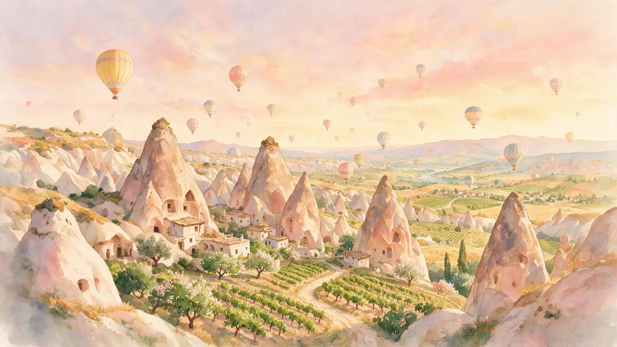
Kapadokya around Göreme is a volcanic plateau in central Turkey where soft tuff has been carved by erosion into valleys, pinnacles and rock-cut sanctuaries that form one continuous cultural landscape. The area is centred on Göreme, a town in Nev?ehir Province in Central Anatolia, and is recognised as Göreme National Park and the Rock Sites of Cappadocia on the UNESCO World Heritage List.
Volcanic plateau shaped into fairy chimneys
Kapadokya lies on the Central Anatolia plateau, a high, undulating landscape formed by ancient volcanic activity and sculpted by wind and water into ridges, gullies and freestanding rock pillars known as fairy chimneys.Central Anatolia plateau These pinnacles rise from a base of soft tuff, a rock created from compacted volcanic ash, which erodes into rounded forms and can be excavated with hand tools without losing stability over moderate spans.soft rock formations
The Göreme valley and surrounding ridges form part of Göreme Historical National Park, a protected area of roughly 9,884 ha designated to preserve this eroded landscape and the structures cut into it.Göreme Historical National Park Within the plateau, narrow valleys twist between tuff walls, while the fairy chimneys carry visible bands of different rock layers and, in many cases, simple openings leading into former dwellings and chapels. The contrast between the pale, sometimes ochre rock and the sparse vegetation underlines that this is a landscape literally carved from volcanic deposits rather than built with imported stone.
Rock-cut churches and underground settlements
Kapadokya is known for its rock-hewn sanctuaries and cave settlements, where communities carved churches, chapels, refectories and entire complexes into the tuff from the fourth century onwards.rock-hewn sanctuaries In and around Göreme, the Open Air Museum presents a cluster of Byzantine churches and monastic spaces cut directly into the valley walls and fairy chimneys, with interiors carrying wall paintings from the post-Iconoclastic period.Goreme Open Air Museum
Beneath the plateau, underground towns such as Kaymakl? and Derinkuyu extend several levels down, with chambers, corridors and communal spaces ventilated by vertical shafts and aligned along descending passages.subterranean cities Above ground, troglodyte villages stand where façades and rooms have been cut into slopes and freestanding chimneys, giving settlements a layered appearance between excavated interiors and added masonry. Together, these features turn Kapadokya into a continuous inhabited rock landscape, where houses, sanctuaries and storage spaces share the same tuff mass as the surrounding cliffs.
Göreme at the heart of the UNESCO landscape
Göreme itself is a town in the Nev?ehir District, Nev?ehir Province, set among the valleys and fairy chimneys that make up the core of Kapadokya.town in Nev?ehir Province It functions as a base for exploring the surrounding national park, with settlements climbing the slopes and former cave dwellings adapted to contemporary use. Göreme lies within the boundaries of Göreme National Park and the Rock Sites of Cappadocia, the UNESCO World Heritage property inscribed in 1985 for the combined geological and cultural heritage of the eroded volcanic landscape and its rock-cut architecture.UNESCO World Heritage property
The town gives access to valleys such as those around the Göreme Open Air Museum, where paths lead between chimneys and along tuff slopes, and to viewpoints over the plateau where the scale of the erosional landscape becomes apparent.Göreme travel guide Beyond Göreme, the World Heritage property covers land between Nev?ehir, Ürgüp and Avanos, including rock sites such as So?anl? and the underground cities already mentioned, so the town stands at the centre of a wider network of valleys and settlements that together define Kapadokya.
Visiting Kapadokya: what travellers from Western Europe should know
- Kapadokya lies in Central Anatolia in Turkey, with Göreme in Nev?ehir Province accessible from regional centres such as Nev?ehir and Kayseri by road and public transport.
- Valley paths and approach routes often follow uneven tuff surfaces and slopes, and some routes pass through areas with steps cut into rock and short ascents on loose ground.
- In winter, snow can fall across the plateau and settle on the tuff formations, while summers bring dry conditions with strong sun exposure on the open ridges.
- Göreme sits near other named sites within the Göreme National Park, including the underground cities of Kaymakl? and Derinkuyu and the valleys between Nev?ehir, Ürgüp and Avanos.
- The official language is Turkish and the currency is the Turkish lira; entry requirements depend on your nationality; UK travellers can check the FCDO travel advice at gov.uk/foreign-travel-advice, Irish travellers the Department of Foreign Affairs at ireland.ie.
Searching for Kapadokya on social platforms
These links open searches for Kapadokya on each platform.Frequently asked questions about Kapadokya
Where is Kapadokya and Göreme located?
Kapadokya is a historical region on the Central Anatolia plateau in Turkey, with Göreme as a town in Nev?ehir Province within Göreme National Park and the Rock Sites of Cappadocia.
What should travellers expect on a visit to Kapadokya?
Travellers encounter eroded tuff landscapes with fairy chimneys, valleys and rock-cut churches, alongside settlements and underground towns where dwellings and sanctuaries are carved directly into the plateau.
What makes Kapadokya distinctive among volcanic landscapes?
The combination of extensive tuff formations shaped into pinnacles, the density of rock-cut churches and monasteries, and the presence of multi-level underground cities makes Kapadokya a distinctive volcanic cultural landscape centred on Göreme.


