
Kenai Fjords National Park where mountains, ice and ocean meet
Published on 08/17/2026 at 13:25 | Editorial responsibility: Rafael Müller, Editor-in-Chief AD HOC NEWS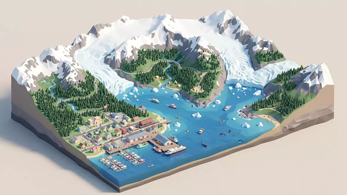
Kenai Fjords National Park on Alaska’s Kenai Peninsula is a coastal wilderness where steep mountains, vast icefields and the Pacific Ocean meet in a tight embrace. Created as a national park in 1980, it protects the Harding Icefield, its outflowing glaciers and the deep fjords that cut inland from Resurrection Bay towards the heart of the Kenai Mountains.
Ice, fjords and the Harding Icefield
The defining feature of Kenai Fjords National Park is the Harding Icefield, a broad sheet of ice that lies across the high country of the Kenai Mountains and feeds a network of glaciers that descend towards sea level. The park was designated through the Alaska National Interest Lands Conservation Act in 1980 to maintain the scenic and environmental integrity of this landscape of ice, tidewater glaciers and deeply carved fjords.Designated as a National Park through ANILCA in 1980 From above, the icefield forms a largely continuous surface; at its margins, glaciers spill down through mountain valleys towards the ocean.
Kenai Fjords National Park covers hundreds of thousands of acres on the Kenai Peninsula in south-central Alaska, west of the town of Seward.The park covers an area of 669,984 acres on the Kenai Peninsula More than half of this area is covered by ice, a figure that reflects how deeply the Harding Icefield shapes the region.Nearly 51 percent of the national park is covered by ice Glaciers flowing from the icefield have carved a series of fjords that extend from the open waters of the Gulf of Alaska into the mountains, creating narrow inlets backed by cliffs, waterfalls and tidewater glacier fronts.
Coastal fjords and tidewater glaciers
Along the coast, Kenai Fjords National Park is defined by its fjords, which are glacial valleys submerged below sea level and flooded by the ocean. These inlets, including Aialik Bay, Harris Bay, McCarty Fjord and Nuka Bay, cut deeply into the Kenai Peninsula and offer views of both steep rock walls and active glaciers descending towards the water.The most significant fjords include Aialik Bay, Harris Bay, McCarty Fjord and Nuka Bay Some of the glaciers that reach the sea are tidewater glaciers, terminating at the water’s surface with a vertical face that calves ice into the fjord.
Boat tours from Seward’s harbour give visitors access to these coastal sections of Kenai Fjords National Park, entering fjords where mountains rise steeply from the water and glaciers form bright blue walls against darker rock. The fjords themselves are the result of glaciers flowing from the Harding Icefield and eroding the valleys that were later inundated by the ocean.The Kenai Fjords were formed by glaciers flowing from the Harding Icefield Out on the water, visitors can see how ice, rock and sea interact, with floating ice fragments, seabirds using the cliffs and marine mammals surfacing in the fjords.
Exit Glacier and access from Seward
Although much of Kenai Fjords National Park is reachable only by boat or aircraft, one of its glaciers is accessible by road from the nearby town of Seward. Exit Glacier lies on the north-west side of the town and is reached via a road that leads to trails and viewpoints where visitors can see the glacier and the surrounding mountains.Exit Glacier, the coastal fjords and the Harding Icefield are the park's main areas Exit Glacier is one of the outflow glaciers of the Harding Icefield, descending from the high ice down into a valley that visitors can follow on foot.
The town of Seward acts as the gateway to Kenai Fjords National Park, standing on Resurrection Bay immediately to the east of the park boundary.The nearest town is Seward on Resurrection Bay From the community, visitors can reach the park’s coastal fjords by boat or travel inland towards Exit Glacier and, for those equipped and experienced, towards the Harding Icefield itself. This combination of sea access and a single road into the glacier area makes Seward a compact base from which to experience both the maritime and glacial sides of Kenai Fjords National Park.
Visiting Kenai Fjords National Park: what travellers from Western Europe should know
- Kenai Fjords National Park lies on the Kenai Peninsula in south-central Alaska, with Seward on Resurrection Bay providing harbour access and road connections towards Exit Glacier.
- Terrain in the park ranges from steep coastal fjord walls to glaciated valleys and high icefield surfaces, and approaches often involve uneven ground, wet conditions and, away from the road, travel in remote backcountry.
- Exit Glacier is reached on a road from Seward, and from its trailheads paths lead towards glacier viewpoints and, for prepared parties, further towards the Harding Icefield.
- The official language is English and the currency is the United States dollar.
- Entry requirements depend on your nationality; UK travellers can check the FCDO travel advice at gov.uk/foreign-travel-advice, Irish travellers the Department of Foreign Affairs at ireland.ie.
Searching for Kenai Fjords National Park on social platforms
These links open searches for Kenai Fjords National Park on each platform.
Frequently asked questions about Kenai Fjords National Park
Where is Kenai Fjords National Park located?
Kenai Fjords National Park lies on the Kenai Peninsula in south-central Alaska, west of Seward, with its coastal boundary on the Gulf of Alaska.
What should visitors expect on a visit to Kenai Fjords National Park?
Visitors encounter glaciated mountains, deep fjords, tidewater glaciers and coastal wildlife, accessed mainly by boat into the fjords and by road only to the Exit Glacier area.
What makes Kenai Fjords National Park distinctive among Alaska’s national parks?
Kenai Fjords National Park is distinctive for the Harding Icefield, the high proportion of its area covered by ice and the combination of accessible fjords and a road-accessible outlet glacier near Seward.


