
Kerala Backwaters and the landscape of Alappuzha
Published on 09/23/2026 at 04:40 | Editorial responsibility: Rafael Müller, Editor-in-Chief AD HOC NEWS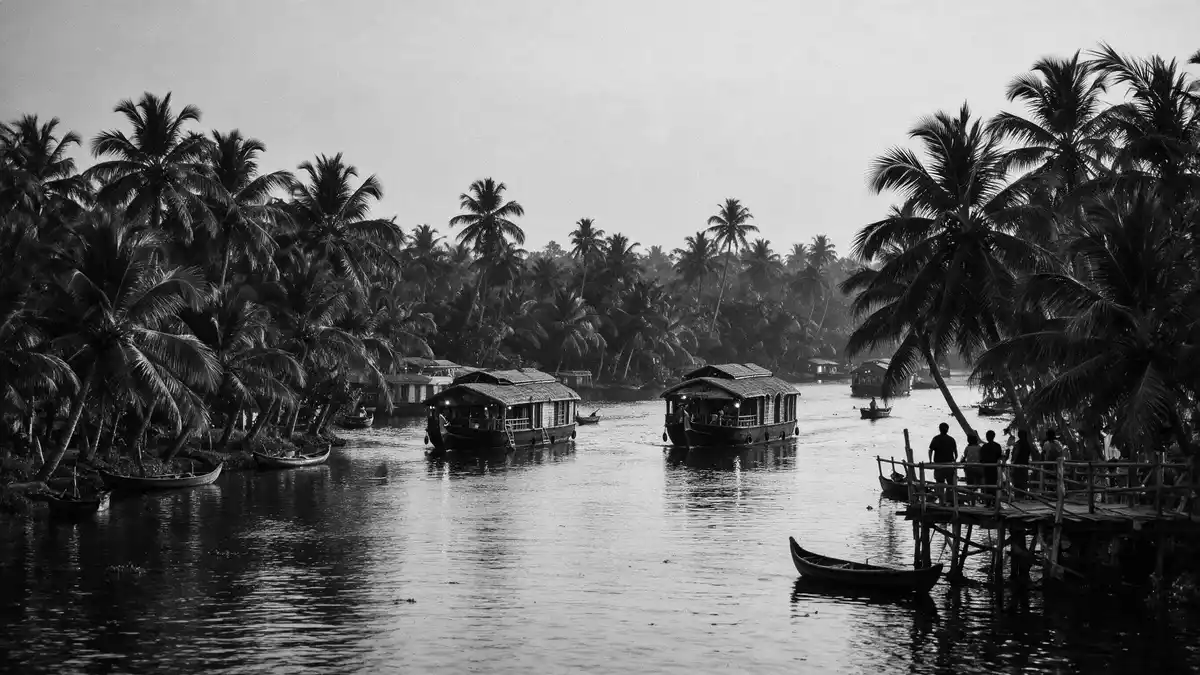
Kerala Backwaters form a connected landscape of canals, lakes, lagoons and rivers around Alappuzha in Kerala, India. Waterways pass between coconut palms, paddy fields, villages and working jetties, while the Vembanad Lake provides the region’s broadest aquatic setting.
The landscape is not a single lake or river. It is a network linking inland water, cultivated lowlands and the Arabian Sea coast, with boats remaining central to movement, trade and local life.
Alappuzha between Vembanad Lake and the Arabian Sea
Alappuzha lies on Kerala’s south-western coast, between the Arabian Sea and Vembanad Lake. The district is a low, sandy region crossed by lagoons, rivers and canals, with water bodies forming a substantial part of its geography.
Vembanad Lake extends between Alappuzha and Kochi. The lake is recorded at 84 km long, with an average breadth of 3.1 km and an area of 204 square kilometres. Several rivers, including the Pamba, Achankovil, Manimala and Meenachil, discharge into it. Vembanad Lake’s dimensions place it at the centre of the Alappuzha water system.
The waterways include navigable canals within the town and broader channels across the district. Vadai Canal, Commercial Canals and connecting links form part of the west coast canal system. Inland transport has carried passengers and cargo, while fishing remains associated with the lakes and channels.
Kettuvallams, canals and the working water landscape
The traditional kettuvallam was a wooden cargo boat associated with the movement of rice and spices. Its hull used jackwood planks joined with coir rope, a construction tradition reflected in the houseboats that travel through the backwaters.
Houseboats bring accommodation onto the water, but the landscape also contains ordinary passenger boats, fishing craft and small ferries. Along the banks, houses, temples, churches, workshops and coconut groves appear beside channels used for everyday transport.
Alappuzha’s canals reach directly into the town. Their presence connects urban streets with the wider lakes and lagoons, creating a setting where the distinction between waterfront and neighbourhood is defined by jetties, bridges and narrow channels.
The region’s maritime history includes the development of Alappuzha under Raja Kesava Das, the Diwan of Travancore. The canals associated with his period remain part of the town’s historical identity. Alappuzha’s canal system links the town’s history with its waterborne geography.
Kuttanad’s fields below sea level
South and east of Alappuzha, Kuttanad is identified with extensive paddy cultivation and waterways. The agricultural region includes low-lying fields, dykes, canals, streams and villages, with cultivated land lying below sea level.
Water and farming share the same visible terrain. Raised embankments border fields, palms line the channels, and boats provide access between settlements and agricultural areas. Kuttanad is also known as the Rice Bowl of Kerala.
The backwaters support aquatic habitats and birdlife, while fishing and aquaculture form part of the local economy. The water network also contains islands, including Pathiramanal in Vembanad Lake, where coconut palms and dense vegetation rise from the lake.
Religious and cultural sites stand within the wider landscape. The Ambalapuzha Sri Krishna Temple and Champakulam Church are associated with the region’s Hindu and Christian traditions. Boat songs, temple festivals and the long, narrow snake boats of Vallamkali belong to Kerala’s waterborne cultural life.
Kerala Backwaters therefore combine natural water, engineered channels, agriculture and settlement. The defining view is not an isolated attraction, but a continuous landscape in which lakes and canals connect Alappuzha with Kuttanad and the coast.
Visiting Kerala Backwaters: what travellers from Western Europe should know
- Alappuzha lies on Kerala’s Arabian Sea coast, with rail connections and waterways leading towards Vembanad Lake, Kuttanad and nearby villages.
- Boat routes pass through narrow canals, broad lake water and agricultural channels. Boarding points may involve jetties, steps or uneven banks.
- The official language is Malayalam and the national currency is the Indian rupee.
- Entry requirements depend on your nationality; UK travellers can check the FCDO travel advice at gov.uk/foreign-travel-advice, Irish travellers the Department of Foreign Affairs at ireland.ie.
Searching for Kerala Backwaters on social platforms
These links open searches for Kerala Backwaters on each platform.
Frequently asked questions about Kerala Backwaters
Where are Kerala Backwaters?
Kerala Backwaters lie along Kerala’s south-western coast, with Alappuzha as a principal gateway. The network extends through Vembanad Lake, Kuttanad and connected canals.
What can travellers expect on a visit?
Boat journeys pass canals, lake water, paddy fields, coconut palms, villages and working waterfronts. Houseboats, passenger boats and fishing craft share the waterways.
What makes Kerala Backwaters distinctive?
The landscape combines inland water transport, below-sea-level agriculture, wetlands and settled riverbanks. Kettuvallams, canals and Kuttanad’s rice fields give the region its particular character.


