
Kerala Backwaters where canals become the road
Published on 09/24/2026 at 09:06 | Editorial responsibility: Rafael Müller, Editor-in-Chief AD HOC NEWS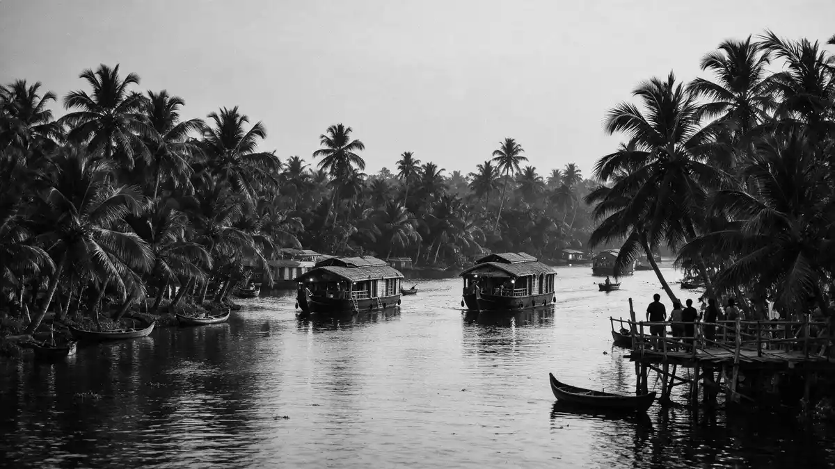
Kerala Backwaters spread around Alappuzha as a landscape where water serves as road, boundary and workplace. Canals, rivers, lagoons and lakes connect the town with paddy fields, villages and Vembanad Lake. Traditional wooden kettuvallams add a visible link between cargo transport and life on the waterways.
Alappuzha and the waterway landscape
Alappuzha lies on Kerala’s Malabar Coast, beside a connected system of inland waters that reaches from the coast towards the interior. The network includes canals, rivers, lakes and lagoons, with Vembanad Lake forming its principal water body. Vembanad Lake’s dimensions are recorded as 84 kilometres in length and an average breadth of 3.1 kilometres.
The lake covers 204 square kilometres and receives water from the Pamba, Achankovil, Manimala, Meenachil and Muvattupuzha rivers. Its shores extend across parts of Alappuzha, Kottayam and Ernakulam districts. The landscape therefore has no single viewpoint or isolated attraction. It is a broad water environment with settlements, cultivation and navigation woven together.
Canals, rice fields and everyday movement
Alappuzha’s canals pass through the town and continue towards rural waterways. Vadai Canal, Commercial Canal and connecting canals belong to the west coast canal system. Inland channels carry passengers and goods, while lakes provide broader routes between settlements.
Water transport shaped commerce in the region before road networks became dominant. Rice, spices, timber and other goods travelled by boat, linking agricultural areas with market centres and the coast. The result is a cultural landscape in which houses, churches, temples, fields and landing places stand beside navigable water.
From kettuvallam cargo boats to houseboats
The kettuvallam is a traditional Kerala boat with a wooden hull joined using coir. The name combines Malayalam words associated with tying and boats. Jackwood planks, coconut fibre and a protective coating form the basis of its traditional construction. Traditional kettuvallam construction belongs to an older cargo-boat tradition.
These boats carried rice and spices through the waterways, with covered sections for crews and stored goods. Their later form includes accommodation, dining areas and open decks, creating the houseboat associated with Kerala travel. The change of function remains visible in the boat’s long wooden body, woven roof and relationship with the water.
Visiting Kerala Backwaters: what travellers from Western Europe should know
- Alappuzha is the principal town for the southern backwaters. Boats depart through the town’s canals and connect with the wider Vembanad system.
- The landscape is navigated by water, with paddy fields, narrow channels, lake crossings and village landing places forming the route.
- The official language is Malayalam and the currency is the Indian rupee.
- Entry requirements depend on your nationality; UK travellers can check the FCDO travel advice at gov.uk/foreign-travel-advice, Irish travellers the Department of Foreign Affairs at ireland.ie.
Searching for Kerala Backwaters on social platforms
These links open searches for Kerala Backwaters on each platform.
Frequently asked questions about Kerala Backwaters
Where are Kerala Backwaters?
They are centred around Alappuzha in Kerala, southern India. The waterways connect inland canals, rivers, lagoons and Vembanad Lake.
What can travellers expect on a visit?
Travel takes place across navigable water beside paddy fields, villages and canal-side homes. Houseboats and smaller craft provide different ways to view the landscape.
What makes Kerala Backwaters distinctive?
The landscape combines working waterways with a long boat-building tradition. Kettuvallams connect historic cargo transport with contemporary houseboat travel.


