
Lago di Como: an upside-down Y of water and stone
Published on 08/25/2026 at 07:21 | Editorial responsibility: Rafael Müller, Editor-in-Chief AD HOC NEWS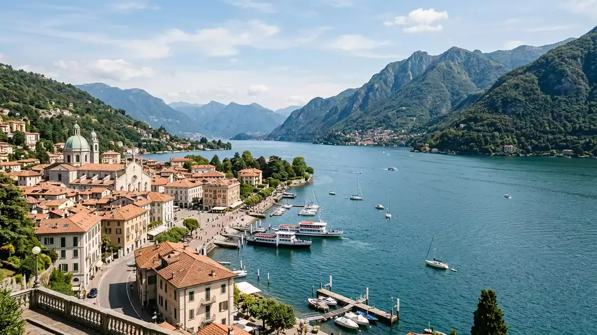
Lago di Como, known in English as Lake Como, is a deep glacial lake in Lombardy in northern Italy, stretching north from the city of Como into the foothills of the Alps.The lake lies at an elevation of about 198 m (650 ft) above sea level, framed by limestone and granite mountains.Its outline forms a distinctive inverted Y with three long branches that meet near Bellagio, giving the lake a geometry that visitors can trace simply by following the shore.
The inverted Y: geography written in water
Lago di Como occupies a long, narrow basin carved by ancient ice, with the water surface covering about 146 km² (56 square miles).From north to south it extends for roughly 47 km (29 miles), while the width varies, reaching several kilometres at its widest point.The basin lies within the southern Alps of Lombardy, with shorelines that climb quickly into surrounding hills and mountains.
The lake’s inverted Y form is not an abstract map detail but a visible structure in the landscape.One branch leads south-west to Como, another south-east to Lecco, and a third north towards Colico, so that moving along the shore brings a sense of passing through three linked corridors of water.Bellagio stands roughly where these branches meet, a reference point where the lake seems to divide around a central headland.
Depth and geology beneath the surface
Lago di Como is defined as much by its depth as by its length.Measurements place its maximum depth at over 400 m (about 1,350 ft), making it one of the deepest lakes in Europe.The lake’s floor lies well below sea level in some sections, while the water surface remains high above it, a reminder that this basin was carved by glacial ice rather than by ordinary river erosion.
The surrounding mountains rise in stages from the shoreline.In the southern reaches near Como the nearby ridges reach elevations of around 600 m (2,000 ft), while further north the skyline includes higher Alpine peaks that exceed 2,000 m (6,600 ft).The bedrock here includes both limestone and granite, and the contrast between dark slopes, pale stone and the reflective water surface is part of the lake’s visual character.
Towns, villas and crossings along the shore
Human life around Lago di Como gathers in a series of towns and villages that line the water’s edge.Como stands at the end of the south-western branch, while Lecco occupies the end of the south-eastern branch and Colico anchors the northern end.The lake has been associated for generations with villas and gardens built along its shores, many of which face directly onto the water, with terraced planting and paths aligned with the steep terrain.
The surface of Lago di Como functions as a transport corridor as well as a landscape feature.The Adda River flows into the lake and then out again near Lecco, and smaller rivers and streams reach the water from surrounding valleys.Because the branches converge near Bellagio, crossings here give clear views along more than one arm of the lake at once, with town façades, piers and hillsides forming a layered backdrop.
Visiting Lago di Como: what travellers from Western Europe should know
- Lago di Como lies in the Lombardy region of northern Italy, north of Milan, with the city of Como at the southern end of one branch and Lecco at the end of another.
- The shores combine flat promenades with steep streets and stepped paths rising from the water, and some viewpoints involve sustained gradients along paved or cobbled routes.
- Rail connections link Milan with towns such as Como and Lecco, and from these towns roads and local transport follow the lake’s three branches to smaller settlements.
- The official language is Italian and the currency is the euro.
- Entry requirements depend on your nationality; UK travellers can check the FCDO travel advice at gov.uk/foreign-travel-advice, Irish travellers the Department of Foreign Affairs at ireland.ie.
Searching for Lago di Como on social platforms
These links open searches for Lago di Como on each platform.
Frequently asked questions about Lago di Como
Where is Lago di Como?
Lago di Como is in Lombardy in northern Italy, north of Milan, with its southern branches ending at the cities of Como and Lecco.
What should visitors expect when they arrive?
Visitors encounter a long glacial lake bordered by steep hills and mountains, with towns, promenades and terraced streets lining the waterfront along its three branches.
What makes Lago di Como distinctive among Italian lakes?
The combination of great depth, an inverted Y layout with three branches and steep mountain slopes close to the water gives Lago di Como a characteristic landscape form.


