
Luang Prabang where Lao timber meets colonial streets
Published on 09/22/2026 at 15:24 | Editorial responsibility: Rafael Müller, Editor-in-Chief AD HOC NEWS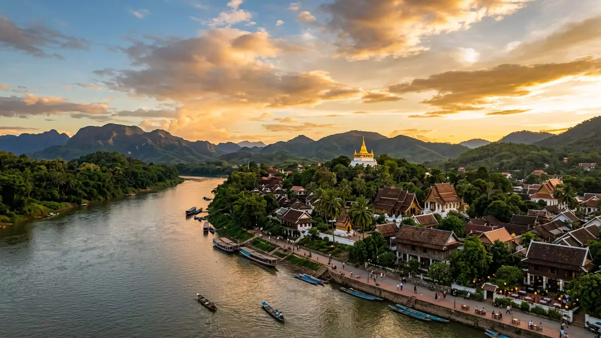
Luang Prabang is a historic town in northern Laos, set where the Mekong meets the Nam Khan. Its compact peninsula gathers Buddhist monasteries, timber houses and colonial buildings into one visible architectural landscape.
Luang Prabang on the Mekong and Nam Khan
The town occupies a narrow area between waterways and mountains. Riverbanks frame streets of low-rise buildings, while Mount Phousi rises above the historic centre with temples and viewpoints on its slopes.
The landscape remains closely connected to the settlement. The Mekong forms one edge of the peninsula, and the Nam Khan curves along another. Bridges, river paths and temple compounds give the town a distinct relationship with water.
Temples, timber houses and colonial façades
Luang Prabang’s character comes from the meeting of architectural traditions. UNESCO’s architectural description identifies a fusion of Lao urban structures with European colonial buildings from the nineteenth and twentieth centuries.
Religious buildings form the visual centre of many neighbourhoods. Wat Xieng Thong is known for its richly decorated surfaces and sweeping rooflines, while other monasteries line streets with whitewashed walls, gilded details and carved timber.
Traditional houses use timber, raised floors and pitched roofs. Colonial-era buildings add brick, stucco, shutters and arcaded façades. The contrast is visible within short walks, without separating the town into isolated architectural zones.
A former royal capital with a living religious landscape
Luang Prabang became the capital of the Lan Xang kingdom in 1353. The royal court remained associated with the town until 1975, and the former Royal Palace now functions as the National Museum.
The town’s religious history reaches beyond individual monuments. Monasteries remain part of local neighbourhoods, and saffron-robed monks are associated with Buddhist practice throughout Luang Prabang.
The historic town was inscribed on the UNESCO World Heritage List in 1995. The World Heritage designation recognises the relationship between the built environment, the rivers and the mountainous setting.
The protected townscape includes religious buildings, vernacular homes and colonial structures. Luang Prabang’s heritage record also describes temple communities, wooden houses and architectural changes through the nineteenth and twentieth centuries.
Visiting Luang Prabang: what travellers from Western Europe should know
- Luang Prabang lies in northern Laos at the confluence of the Mekong and Nam Khan. The town is reached by air, road and rail, with Luang Prabang railway station outside the historic centre.
- Mount Phousi involves a climb on foot over steps. Temple compounds, river paths and the historic streets are explored on foot, with uneven surfaces in some areas.
- The official language is Lao and the national currency is the Lao kip.
- Entry requirements depend on your nationality; UK travellers can check the FCDO travel advice at gov.uk/foreign-travel-advice, Irish travellers the Department of Foreign Affairs at ireland.ie.
Searching for Luang Prabang on social platforms
These links open searches for Luang Prabang on each platform.Frequently asked questions about Luang Prabang
Where is Luang Prabang?
Luang Prabang is in northern Laos, on a peninsula formed by the Mekong and Nam Khan rivers. Mountains surround the town and shape its wider landscape.
What can visitors expect in Luang Prabang?
The historic centre contains monasteries, timber houses, colonial buildings, river paths and the former Royal Palace. Mount Phousi adds a stepped climb above the town.
What makes Luang Prabang distinctive?
Its distinctive character comes from the close combination of Lao religious and vernacular architecture with European colonial buildings. The town has held UNESCO World Heritage status since 1995.


