
Niagara Falls and the landscape shaped by water
Published on 09/23/2026 at 02:30 | Editorial responsibility: Rafael Müller, Editor-in-Chief AD HOC NEWS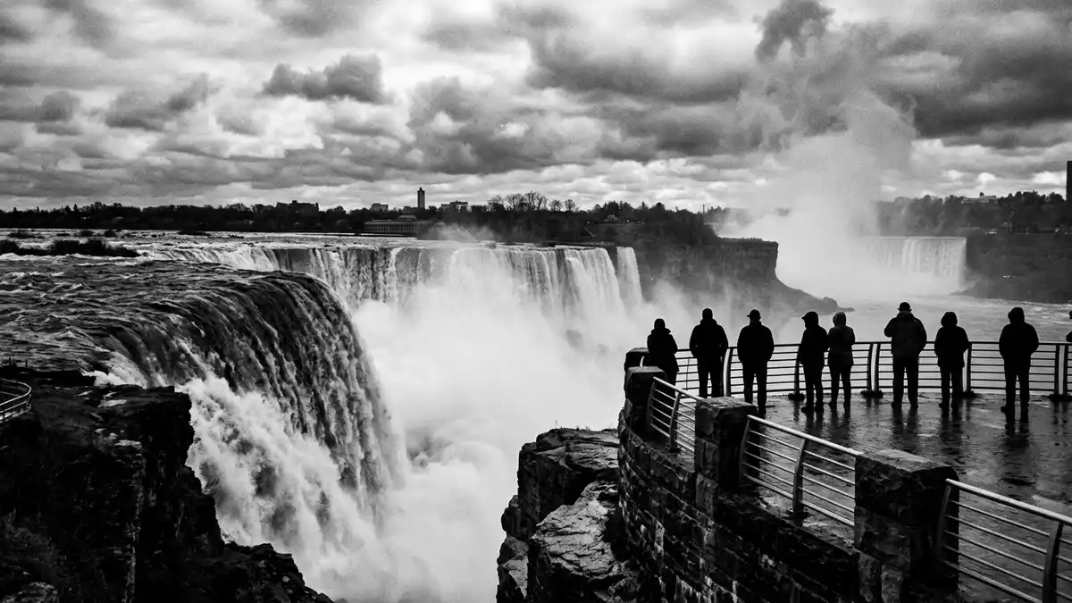
Niagara Falls is a waterfall system on the Niagara River, where the waterway crosses the border between Ontario and New York State. Its three principal sections are Horseshoe Falls, American Falls and Bridal Veil Falls, with water descending through a gorge cut into ancient rock.
The falls combine a broad Canadian crescent with narrower American cascades. Their visible form records the retreat of glaciers, the structure of the Niagara Escarpment and the long movement of the river.
Three cascades across an international river
Horseshoe Falls occupies the Canadian side and has a crest about 670 metres (2,200 ft) long. Its drop is 57 metres (188 ft), with the curved brink facing the upper Niagara River.
American Falls lies beside the United States bank. Its height ranges from 21 to 34 metres (70 to 110 ft), while its crest extends for about 260 metres (850 ft). Bridal Veil Falls forms a smaller neighbouring cascade near the American side.
Goat Island separates parts of the American falls and belongs to Niagara Falls State Park. On the Canadian side, parks and paths follow the river above the brink, with views towards the water, the gorge and the opposing shore.
Ice, limestone and the Niagara Gorge
Niagara Falls began forming about 12,000 years ago, after glaciers withdrew from the Great Lakes region. Meltwater flowed from Lake Erie towards Lake Ontario through the Niagara River and over the Niagara Escarpment.
The gorge exposes sedimentary layers formed more than 400 million years ago. Resistant dolomite and limestone cap softer rock below, while erosion gradually carries the brink upstream.
The falls have moved about seven miles from their earlier position near the Queenston-Lewiston escarpment. Niagara Falls geology connects the modern landscape with the retreat of the last continental ice sheets.
The Niagara River links Lake Erie and Lake Ontario, while the gorge begins below the falls and continues towards the lower river. The exposed walls show the path cut by the cataract through the escarpment.
From written description to hydroelectric history
Indigenous peoples lived in the Niagara region before European exploration. Father Louis Hennepin recorded the falls during a 1678 expedition, and his published account introduced their scale to European readers.
Niagara Falls later became associated with the War of 1812, the Underground Railroad and the development of hydroelectric power. The river formed a crossing between communities on both sides of the international boundary.
Frederick Law Olmsted and Calvert Vaux worked on the landscape surrounding the falls in 1886. The Niagara Reservation was created in New York in 1885, establishing a protected public setting beside the American cascades.
Hydroelectric development expanded in the nineteenth century. The Canadian Niagara Power Company generating station began producing electricity in 1905, while the Edward Dean Adams Power Plant on the American side opened in 1896. Tesla and Niagara power belong to the industrial history of the river.
The Niagara Falls National Heritage Area follows a 13-mile corridor along the United States side, from Niagara Falls towards Lake Ontario. Its themes include natural history, borderlands, conservation and industry. Niagara heritage area places the waterfall within that wider cultural landscape.
Visiting Niagara Falls: what travellers from Western Europe should know
- Niagara Falls lies between Ontario and New York State on the Niagara River. The Canadian city and the United States city face each other across the international boundary.
- On the United States side, Niagara Falls State Park occupies Goat Island and the riverbank near the American Falls. The Buffalo Niagara International Airport and Amtrak’s Niagara Falls Station serve the regional approach.
- On the Canadian side, Niagara Parkway follows the river through Niagara Falls, Ontario. VIA Rail and GO Transit connect the city with the wider Ontario transport network.
- The gorge contains steep riverbanks, exposed rock and pathways near powerful water. The approach includes stairs, bridges and uneven ground in several viewing areas.
- The official languages are English and French in Canada, while English is the main language used in the surrounding United States region. The currencies are the Canadian dollar and the United States dollar.
- Entry requirements depend on your nationality; UK travellers can check the FCDO travel advice at gov.uk/foreign-travel-advice, Irish travellers the Department of Foreign Affairs at ireland.ie.
Searching for Niagara Falls on social platforms
These links open searches for Niagara Falls on each platform.
Frequently asked questions about Niagara Falls
Where is Niagara Falls?
Niagara Falls lies on the Niagara River between Ontario in Canada and New York State in the United States. The two cities named Niagara Falls stand on opposite sides of the river.
What can visitors expect at Niagara Falls?
Visitors encounter river viewpoints, parks, bridges, stairs and paths near the American and Canadian cascades. The landscape includes spray, exposed rock and the steep Niagara Gorge.
What makes Niagara Falls distinctive?
Niagara Falls combines three named cascades with an international border, a glacial origin and a long hydroelectric history. Horseshoe Falls has a 670-metre crest and a 57-metre drop.


