
Parque Nacional Natural Tayrona where mountains meet the Caribbean
Published on 09/10/2026 at 13:37 | Editorial responsibility: Rafael Müller, Editor-in-Chief AD HOC NEWS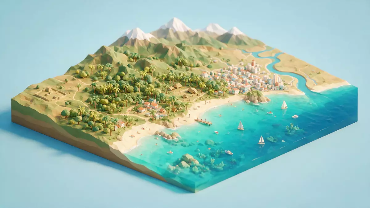
Parque Nacional Natural Tayrona on Colombia’s northern Caribbean coast is a protected landscape where the foothills of the Sierra Nevada de Santa Marta fall directly towards the sea, meeting bright sandy coves and forested headlands in a single sweep. Established as a national park in 1964, it lies within the jurisdiction of Santa Marta in the Department of Magdalena and combines coastal hills with a belt of Caribbean waters.
Coastline framed by mountains and forest
The defining impression of Parque Nacional Natural Tayrona is the way steep green slopes reach down to the shoreline, creating short valleys that open suddenly onto beaches with pale sand and scattered boulders. The park occupies a stretch of Colombia’s Caribbean coast east of Santa Marta, where the protected area runs from bays near Taganga towards the mouth of the Río Piedras and includes both land and marine zones.a protected area on the northern Caribbean coast The land section covers around 150 km² (58 sq mi), backed by maritime areas in the Caribbean Sea that shelter reefs and coastal waters.land and sea combined in the park’s area
Behind the beaches, forest and dry scrub rise towards the lower slopes of the Sierra Nevada de Santa Marta, a mountain range described as the highest coastal range in the world. Trails lead through tropical vegetation with quick changes in plant cover as altitude and exposure shift, moving from dry coastal thickets to more humid forest in sheltered gullies.rapid changes of vegetation and tropical forest The combination of mountain backdrop and sea-facing bays gives many viewpoints in the park clear sightlines over both forested ridges and the Caribbean.
Landscapes, ecosystems and traces of the Tayrona people
Parque Nacional Natural Tayrona was formally declared and delimited in the 1960s to safeguard its ecological richness and cultural remains, with resolutions in 1964 and 1969 defining the protected area under Colombian law.declared and delimited in the 1960s Within its boundaries, the park brings together dry coastal forest, more humid woodland, mangroves, rocky shorelines, coral formations and seagrass meadows. Older descriptive material from the park administration lists thorny scrub, dry, wet and cloud forests, coral formations, marine pastures, beaches, rocky littoral, mangroves, algal meadows and oxbow lagoons as part of its mosaic of ecosystems.a mosaic of coastal and marine ecosystems
Beyond the natural setting, the park preserves archaeological remains connected with the Tayrona people, who inhabited the Sierra Nevada and coastal foothills before Spanish colonisation. Paths in the interior reach former settlements and terraces where stonework survives among the vegetation, alongside fragments of paths and platforms that indicate organised habitation in the hills. These remains sit within a wider cultural landscape still significant for Indigenous communities from the Sierra Nevada, who maintain links between highland settlements and coastal areas, giving the park a dual character as both ecological reserve and cultural territory.archaeological remains and Tayrona ruins
Beaches, coves and routes through the park
Much of the visitor experience in Parque Nacional Natural Tayrona centres on moving between forest paths and small bays where the Caribbean reaches right up to the edge of the hills. Stretches of golden sand, clusters of rounded rocks and lines of palm trees form recognisable scenes at several points along the coast, with headlands enclosing inlets that feel more sheltered than open ocean shores.golden beaches backed by rainforest and palms Inland tracks link these bays with viewpoints on ridges and with clearings where forest opens briefly, giving alternating glimpses of sea, rock and vegetation.
The main road along this section of coast, sometimes described as the Caribbean trunk road, passes behind the park and forms the access line for recognised entrance sectors such as El Zaino and Palangana.a protected area along the Caribbean coast near Santa Marta From these points, marked routes lead into the interior towards beaches and archaeological sites. Approaches on foot vary from relatively short, well-trodden segments to longer, steeper paths with significant ascents and descents through forest and over rocky ground. The alternation between shaded woodland and exposed coastal stretches, along with the presence of roots, stones and occasional wooden steps, makes footwear and a readiness for uneven terrain important for anyone planning longer walks.
Visiting Parque Nacional Natural Tayrona: what travellers from Western Europe should know
- Parque Nacional Natural Tayrona lies north-east of Santa Marta in the Department of Magdalena, along Colombia’s Caribbean trunk road towards Riohacha, with recognised road access points such as El Zaino and Palangana.
- Many routes inside the park involve sustained walking on uneven, sometimes steep paths with roots, rocks and occasional steps, and some approaches to beaches cross stretches of loose sand under strong sun.
- Sea-facing areas combine exposed headlands with more enclosed bays, and some viewpoints require short ascents to reach ridges overlooking the forest and the Caribbean.
- The official language is Spanish and the currency is the Colombian peso.
- Entry requirements depend on your nationality; UK travellers can check the FCDO travel advice at gov.uk/foreign-travel-advice, Irish travellers the Department of Foreign Affairs at ireland.ie.
Searching for Parque Nacional Natural Tayrona on social platforms
These links open searches for Parque Nacional Natural Tayrona on each platform.
Frequently asked questions about Parque Nacional Natural Tayrona
Where is Parque Nacional Natural Tayrona?
Parque Nacional Natural Tayrona is on Colombia’s northern Caribbean coast in the Department of Magdalena, within the jurisdiction of Santa Marta and reached via the main coastal road.
What should visitors expect on a visit?
Visitors encounter a combination of forested hills, dry coastal scrub, mangroves and coral-rich sea, along with beaches, coves and inland paths that involve walking on uneven terrain under tropical conditions.
What makes Parque Nacional Natural Tayrona distinctive?
The park’s character comes from the meeting of the Sierra Nevada de Santa Marta’s foothills with the Caribbean Sea, its range of coastal and marine ecosystems, and archaeological remains linked to the Tayrona people.


