Pico de Orizaba, Mexico’s snow-capped giant above Orizaba
Published on 09/01/2026 at 08:16 | Editorial responsibility: Rafael Müller, Editor-in-Chief AD HOC NEWS
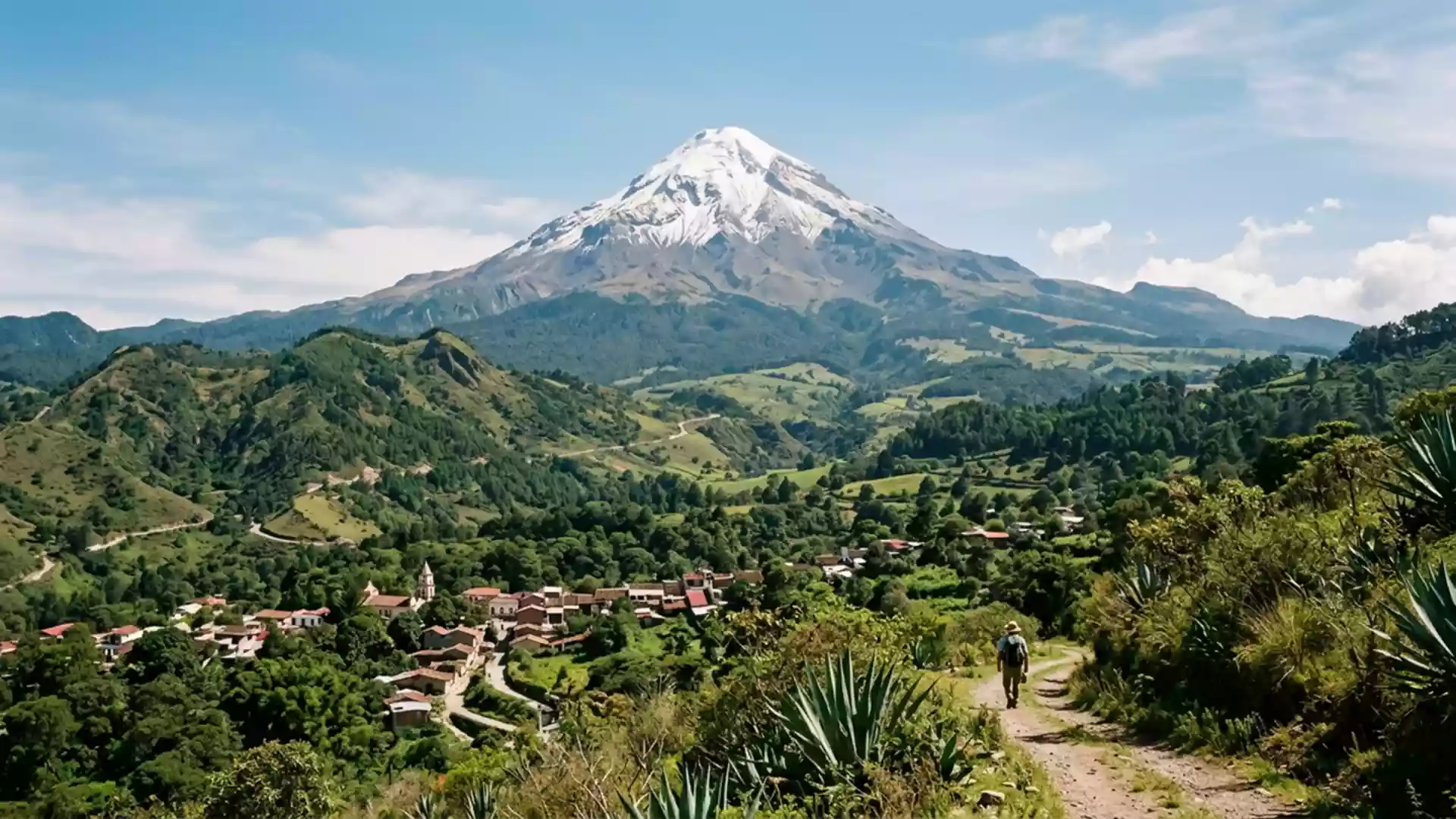
Pico de Orizaba, also known by its Nahuatl name Citlaltépetl, is a snow-capped stratovolcano rising above the region around Orizaba in eastern Mexico. It is the country’s highest mountain and North America’s highest volcano, standing over 5,600 m (around 18,000 ft) above sea level in the Trans-Mexican Volcanic Belt.
A star mountain on the Veracruz–Puebla border
The Nahuatl name Citlaltépetl is often translated as “Star Mountain”, a reminder of the Indigenous languages that named this peak long before mountaineers arrived.Citlaltépetl The volcano rises on the border between the states of Veracruz and Puebla, forming a prominent summit above the Mexican Plateau and the lowlands that lead towards the Gulf of Mexico.the border between Veracruz and Puebla
The mountain is part of the Trans-Mexican Volcanic Belt, a chain of volcanoes that spans central Mexico.Trans-Mexican Volcanic Belt Pico de Orizaba forms a broad, symmetrical cone whose upper slopes carry permanent snow and ice, one of a small number of Mexican peaks where glaciers survive through the year.permanent snow and ice Below the white upper dome, the lower slopes descend through high-altitude grasslands and forested zones into farmland and villages.
Stratovolcano and national park
Geologically, Pico de Orizaba is a stratovolcano built by repeated eruptions that layered lava and ash into a steep-sided cone.stratovolcano built by repeated eruptions It has been classified as an active volcano, although historical eruptions are documented long before the twentieth century.active volcano The summit reaches 5,636 m (18,491 ft), making it Mexico’s highest point and the third-highest peak in North America, after Denali in Alaska and Mount Logan in Canada.third-highest peak in North America
The volcano and its surrounding landscapes form the core of Parque nacional Pico de Orizaba, a protected area established in 1937.national park established in 1937 The park spans roughly 197.5 km² of alpine and subalpine terrain, straddling the boundary between Veracruz and Puebla and including forested lower slopes, high meadows and the volcanic cone itself.area of 197.5 km² For travellers, the protected status is visible in the transition from cultivated land into pine and fir forest, then rocky volcanic ground as the road climbs towards the mountain refuges.
Summit glacier and climbing culture
Above roughly 4,900–5,000 m, the upper part of Pico de Orizaba is covered by a glacier that drapes the steep summit cone.glacier starts around 4,900–5,000 m The icefield feeds gullies and channels that mark the face, and the snow line shifts with the seasons, but the white cap remains a defining feature in views from the towns and villages below.snow-covered upper cone
Mountaineers have been drawn to Citlaltépetl since at least the nineteenth century; one recorded first ascent dates from 1848, when the summit was climbed by F. Maynard and William F. Raynolds.first ascent in 1848 Modern ascents generally begin from high refuges such as Refugio Piedra Grande on the Veracruz side, and standard routes traverse volcanic scree before reaching the glacier, where climbers use crampons and ice axes on the final steep slopes.routes from Refugio Piedra Grande Even for those who remain well below the summit, the climbing culture is tangible in the presence of guiding services, base villages and tracks leading up towards the high camps.
Visiting Pico de Orizaba: what travellers from Western Europe should know
- Pico de Orizaba rises north-west of the city of Orizaba in eastern Mexico, with access roads leading from Orizaba towards highland villages on the Veracruz and Puebla sides.
- Approaches into the national park reach high altitude, and paths towards the refuges and higher slopes cross rocky volcanic ground where sturdy footwear is important.
- The official language is Spanish and the currency is the Mexican peso.
- Entry requirements depend on your nationality; UK travellers can check the FCDO travel advice at gov.uk/foreign-travel-advice, Irish travellers the Department of Foreign Affairs at ireland.ie.
Searching for Pico de Orizaba on social platforms
These links open searches for Pico de Orizaba on each platform.
Frequently asked questions about Pico de Orizaba
Where is Pico de Orizaba?
Pico de Orizaba stands on the border between the Mexican states of Veracruz and Puebla, north-west of the city of Orizaba in eastern Mexico.
What should visitors expect on a visit?
Visitors encounter a high volcanic landscape ranging from forested slopes to alpine meadows and, at greater altitude, rocky ground and snow-covered upper slopes.
What makes Pico de Orizaba distinctive?
Pico de Orizaba is distinctive as Mexico’s highest mountain, North America’s highest volcano and the centrepiece of a national park where permanent snow and ice meet temperate forest.