
Plitvicka jezera and the terraced lakes of Plitvice
Published on 09/02/2026 at 12:04 | Editorial responsibility: Rafael Müller, Editor-in-Chief AD HOC NEWS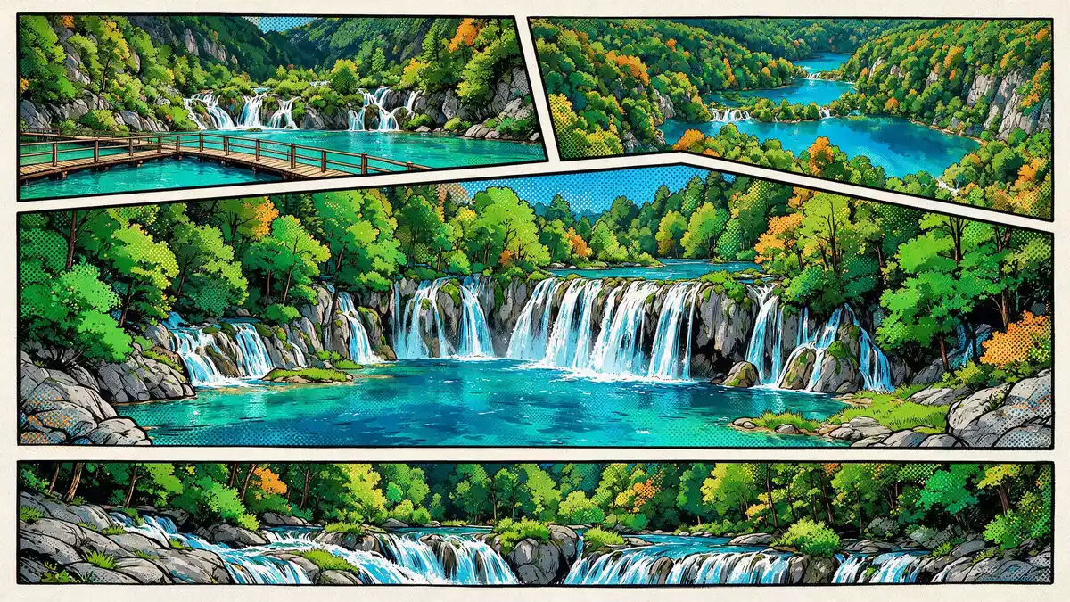
Plitvicka jezera, known in English as Plitvice Lakes, stretches across a karst plateau in central Croatia where water, rock and forest form a terraced landscape of lakes and waterfalls. Declared a national park in 1949 and inscribed on the UNESCO World Heritage List in 1979, it is a protected landscape where flowing water steadily builds new limestone formations while visitors trace wooden paths above the turquoise pools.
Karst water, tufa and a living staircase of lakes
The defining feature of Plitvicka jezera is a chain of lakes stepped down a limestone valley, linked by countless waterfalls and cascades. Water flows over and through the porous rock of the Dinaric karst, depositing calcium carbonate that hardens into tufa and forms natural barriers between the basins.The park lies in a mountainous karst area The lakes follow the course of the Korana River, occupying a trough between the Mala Kapela and Li?ka Plješivica massifs, so water seems to descend in stages from one level of the valley to the next.The Plitvice Lakes are described as a tufa landscape
Tufa barriers are not static formations. Mineral-rich water coats moss, branches and stones, gradually locking them into pale ridges that grow, erode and redirect the flow. The result is a landscape where small terraces, shallow basins and curtains of stone mark the edges of pools. Standing on one of the wooden walkways, it is possible to look down into clear water and see the pale outlines of submerged trunks and rocks, while above, fine streams pour over shelves of limestone into deeper basins below.
A protected park in the Lika region
Plitvicka jezera was proclaimed a national park in 1949, making it the oldest national park in the Republic of Croatia.The Croatian name Nacionalni park Plitvi?ka jezera is the official designation The protected area lies mainly in Lika-Senj County, with a smaller part in Karlovac County, and extends over almost 300 square kilometres (about 115 square miles).UNESCO describes Plitvice Lakes National Park as covering almost 30,000 hectares Forest covers much of this area, with beech and fir woodland surrounding the lakes and continuing up the flanks of the surrounding hills.
UNESCO recognised Plitvicka jezera in 1979 for the outstanding natural value of its terraced lakes, waterfalls and tufa formations.The inscription on the World Heritage List took place on 26 October 1979 The park lies in the lower elevations of the Dinarides, a mountain chain that runs along much of the Croatian interior. Within this broader landscape, Plitvicka jezera forms a compact basin where water collects, drops from ledge to ledge and eventually feeds the Korana, a river that carries the flow northwards.
Walking the lakes and wooden paths
Visitors experience Plitvicka jezera through a network of paths and walkways that bring them close to the water. Wooden planks trace the edges of lakes, cross inlets and span the foam of smaller falls, while wider gravel paths climb through the forest on the slopes. The walking routes are arranged as circuits of varying length and height difference, combining sections along the lakeshore with short climbs to viewpoints from which the stepped nature of the basins and waterfalls can be seen.
The park administration has set out several numbered routes around the lake system, combining walking sections with boat crossings and internal buses.Official information describes seven different routes and four hiking trails Some paths run close to the waterline, where spray reaches the boards and the sound of falling water dominates. Others rise to higher terraces where the lakes appear as a chain of elongated basins, their surfaces divided by pale barriers and bands of vegetation along the margins.
Visiting Plitvicka jezera: what travellers from Western Europe should know
- Plitvicka jezera lies in central Croatia, between the Mala Kapela and Li?ka Plješivica mountain ranges in the Lika region. It sits south of Karlovac on the route towards Zadar.
- The terrain combines lakeside boardwalks with earthen paths and forest tracks. Many sections involve steps or gentle gradients, and some walkways pass directly above moving water.
- The park lies at a moderate elevation in a continental climate zone, so snow can cover paths in winter and summers can be warm, with vegetation dense around the lakes.
- The official language is Croatian and the currency is the euro.
Searching for Plitvicka jezera on social platforms
These links open searches for Plitvicka jezera on each platform.
Frequently asked questions about Plitvicka jezera
Where is Plitvicka jezera?
Plitvicka jezera is in central Croatia, in the Lika region between the Mala Kapela and Li?ka Plješivica mountain ranges, south of Karlovac and north of Zadar.
What should visitors expect on a visit?
Visitors can expect a network of wooden walkways and forest paths around a series of terraced lakes and waterfalls, with walking routes that combine lakeside sections and short climbs.
What makes Plitvicka jezera distinctive?
The park is distinctive for its tufa-formed barriers that create a chain of clear lakes and waterfalls, recognised as a World Heritage Site for this karst landscape.


