
Salar de Uyuni, the mirror-like salt flat of southwest Bolivia
Published on 08/24/2026 at 20:26 | Editorial responsibility: Rafael Müller, Editor-in-Chief AD HOC NEWS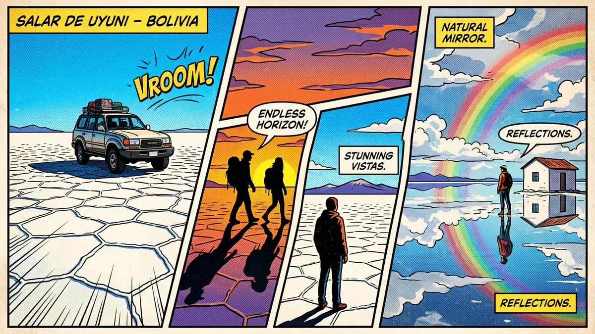
On the high plateau of southwest Bolivia, Salar de Uyuni spreads out as a vast salt flat that seems to erase the horizon when thin seasonal water covers its surface. The expanse lies in the Potosí Department near Uyuni on the Andean Altiplano, at an elevation of around 3,656 m (11,995 ft), and has become one of the most recognisable landscapes in the region for its geometric salt crust and mirror-like reflections.Uyuni Salt Flat elevation and area
A salt flat on the Bolivian Altiplano
Salar de Uyuni occupies a broad basin within the Bolivian Altiplano, the high plateau that sits between the eastern and western ranges of the Andes in South America.location within the Daniel Campos Province The salt flat lies in the Daniel Campos Province of the Potosí Department, with the town of Uyuni acting as the main gateway on its south-eastern edge.position in southwest Bolivia Standing on the crust, travellers are on a plateau that maintains an elevation variance of less than a metre across many kilometres, which contributes to the sense of a level white plain stretching in every direction.flat surface and minimal elevation change
The surface area of Salar de Uyuni is widely recorded at around 10,582 km² (4,086 sq mi), making it the largest continuous salt flat on Earth by area.largest salt flat and depth Beneath the crust lies a deposit of halite and brine that reaches significant depth in places, while the visible layer is thick enough for vehicles to drive across large parts of the flat when conditions allow.salt layers and thickness Around the margins, low hills and volcanic remnants rise from the plateau, breaking the horizonal line and offering elevated viewpoints back over the patterned crust.
Salt crust patterns, islands and Andean vistas
The surface of Salar de Uyuni is characterised by a crust of white salt broken into polygonal patterns that repeat across the flat. As the brine beneath the crust dries and crystallises, the surface forms a network of raised edges enclosing slightly lower panels, creating a geometric texture that can be seen both underfoot and in aerial views.satellite view of the salt flat The crust itself serves as an active source of salt, with extraction taking place at several points where saltworks have been established at the flat’s shores.saltworks around the flat
Within the salt flat, rocky islands rise from the white expanse, formed from remnants of ancient lake beds and volcanic rock that predate the current salt surface. These islands carry cacti and other hardy vegetation and provide vantage points from which the surrounding plateau and the distant Andes can be viewed in all directions.islands within the salar When a shallow layer of water lies on the salt crust, the flat becomes a reflective surface that mirrors the sky, producing the well-known “natural mirror” effect over tens of kilometres.mirror effect during wet conditions The combination of polygonal salt patterns, scattered islands and distant volcanoes gives the area a distinctive Andean character.
Lithium-rich brine and scientific uses
Beneath the salt crust of Salar de Uyuni lies a pool of brine that is exceptionally rich in dissolved minerals, particularly lithium. Studies and reports have estimated that the brine contains a substantial portion of the world’s known lithium reserves, with figures commonly cited between roughly half and around two-thirds of global known reserves.lithium-rich brine and reserves This mineral resource has drawn attention because lithium is a key component in batteries used in electronics and electric vehicles.lithium reservoir and estimated tonnage
The extreme flatness and broad, unobstructed surface of Salar de Uyuni have also made it useful for scientific and technical purposes. The salt flat’s clear skies and wide, level crust are used as a reference surface for calibrating satellite altimeters, a role noted by Earth observation agencies.use in satellite calibration Researchers have mapped the topography of the salt flat using kinematic GPS, confirming that vertical relief across large areas is less than a metre and studying subtle variations in elevation within the basin.topography from kinematic GPS Alongside scientific work, small-scale salt extraction and transport across the crust continue, while broader plans for lithium development remain part of Bolivia’s economic discussion.
Visiting Salar de Uyuni: what travellers from Western Europe should know
- Salar de Uyuni lies in southwest Bolivia’s Potosí Department, with access commonly arranged through Uyuni, a town at the south-eastern edge of the salt flat.
- The salt crust forms an open plateau at high altitude, and a visit typically involves travelling across the exposed surface and, in some areas, walking on the patterned salt.
- Rocky islands within the salt flat, some covered with cacti, can be reached on organised excursions and provide viewpoints over the surrounding white expanse and nearby volcanoes.
- The official language is Spanish and the currency is the Boliviano.
- Entry requirements depend on your nationality; UK travellers can check the FCDO travel advice at gov.uk/foreign-travel-advice, Irish travellers the Department of Foreign Affairs at ireland.ie.
Searching for Salar de Uyuni on social platforms
These links open searches for Salar de Uyuni on each platform.
Frequently asked questions about Salar de Uyuni
Where is Salar de Uyuni located?
Salar de Uyuni lies in southwest Bolivia on the Andean Altiplano, within the Daniel Campos Province of the Potosí Department near the town of Uyuni.
What should visitors expect on a visit?
Visitors encounter a high-altitude salt flat with a white polygonal crust, scattered rocky islands, distant Andean peaks and, in wetter periods, broad mirror-like reflections on the surface.
What makes Salar de Uyuni distinctive compared with other landscapes?
The combination of its vast, extremely flat salt surface, lithium-rich brine beneath the crust and role in satellite calibration sets Salar de Uyuni apart from other Andean plateaus.


