
Sydney Harbour Bridge and the harbour skyline
Published on 08/16/2026 at 14:48 | Editorial responsibility: Rafael Müller, Editor-in-Chief AD HOC NEWS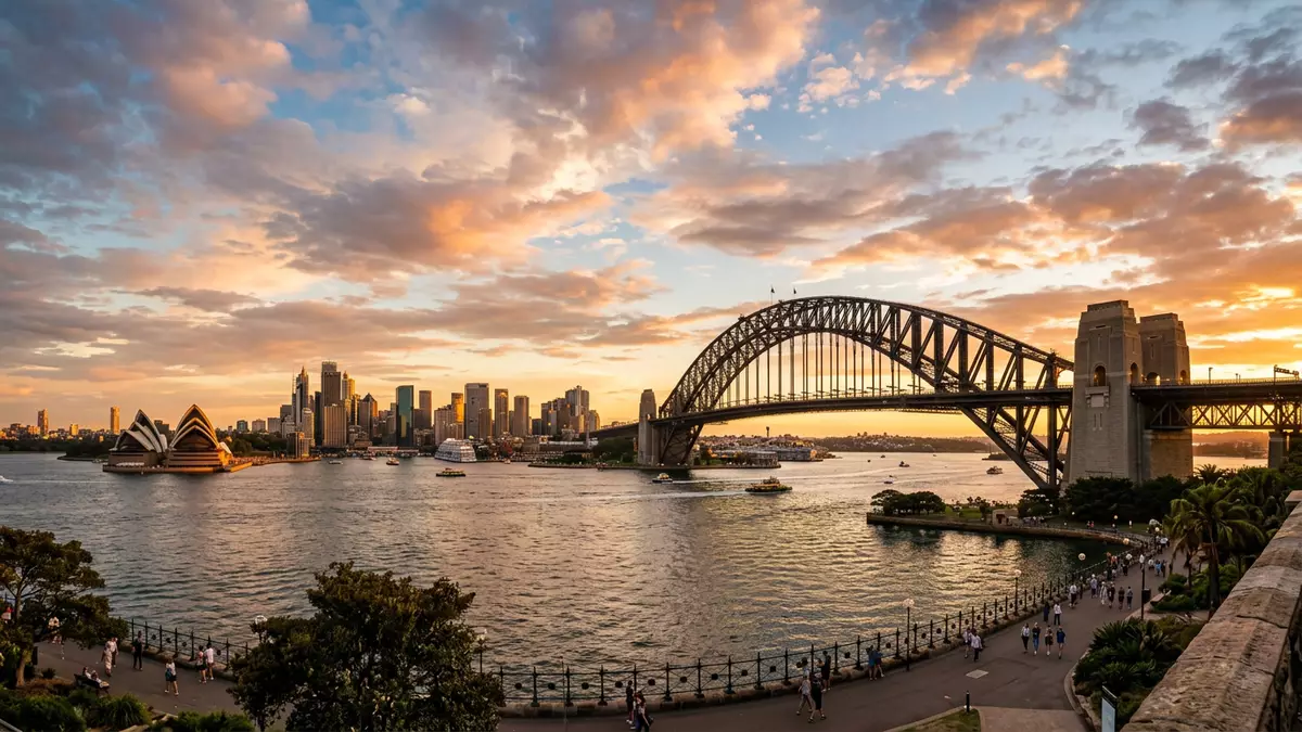
Sydney Harbour Bridge spans Sydney Harbour between Dawes Point and Milsons Point, carrying road, rail, cycle and pedestrian routes across the water. Opened on 19 March 1932, it is a steel arch framed by granite-faced pylons and approach spans.
The steel arch over Sydney Harbour
The bridge’s main span is the feature that most readily holds the eye: a great steel arch, dark against the water and city skyline. Its arch and pylons give the structure its familiar profile, and the whole composition sits within a harbour view that includes the Opera House and the central city.
The bridge was designed by John Job Crew Bradfield, working with Dorman Long and Co. The bridge opened in the early 1930s, when large-scale steel engineering still carried an air of civic ambition.
Granite pylons and approach spans
The pylons are faced in granite, giving the ends of the arch a heavier, masonry presence than the steel centre. The approach spans stretch away from the harbour crossing and bring the bridge into the streets of The Rocks and North Sydney.
Bradfield was a central figure in the bridge’s conception, and the structure remains closely linked with Sydney’s transport history. The bridge also holds a formal place in heritage records as a listed site of national importance, and its physical form has changed little in its overall silhouette.
A working crossing, not a static monument
The bridge still functions as part of Sydney’s transport network, with lanes, rail tracks, a cycleway and footpaths sharing the same structure. That everyday use is visible in the deck itself, where movement by different kinds of traffic is built into the bridge’s layout.
The bridge’s presence reaches beyond the water crossing. It connects to places such as Dawes Point Battery remains and Milsons Point station, both closely tied to the bridge approaches and the city’s harbour edge.
Visiting Sydney Harbour Bridge: what travellers from Western Europe should know
- It stands between Dawes Point in Sydney and Milsons Point on the north shore. The Bradfield Highway crosses the harbour here, and the bridge links the city centre with the northern suburbs.
- The bridge is a busy transport corridor with road and rail above the harbour. Pedestrian access is on the eastern side, while the western side carries the cycleway and railway lines.
- The structure is substantial in scale and includes granite-faced pylons, steel arches and long approach spans. Those elements make the bridge readable from several parts of the harbour foreshore.
- Nearby places include The Rocks, Circular Quay, Bradfield Park and Milsons Point station. Together they frame the bridge within a harbour setting that is part built landscape and part open water.
- Entry requirements depend on your nationality; UK travellers can check the FCDO travel advice at gov.uk/foreign-travel-advice, Irish travellers the Department of Foreign Affairs at ireland.ie.
Searching for Sydney Harbour Bridge on social platforms
These links open searches for Sydney Harbour Bridge on each platform.
Frequently asked questions about Sydney Harbour Bridge
Where is Sydney Harbour Bridge?
It crosses Sydney Harbour in Sydney, linking Dawes Point on the southern side with Milsons Point on the northern side. The bridge forms part of the Bradfield Highway.
What does a visit involve?
The main impression is of a working harbour crossing rather than a detached monument. Roads, trains, pedestrians and cyclists all share the structure.
What makes it distinctive?
Its combination of a steel arch and granite-faced pylons is the defining image. The bridge is also one of Sydney’s strongest visual landmarks in the harbour setting.


