
Tikal’s stone skyline rising above the Guatemalan jungle
Published on 08/18/2026 at 14:41 | Editorial responsibility: Rafael Müller, Editor-in-Chief AD HOC NEWS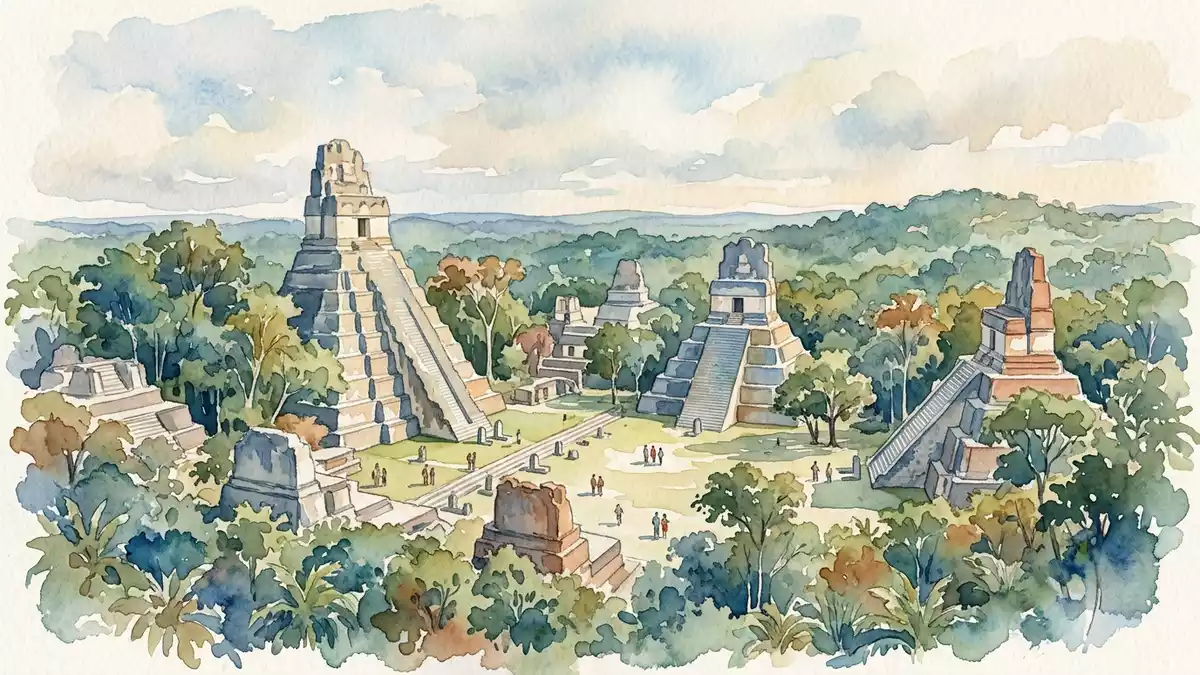
Tikal in northern Guatemala is an ancient Maya city where tall limestone pyramids rise above dense rainforest, forming a stone skyline within a protected national park. The site lies in the Petén region near Flores and is part of Tikal National Park, which was inscribed as a UNESCO World Heritage Site in 1979.
Temples above the canopy
Tikal grew into one of the principal cities of the Classic Maya world between about AD 200 and 900, and its ceremonial core still reflects that era of power. Monumental construction at the site is documented from as early as the fourth century BC, with activity spanning many centuries of Maya history.Monumental construction from the fourth century BC The surviving architecture stands on gently raised limestone ground above surrounding seasonal wetlands in the Petén lowlands.
The most recognisable elements of Tikal are its steep temple-pyramids, which rise far above the forest canopy and frame open plazas on the ground. Several of these temples reach more than 60 m (197 ft) in height, with Temple IV among the tallest at about 70 m (230 ft), making it one of the highest pre-Columbian structures in the Americas.Temple heights including Temple IV From the upper platforms, the view is a pattern of treetops punctuated by the stone roof-combs of neighbouring pyramids.
A Classic Maya capital in the forest
Archaeology identifies Tikal as a major political, economic and military centre of the ancient Maya, with influence across large parts of the lowlands.A major Maya political and economic centre The city is associated with the ancient name Yax Mutal in inscriptions, and its dynastic history is recorded on stelae and temple stairways that survive around the plazas.The ancient name Yax Mutal and Classic-period dates Stone monuments describe royal accession, alliance, warfare and ritual activity spanning many generations.
The core architecture of Tikal is built from local limestone and arranged around a network of plazas, causeways and courtyards. Temple I, also known as the Temple of the Great Jaguar, stands on the eastern side of the Great Plaza and dates to the reign of Jasaw Chan K’awiil I in the eighth century AD.Temple I and its association with Jasaw Chan K’awiil I Opposite it, Temple II faces across the same plaza, while palace complexes such as the Central Acropolis cluster nearby with multiple courtyards and rooms built on stepped platforms.
National park, wildlife and setting
Tikal lies within a large protected area of tropical forest in the Petén Department, where the archaeological remains share the landscape with diverse wildlife. Tikal National Park covers a core zone of ruins and a much wider area of forest that conserves a mosaic of habitats, including broadleaf jungle and seasonal wetlands.National park extent and forest setting The combination of cultural remains and surrounding ecology forms the basis for its UNESCO inscription as a mixed cultural and natural World Heritage Site.UNESCO World Heritage inscription in 1979
The broader setting of Tikal is the lowland jungle of northern Guatemala, with Flores on Lake Petén Itzá acting as a common base for visits. Flores itself occupies an island linked to the mainland by a causeway and serves as an access point for routes into Petén and towards Tikal.Flores as the main gateway town The contrast between the compact streets of Flores and the broad forest clearings of Tikal gives a sense of moving from a small lakeside town into an ancient landscape on a different scale.
Visiting Tikal: what travellers from Western Europe should know
- Tikal lies in the Petén region of northern Guatemala, with Flores on Lake Petén Itzá acting as the main gateway town linked by road to the national park.
- The archaeological core is spread across uneven limestone ground and forest paths, with stone stairways on many structures and steep steps on the main temple-pyramids.
- The surrounding landscape is lowland tropical forest, so shade from trees alternates with exposed clearings on plazas and on the upper platforms of the pyramids.
- The official language is Spanish and the currency is the Guatemalan quetzal. Entry requirements depend on your nationality; UK travellers can check the FCDO travel advice at gov.uk/foreign-travel-advice, Irish travellers the Department of Foreign Affairs at ireland.ie.
Searching for Tikal on social platforms
These links open searches for Tikal on each platform.
Frequently asked questions about Tikal
Where is Tikal?
Tikal is in the Petén Department of northern Guatemala, within Tikal National Park, with Flores on Lake Petén Itzá as the nearest main town.
What should visitors expect at the site?
Visitors encounter extensive Maya ruins spread through tropical forest, including tall temple-pyramids with steep stairways, broad plazas and palace complexes on uneven ground.
What makes Tikal distinctive among Maya sites?
Tikal combines monumental Classic-period architecture rising above the canopy with a large protected forest, and it is recognised as a mixed cultural and natural UNESCO World Heritage Site.


