
Tottori Sakyu, Japan’s desert-like dunes by the sea
Published on 08/15/2026 at 14:12 | Editorial responsibility: Rafael Müller, Editor-in-Chief AD HOC NEWS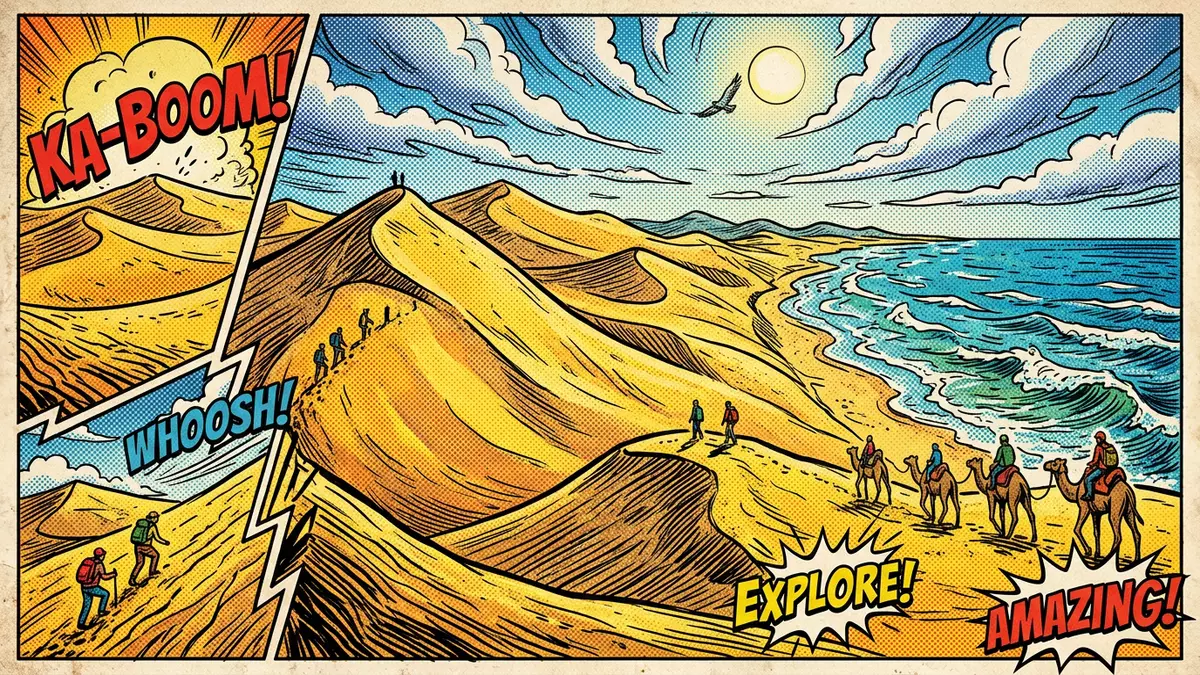
Tottori Sakyu, the Tottori Sand Dunes on Japan’s Sea of Japan coast, transform the outskirts of Tottori City into a vast desert-like landscape shaped over tens of thousands of years. Stretching along the shoreline in Tottori Prefecture, the dunes form Japan’s largest coastal sand-dune field and are part of the wider San’in Kaigan Geopark in western Honshu.
A coastal dune landscape on the Sea of Japan
The defining experience at Tottori Sakyu is standing on wind-sculpted sand above the Sea of Japan, with long ridges running parallel to the water and steep slopes dropping towards the surf. The dune field lies just outside the urban area of Tottori City, occupying a strip of coastline where the Sendai River meets the sea and sand has accumulated into dramatic relief.The Tottori Sand Dunes extend for many kilometres along the coast and reach several tens of metres in height at their tallest points.They span roughly 16 kilometres east to west and up to around 2 kilometres north to south, creating room for broad open slopes and narrower ridges.
The surface of the dunes ranges from firm, packed sand on wind-exposed crests to softer sand in sheltered hollows. On clear days, the contrast between pale sand and dark blue sea defines the scene, with the coastal strip framed by low headlands and the city lying inland. The tallest ridge, known as Umanose, rises to a height of more than 40 m (around 130 ft) above sea level, giving a vantage point over the entire dune field and the coastline beyond.Umanose ridge is identified as the highest point within the protected area.
Sand, river and sea: how the dunes formed
Beneath the apparently simple expanse of sand, Tottori Sakyu is the product of a long geological story involving river erosion, coastal processes and wind. Granite and other rocks in the Chugoku Mountains to the south of Tottori break down into gravel and sand, which is carried by rain-fed rivers such as the Sendai River towards the Sea of Japan.Material from the Chugoku Mountains is transported north to the coast over more than 100,000 years.
At the shoreline, waves and coastal currents sort this material, pushing finer sand landwards and building a coastal terrace that eventually filled an earlier bay.Fluctuating sea levels and coastal currents redistributed seafloor sediments as well, adding more sand to the future dune site. Prevailing northwesterly winds then drove this sand inland, sculpting it into ever-shifting dune forms with crests, slip faces and smaller ripples on the surface. Volcanic eruptions in the wider region added ash and pumice to the mix, giving the sand a varied grain size and composition that can be seen in cross-sections and eroded faces.
Protected landscape within a Global Geopark
Tottori Sakyu is not an isolated curiosity but part of a broader protected coastal landscape recognised for its geological heritage. The dunes sit within the San’in Kaigan National Park and form one of the core sites of the San’in Kaigan Geopark.The dune field is incorporated into the national park along this part of the Sea of Japan coast. The wider geopark has been accepted into the UNESCO Global Geoparks network, highlighting the scientific value of the region’s coastal terraces, marine cliffs and dune systems.San’in Kaigan Geopark is identified as a UNESCO Global Geopark that includes the dunes.
Within this framework, Tottori Sakyu is managed as both a natural landscape and a visitor destination. Trails and access points keep much of the dune area walkable while conserving the larger geomorphological features. Interpretation materials produced by Japanese agencies describe how dune patterns change with wind direction and strength, and how vegetation encroaches on some margins while the core slopes remain largely bare. Far below the sand, bedrock that once formed part of the ocean floor underlies the entire area, tying the modern dunes to a much older geological history.Explanatory material from Japan’s Ministry of Land emphasises the depth of this buried seafloor.
Visiting Tottori Sakyu: what travellers from Western Europe should know
- Tottori Sakyu lies on the Sea of Japan coast just north-east of Tottori City in Tottori Prefecture, with access from JR Tottori Station by local buses that run to stops near the dunes.
- The terrain consists of unconsolidated sand with long slopes and short, steep faces; reaching higher viewpoints involves climbing sandy inclines where footing can be loose and physically demanding.
- The surrounding area forms part of San’in Kaigan National Park, and the official language is Japanese while the national currency is the yen.
- The dunes stand at low coastal elevation but weather conditions on the shore can be exposed, with strong winds shaping the surface and influencing how easy or difficult walking becomes.
Searching for Tottori Sakyu on social platforms
These links open searches for Tottori Sakyu on each platform.
Frequently asked questions about Tottori Sakyu
Where is Tottori Sakyu located within Japan?
Tottori Sakyu lies on the Sea of Japan coast just north-east of Tottori City in Tottori Prefecture, on the western side of Honshu.
What should visitors expect when walking on the dunes?
Visitors encounter extensive sandy slopes, wind-shaped ridges and views over the sea, with walking that can be strenuous on loose sand, especially when climbing higher sections.
What makes Tottori Sakyu distinctive compared with other Japanese landscapes?
Its broad coastal sand-dune field, formed by long-term interaction of river, sea and wind, creates a desert-like environment unusual in a country better known for forested mountains and cities.


