
Uluru’s sandstone monolith in Australia’s Red Centre
Published on 08/18/2026 at 14:45 | Editorial responsibility: Rafael Müller, Editor-in-Chief AD HOC NEWS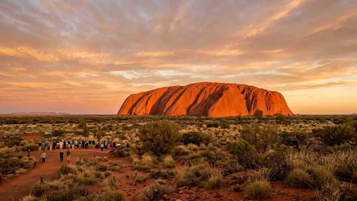
Uluru is a vast sandstone monolith rising from the desert plains near Yulara in Australia’s Northern Territory, its rust-red bulk forming a single dominant landmark in the country’s arid interior. For the Anangu people, whose traditional lands include this part of the continent, Uluru is a sacred place woven into stories and law that stretch back beyond written history.
Ayers Rock and the scale of the monolith
From a distance, Uluru appears as a single block of rock emerging from a remarkably flat landscape, an inselberg that lifts its summit hundreds of metres above the surrounding plain.Uluru facts and figures Up close, the outer surface reveals layers and ribs formed by erosion, with deep gullies running down the sides and narrow ledges catching the light at different times of day. The rock’s bulk is measured in kilometres: the exposed length is about 3.6 km (2.2 miles), its width around 1.9 km (1.2 miles), and the circumference roughly 9.4 km (5.8 miles) around the base.dimensions of the monolith
In vertical scale, Uluru rises about 348 m (1,142 ft) above the surrounding plain, with its summit reaching approximately 863 m (2,831 ft) above sea level.height and circumference Much of the formation continues below ground, with estimates that the rock extends several kilometres beneath the surface, anchoring what is visible to a much larger body of sandstone. Geologically, Uluru is composed mainly of arkose, a coarse-grained sandstone rich in feldspar, derived from ancient mountain ranges that once stood nearby and were worn down over immense spans of time.arkose sandstone composition
Geology in the Uluru-Kata Tjuta landscape
Uluru sits within Uluru-Kata Tjuta National Park, an area of arid ecosystems where isolated rock masses rise sharply from sand plains and low scrub. The park covers more than 1,300 km², bringing together the monolith of Uluru and the multi-domed massif of Kata Tjuta in a single protected landscape.Uluru-Kata Tjuta National Park factsheet Both formations are examples of inselbergs, steep-sided isolated hills that stand out against the relatively level terrain and record tectonic and geomorphic processes over geological time.World Heritage description
The strata within Uluru are nearly vertical, dipping steeply to the south-west, and have an exposed thickness measured in thousands of metres.geological structure Weathering has carved hollows, overhangs and fluted channels into the rock, and the iron-rich minerals in the sandstone give its outer surface the familiar red colour. When the surface layer weathers, fresh sandstone exposed beneath can appear grey or pink before oxidising, creating subtle variations in tone on faces and ledges. Around the base, sheets of rock dip outward beneath spinifex and desert grasses, while occasional waterholes and shaded clefts show how the formation interacts with the limited surface water of the region.
Cultural significance and World Heritage protection
For the Anangu people, Uluru is not only a prominent landform but a place embedded in Tjukurpa, the belief system and law that guides everyday life and links present communities to ancestral beings. Specific features of the rock, including caves, ridges and markings on the surface, are associated with particular Tjukurpa stories and are treated with care and respect.Uluru and Anangu cultural connections The wider landscape of Uluru and Kata Tjuta is viewed as a living cultural environment in which law, ceremony and land management are intertwined.
Uluru-Kata Tjuta National Park has formal recognition for both its natural and cultural values through inscription on the UNESCO World Heritage List. The park was inscribed first for its outstanding natural qualities in 1987 and later, in 1994, for its cultural significance as a landscape directly associated with living traditions of outstanding universal importance.World Heritage inscription dates Joint management arrangements recognise Anangu as traditional owners, with park operations structured to respect cultural protocols and responsibilities. The colonial name “Ayers Rock”, applied by William Gosse in the nineteenth century to honour Sir Henry Ayers, sits alongside the name Uluru, but the Indigenous name is the primary form used.
Visiting Uluru: what travellers from Western Europe should know
- Uluru lies in Australia’s Northern Territory, south-west of Alice Springs, with the settlement of Yulara serving as the main service hub for visitors to Uluru-Kata Tjuta National Park.
- Approaches to Uluru involve walking on gently undulating desert terrain, with formed paths around sections of the base and areas of soft sand and exposed rock.
- The climate in the region brings high temperatures in summer and cooler desert nights, and sun exposure on open ground is a constant factor on walks.
- The official language is English and the currency is the Australian dollar.
- Entry requirements depend on your nationality; UK travellers can check the FCDO travel advice at gov.uk/foreign-travel-advice, Irish travellers the Department of Foreign Affairs at ireland.ie.
Searching for Uluru on social platforms
These links open searches for Uluru on each platform.
Frequently asked questions about Uluru
Where is Uluru located?
Uluru is in the Northern Territory of Australia, near the resort settlement of Yulara and within Uluru-Kata Tjuta National Park in the country’s arid interior.
What should visitors expect on a visit?
Visitors encounter a single massive sandstone formation rising from desert plains, with walking routes around parts of the base and views towards the domes of Kata Tjuta in the wider park.
What makes Uluru distinctive?
Uluru stands out through its scale as an arkose sandstone monolith, its red colour and sculpted faces, and its status as a sacred place for Anangu recognised internationally as both a natural and cultural World Heritage site.


