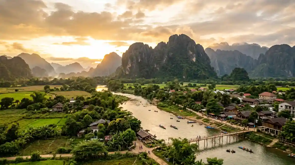
Vang Vieng's Nam Song River remains muddy on 3 November
Published on 11/07/2026 at 08:13 | Editorial responsibility: Rafael Müller, Editor-in-Chief AD HOC NEWSRiver condition and visitor context
- The Nam Song River remained muddy on 3 November 2026, while the Vang Vieng Commission for Information and Education attributed the change to heavy rain.
- Authorities discussed investigation and possible action against projects releasing sediment at a meeting on 26 October 2026.
- Vang Vieng lies 150 kilometres north of Vientiane Capital among limestone peaks, cliffs, caves and the Nam Song River.

Vang Vieng's Nam Song River remained muddy on 3 November 2026, putting the waterway at the centre of a local environmental dispute. The river runs through the limestone landscape in central Laos and supports activities that are important to the town's visitor economy.
A report by the Laotian Times report says residents first noticed the change in October. The water remained discoloured through 3 November, despite early reports that no rain had fallen when the problem began.
Why the muddy Nam Song River matters now
At a meeting on 26 October 2026, authorities agreed to investigate the condition and called for action to clean up the river. They also discussed suspending projects that release sediment into the water, linking the issue to public confidence and the tourism industry.
On 3 November 2026, the Vang Vieng Commission for Information and Education attributed the muddy water to heavy rain in northern Xaysomboun. The commission said soil had been washed into three streams feeding the Nam Song and also pointed to land clearing for a new access road to Houay Khai waterfall in Vang Vieng.
That explanation remains disputed locally. Residents, business owners and travellers cited in the report said the river had turned muddy before the recent rainfall. Some residents also suspected upstream gold mining, but the report does not establish that as the cause of the current discolouration.
The dispute is not the same as a confirmed closure. The 3 November report records an investigation, calls for inspections and discussion of possible controls, but it does not announce a closure of the river or a changed entrance to a named attraction. The practical point for visitors is that the condition of the Nam Song has become a live issue while its cause remains contested.
Vang Vieng's karst setting depends on the river
The official Laos tourism profile places Vang Vieng 150 kilometres north of Vientiane Capital. It describes a town surrounded by limestone mountain peaks and sheer cliffs, with the Nam Song bisecting the settlement.
The same profile identifies a network of caves at the base of the mountains. It also lists kayaking and tubing on the river, rock climbing, trekking and visits to nearby Hmong villages among the area’s established activities. This makes the current water-quality dispute directly relevant to the physical setting visitors come to experience, rather than a detached town story.
Several named natural sites extend the landscape beyond the river. Tham Pou Kham, also called Golden Crab Cave, has wet rock formations and a reclining Buddha statue. Tham Chang rises above the southern part of town, while Kaeng Nyui is a 30-metre waterfall east of the settlement. These features are separate from the reported Nam Song problem, and the current report does not say that they are closed.
The environmental question also has a recent local precedent. The Laotian Times says authorities suspended Daochalearn Mineral Processing in July 2026 over river pollution linked to unauthorised upstream operations. It does not say that the July case proves the cause of the latest muddy water.
What the 3 November report means for a visit
- The current issue concerns the Nam Song River in Vang Vieng, with the water reported as discoloured through 3 November 2026.
- The 26 October 2026 meeting produced an investigation and clean-up action, but no river closure or changed entrance is reported in the 3 November account.
- Vang Vieng is 150 kilometres north of Vientiane Capital and is set among limestone cliffs, caves and waterways.
- River activities named by the tourism authority include kayaking and tubing; the current report gives no assurance about water conditions for either activity.
- Entry requirements depend on your nationality; UK travellers can check the FCDO travel advice at gov.uk/foreign-travel-advice, Irish travellers the Department of Foreign Affairs at ireland.ie.
Searching for Vang Vieng on social platforms
These links open searches for Vang Vieng on each platform.
Frequently asked questions about Vang Vieng
What happened to the Nam Song River on 3 November 2026?
The river remained muddy and discoloured. The Vang Vieng Commission for Information and Education attributed the condition to heavy rain and soil entering streams, while residents disputed that explanation.
What is Vang Vieng known for?
The town is known for its limestone peaks, cliffs, caves and the Nam Song River. Official tourism information lists kayaking, tubing, rock climbing and trekking among its activities.
Where is Vang Vieng and how do you get there?
Vang Vieng is 150 kilometres north of Vientiane Capital in Laos. The official tourism profile places it in Vientiane Province and identifies the town as a settlement divided by the Nam Song River.