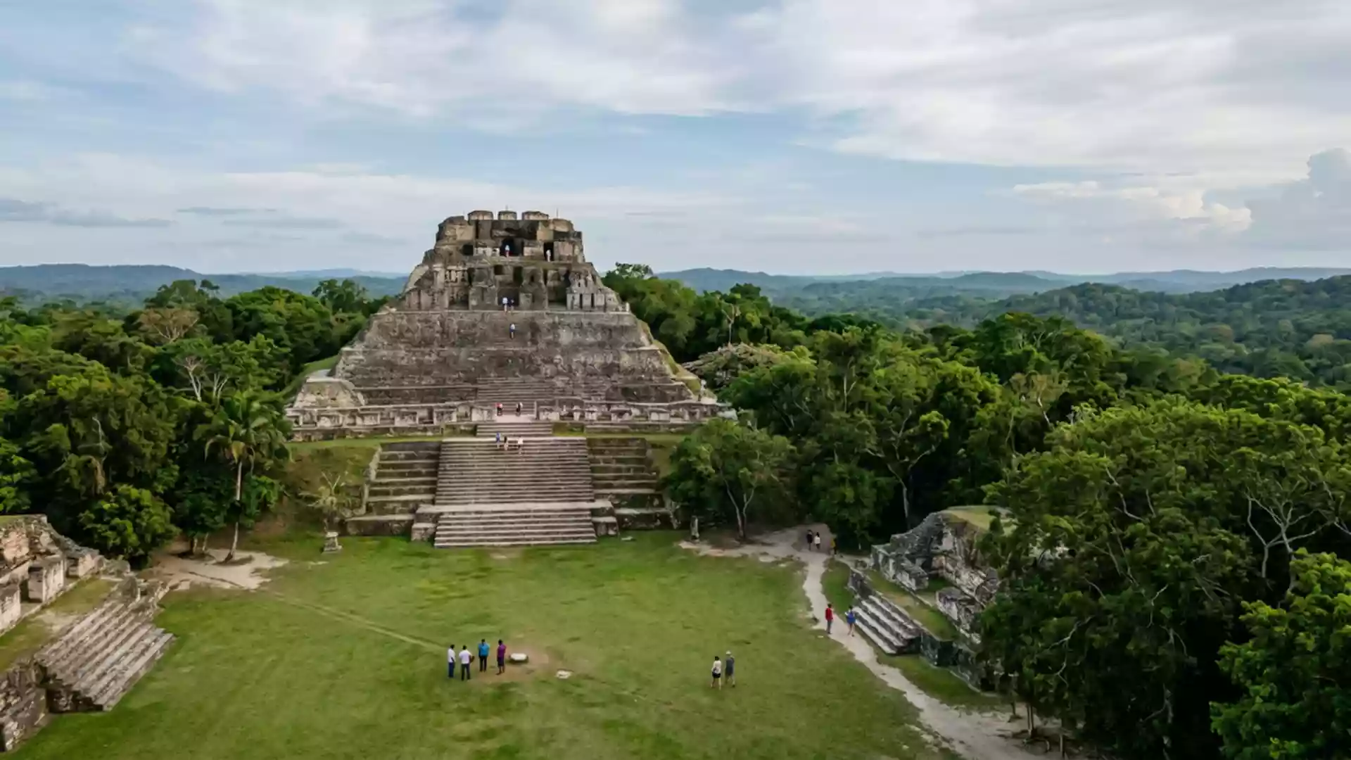
Xunantunich’s stone heights above the Mopan River
Published on 08/23/2026 at 14:56 | Editorial responsibility: Rafael Müller, Editor-in-Chief AD HOC NEWS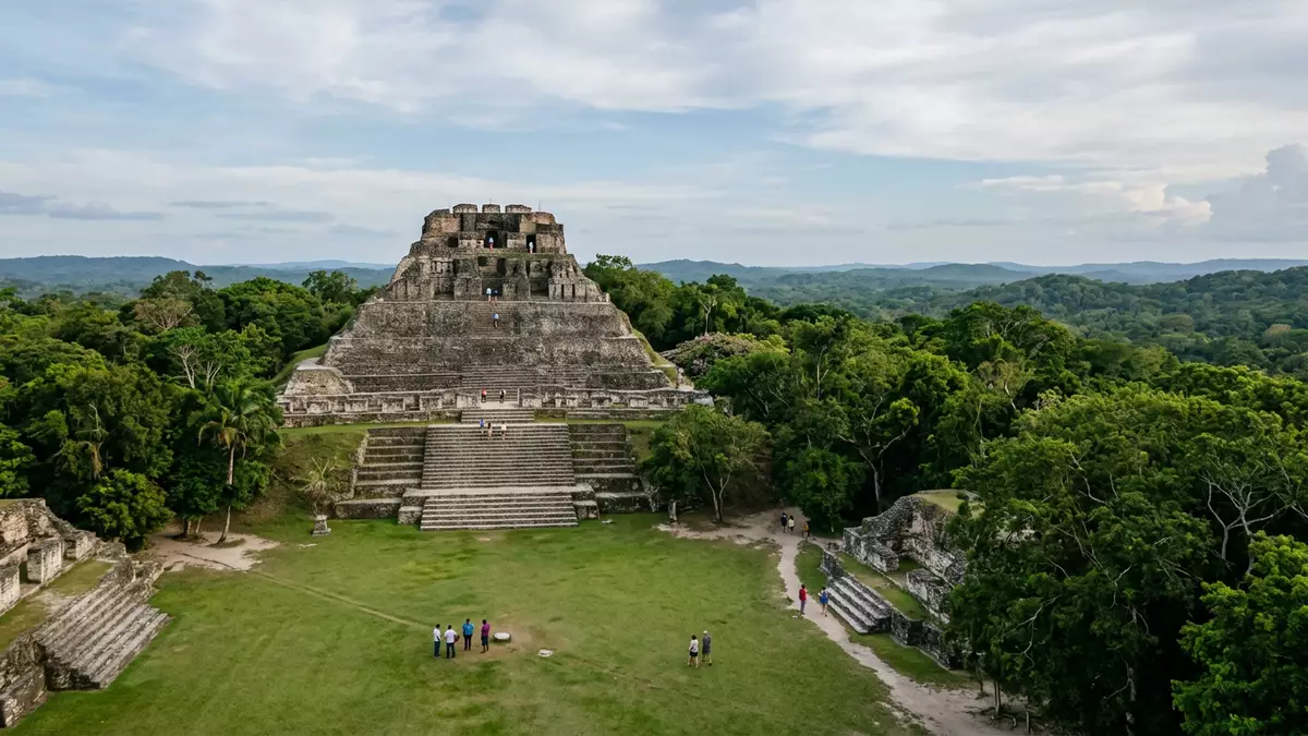
On a ridge above the Mopan River in western Belize, the Maya city of Xunantunich rises from the forest as a compact hilltop cluster of plazas and pyramids. Set in the Cayo District near San Ignacio, the site combines steep stone architecture with wide views towards the Guatemala border, giving a clear sense of how a ceremonial centre once commanded the surrounding valley in the Late and Terminal Classic periods.
A hilltop Maya city shaped by terraces and plazas
Xunantunich stands on a levelled hilltop above the river, its core laid out as a series of plazas edged by temples and palaces built in limestone masonry. The central area occupies around one square mile, with six plazas surrounded by more than twenty-six substantial structures that form the civic and ceremonial heart of the sitein the core of Xunantunich. Around this core, the wider archaeological zone extends across several square miles of forested terrain that once supported the city’s wider populationacross about 7 km².
The visible architecture belongs mainly to the Classic Maya period between about 200 and 900 CE, when Xunantunich developed as a ceremonial centre in the Belize Valley regionas a Classic Maya zone. Stone stairways link the plaza levels, and steep terraces carry visitors up from the entrance to the upper groups. The arrangement of grouped plazas and monumental platforms reflects the wider pattern of Classic-period Maya urban planning, where civic spaces, elite residences and temple complexes cluster together rather than spreading out across a broad grid.
El Castillo and the vertical profile of Xunantunich
The structure known as El Castillo dominates the profile of Xunantunich, rising high above the central plaza as a multi-tiered pyramid with a palace complex on its summit. Standing about 40 m (130 ft) above the plaza floor, it is among the tallest known Maya structures in Belize and remains the focal point of the site’s skylinewith El Castillo about 40 m high. Its upper levels include carved friezes that depict Maya iconography in stucco relief, adding intricate detail to the massive stone masswith sculpted friezes on El Castillo.
From the upper platform of El Castillo, views extend across the forest canopy towards the low hills of the Cayo District and the nearby border with Guatemala. The ridge position places Xunantunich less than a kilometre from the international boundary and within sight of the river corridor that links the interior to the wider lowlandson a ridge near the border. Standing on its upper terraces, the stacked platforms, stairways and plaza edges read as a vertical city, where movement and ceremony once unfolded across multiple levels rather than a single flat surface.
Name, period and setting in the Cayo District
The name Xunantunich means “Stone Woman” or “Maiden of the Rock” in Maya languages, combining elements from Mopan and Yucatec usageas the Stone Woman name. It is a modern designation given after the site’s rediscovery; the ancient Maya name for the city remains unknown. Archaeological investigations indicate that Xunantunich was occupied from around the first millennium AD, with major construction concentrated in the Late and Terminal Classic periods when it served as a civic-ceremonial centre in the Belize Valleyas a Late and Terminal Classic centre.
Geographically, the ruins lie in Belize’s Cayo District near the village of San Jose Succotz, west of San Ignacio and close to the Mopan River crossing used as an access pointnear San Jose Succotz. The ridge location above the river gives the site a defined boundary between forest slopes and levelled ceremonial terraces, and the compact core makes it possible to walk between most major groups along stone paths without covering large horizontal distances.
Visiting Xunantunich: what travellers from Western Europe should know
- Xunantunich lies in Belize’s Cayo District near the village of San Jose Succotz, west of San Ignacio and close to the Belize–Guatemala border, reached by crossing the Mopan River by ferry and following the road uphill to the archaeological zone.
- The terrain within the site includes steep stone stairways, uphill paths from the river crossing to the entrance and further climbs onto the pyramid platforms, particularly the ascent to the upper levels of El Castillo.
- The official language is English and the currency is the Belize dollar.
- Entry requirements depend on your nationality; UK travellers can check the FCDO travel advice at gov.uk/foreign-travel-advice, Irish travellers the Department of Foreign Affairs at ireland.ie.
Searching for Xunantunich on social platforms
These links open searches for Xunantunich on each platform.
Frequently asked questions about Xunantunich
Where is Xunantunich located?
Xunantunich is in Belize’s Cayo District near the village of San Jose Succotz, west of San Ignacio on a ridge above the Mopan River close to the Guatemala border.
What should visitors expect on a visit?
Visitors encounter a compact hilltop Maya site with plazas, steep stone stairways and monumental structures such as El Castillo, reached after crossing the river and walking uphill through forest.
What makes Xunantunich distinctive among Belize’s Maya ruins?
Its ridge-top setting above the Mopan River, the height and sculpted friezes of El Castillo and the dense concentration of Classic-period plazas and temples give Xunantunich a striking vertical profile within a relatively small core.