
Zion National Park and the sandstone canyon of Springdale
Published on 08/24/2026 at 14:19 | Editorial responsibility: Rafael Müller, Editor-in-Chief AD HOC NEWS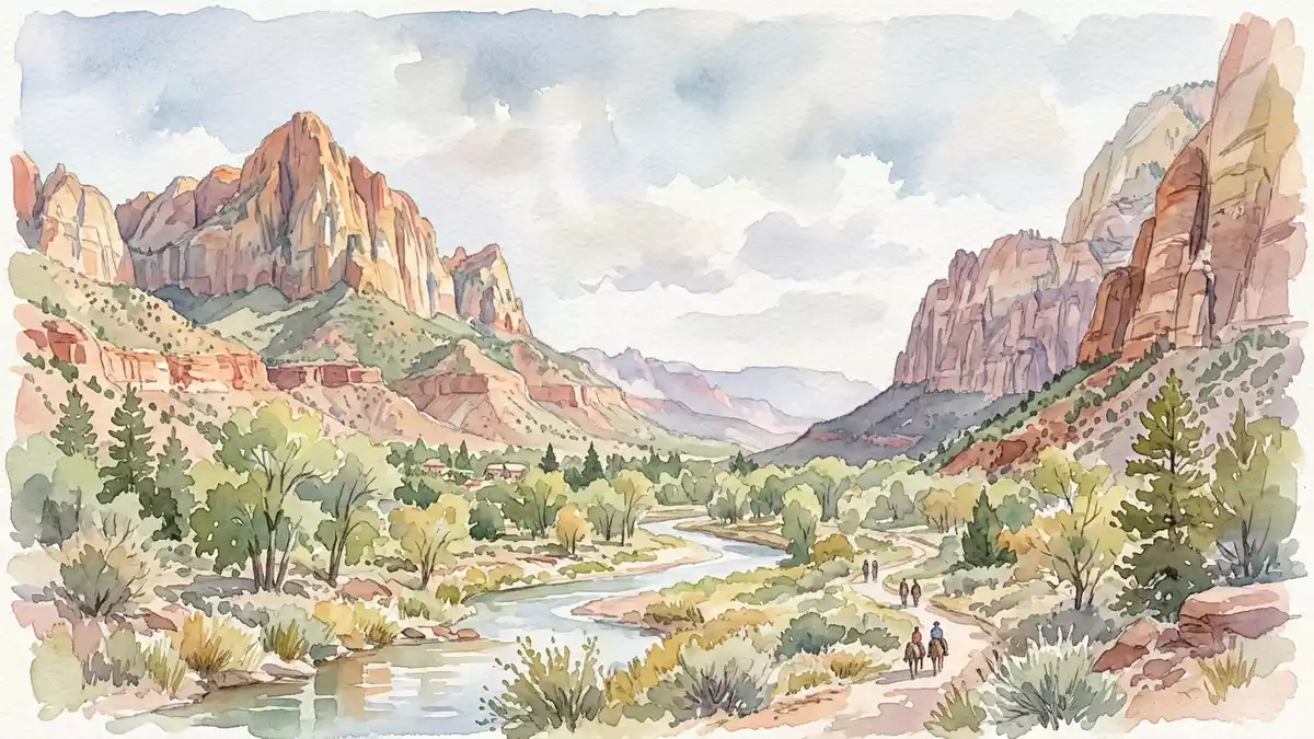
Zion National Park in southern Utah is centred on a deep sandstone canyon where the North Fork of the Virgin River has cut into the edge of the Colorado Plateau and exposed vividly layered cliffs above the town of Springdale. The park was established as a national park in 1919, giving formal protection to a landscape shaped by water, time and thick sequences of sedimentary rock from the Triassic and Jurassic periods.
The Virgin River gorge and towering sandstone walls
The defining feature of Zion National Park is the gorge carved by the North Fork of the Virgin River, which runs through Zion Canyon between high cliffs before reaching Springdale at the park’s southern entrance.The North Fork of the Virgin River has carved a canyon between the Temple of Sinawava and Springdale The river follows joints and fractures in the bedrock, cutting a winding path that has created narrow sections, open amphitheatres and vertical rock faces with local names such as Angels Landing and the Great White Throne.
Within the park the canyon floor lies at elevations of just over 1,100 m above sea level, while nearby high points such as Horse Ranch Mountain reach more than 2,600 m, so cliffs rise in places by 600 to 900 m above the valley.The lowest and highest elevations in the park show this contrast The stream gradient of the Virgin River here is steep compared with many rivers in North America, contributing to the canyon’s depth and the sharp transition between the vegetated floor and the bare rock of the walls.The river has one of the steeper gradients in the region
Layers of the Colorado Plateau revealed in stone
Zion National Park lies along the western margin of the Colorado Plateau, a broad region where sedimentary rock layers were uplifted and gently tilted to form a sequence of cliffs sometimes described as the Grand Staircase stretching between Bryce Canyon and the Grand Canyon.Zion National Park stands on the edge of the Colorado Plateau In the canyon walls visitors see reddish and tan Navajo Sandstone overlying older formations, with cross-bedded layers that record ancient desert dunes of the early Jurassic period.
Beneath the Navajo Sandstone lie formations such as the Kayenta, Moenave and Chinle, which consist of sandstones, siltstones and mudstones deposited by rivers, floodplains and lakes in the Triassic period.The sequence from Moenkopi through Chinle, Moenave, Kayenta and Navajo Sandstone is well documented At the base of the regional stack sits the Permian Kaibab Formation, a marine limestone laid down in a shallow sea, though within the confines of Zion the oldest exposed rocks are the Triassic Moenkopi Formation with its reddish mudstones and sandstones.The Moenkopi Formation is the oldest rock exposed inside the park
From Mukuntuweap monument to national park
The protected area that became Zion National Park was first designated as Mukuntuweap National Monument in 1909, a name derived from a Southern Paiute term used for the river and canyon.Mukuntuweap National Monument was the original designation On 19 November 1919 the United States Congress created Zion National Park, and President Woodrow Wilson signed the act that renamed and enlarged the monument into a national park centred on Zion Canyon.Congress created Zion National Park on 19 November 1919
Subsequent decades saw the development of roads and visitor facilities, but the core of the park remains the natural canyon, its rock formations and the river that carved them. The park’s administrative address places it directly at Springdale in Utah, underscoring the close relationship between the town and the canyon landscape at its doorstep.The park is headquartered at Springdale, Utah
Visiting Zion National Park: what travellers from Western Europe should know
- Zion National Park lies in south-western Utah, with its main entrance at Springdale. The park is reached by road along Utah State Route 9, which connects with other highways across the region.
- The terrain in Zion Canyon is steep, with substantial elevation differences between the canyon floor and surrounding plateaus; paths and routes from the valley to viewpoints involve sustained gradients and long sections on uneven rock.
- The surrounding landscape consists of high desert plateaus and deeply incised canyons, so weather conditions and temperatures can vary with altitude and exposure across short distances.
- The official language is English and the national currency is the United States dollar.
- Entry requirements depend on your nationality; UK travellers can check the FCDO travel advice at gov.uk/foreign-travel-advice, Irish travellers the Department of Foreign Affairs at ireland.ie.
Searching for Zion National Park on social platforms
These links open searches for Zion National Park on each platform.
Frequently asked questions about Zion National Park
Where is Zion National Park?
Zion National Park is in south-western Utah in the United States, with its principal entrance and park headquarters at the town of Springdale.
What should visitors expect on a first visit?
Visitors encounter a deep sandstone canyon carved by the North Fork of the Virgin River, with steep cliffs, desert plateaus and a road that follows the valley between high rock walls.
What makes Zion National Park distinctive among canyon landscapes?
Zion National Park is distinctive for the height of its sandstone cliffs, the visible sequence of Triassic and Jurassic rock layers and the way the Virgin River has cut a gorge into the uplifted edge of the Colorado Plateau.


